
Significant snowfall, strong winds expected on P.E.I. overnight Wednesday
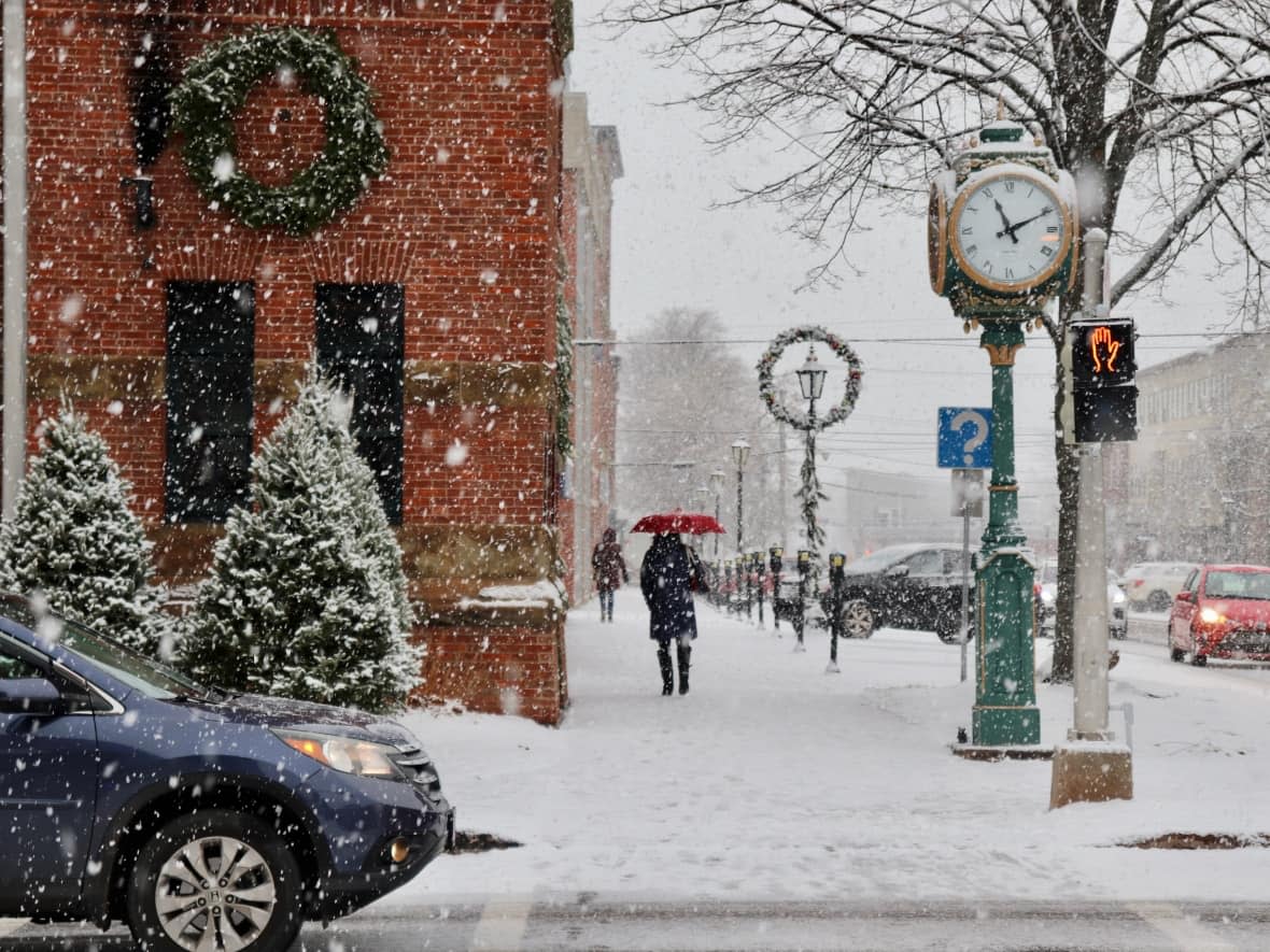
A special weather statement for P.E.I. is warning Islanders of significant snowfall coming to the region.
Environment Canada says the snow is expected to begin Wednesday night and taper off Thursday afternoon.
"Flurries begin this evening ahead of steady snow overnight," said CBC metrologist Jay Scotland.
"Much of P.E.I. should expect snowfall amounts between five and 15 centimetres, with the heavier end of that range expected over eastern areas where local amounts may even top 15 centimetres."
Less snow is anticipated over western Prince County, he said.

'Winter driving conditions'
"While this is definitely not a major snow event, it has been a while since we've had to drive in winter conditions and we may be a little rusty," Scotland said.
"Please allow extra time to get where you need to be on Thursday and reduce your speed according to conditions, especially in areas with snow covered roads or poor visibility."
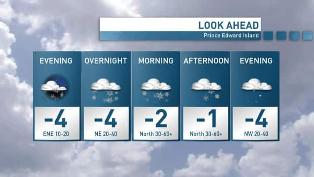
Most of the precipitation will fall overnight, but Scotland said winds will likely continue Thursday morning.
"With the projected path of this storm to our south and east, the higher end of that five- to 15-centimetre range is most likely to fall over eastern areas."
Driving on Island roads could be messy Thursday morning, Scotland warns.
"Blowing and drifting snow may impact driving conditions across the Island, with strong northerly winds developing Thursday morning." he said.
"Gusts from 40-70 km/h are possible on Thursday, which may result in reduced visibility even after the steadier snow eases to lighter flurries in the afternoon."
