
Snow squall warnings for parts of southern Ontario through Sunday
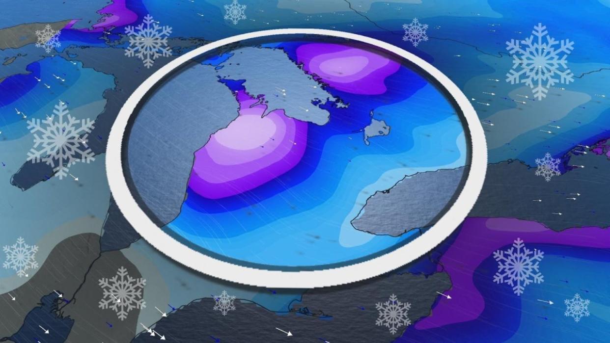
The near-complete lack of ice on the Great Lakes this month is paying dividends in the snow department as chilly winds sweeping the region give rise to snow squalls this weekend.
A threat for dangerous driving conditions will persist Sunday as winds shift direction and snow squalls hammer communities downwind from the lakes.
Going somewhere? Check out the current highway conditions before heading out!
Widespread snow squall warnings are in effect east of Lake Huron and Georgian Bay, as well as for portions of the Niagara Peninsula and the Kingston and Cornwall area.
Prepare ahead for rapidly changing road conditions in and around snow squalls.
We’ve seen plenty of lake-effect snow flying across southern Ontario so far this weekend as a disturbance moving through the area blows cold air over the relatively warm and unfrozen lakes.
A low-pressure system tracking across the northern Great Lakes will force winds to shift and blow from the southwest heading into the early morning hours Sunday.
This wind shift will open up the potential for snow squalls to extend their reach across southern Ontario heading into the peak of our holiday weekend.
DON'T MISS: Record warmth melts Great Lakes ice to historic February lows
Environment and Climate Change Canada (ECCC) issued snow squall warnings downwind from Lake Huron and Georgian Bay, as well as for the eastern Niagara Peninsula and northeastern shores of Lake Ontario, including Kingston.

Snow squalls produce rapidly changing conditions over short distances. Calm conditions can give way a sudden whiteout in a matter of seconds when driving at highway speeds.
Localized whiteouts are possible east of Georgian Bay as frontal squalls develop along a cold front moving into the region.
The southwesterly winds will also align with Highway 401 east of Cobourg, producing bands of heavy snow through Prince Edward Island and Kingston. Expect locally hazardous conditions in this area beginning in the pre-dawn hours on Sunday.
RELATED: Why the Great Lakes produce some of the world's heaviest snows
Plan ahead to avoid areas at risk of snow squalls this weekend, and prepare for extensive delays if travelling through the snowbelts.
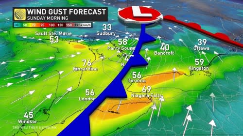
No significant snowfall totals are in the forecast for the Golden Horseshoe, but winds will continue gusting to 60 km/h across the region into Sunday.
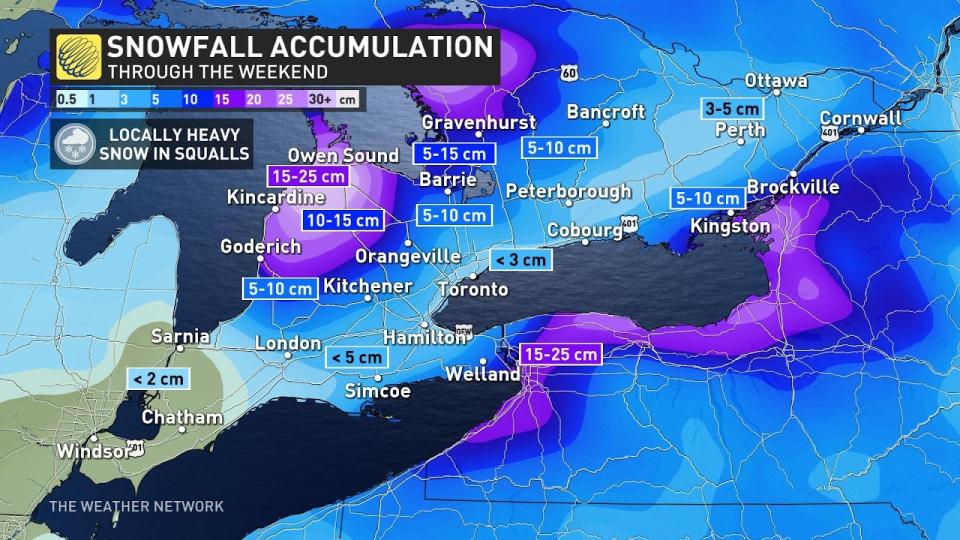
Snowfall totals by the end of Sunday should amount to 15-25 cm across many of the traditional snowbelt areas, which is a gift to ski resorts that have been hurting for decent snows this season.
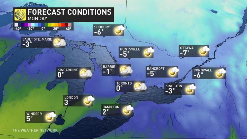
The weather on Monday looks perfect for folks hoping to visit the ski resorts and hit the slopes to celebrate Family Day. High pressure will dominate the region by the start of the week, allowing for sunshine with some periodic clouds through the day.
Temperatures will remain below freezing for central and eastern Ontario, with highs around the freezing mark in the Greater Toronto Area and a bit milder to the southwest.
Stay with The Weather Network for all the latest on your forecast across Ontario.

