
Lethargic, daily threat of severe weather reappears on the Prairies
An Omega blocking pattern over Canada will keep the Prairies locked in its current state of scorching heat and stifling humidity. This, in combination with a boundary over the region, will trigger more severe thunderstorms across the Prairies over the coming days.
After a long week of severe thunderstorms, and even some tornadoes, this will not be the break people are probably hoping for. Tornado watches were issued for parts of southern Saskatchewan on Monday. While the seemingly endless bouts of severe weather may be tiring, it’s important to not become nonchalant when it comes to monitoring your local weather and alerts.
RELATED: This ‘Omega block’ will dominate Canada’s weather this week
TUESDAY
Areas: Saskatchewan and Manitoba
Weather: The storm risk will shift east for Tuesday with another cap in place across southeastern Saskatchewan and southern Manitoba. Storm development will be very minimal in the region. The greater risk for storms will lie in the orange, highlighted region where some scattered storm initiation will be likely late in the afternoon and will continue into the early evening.

Storm hazards for Tuesday will be large hail, heavy to torrential rain, and strong wind gusts.
MID-LATE WEEK
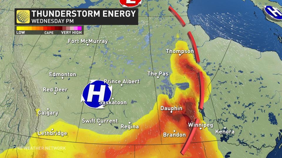
The storm threat will continue Wednesday and Thursday across eastern Saskatchewan and much of Manitoba.
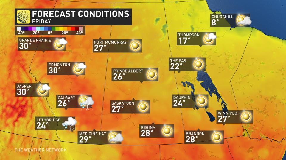
Towards the end of the week and into the weekend, the ridge of high pressure will slowly migrate west and rebuild its strength across the central Prairies, diminishing most of the thunderstorm risk and leaving mid-summer temperatures and lots of sunshine.
Thumbnail image courtesy: Fran Bryson, taken at Barrier Lake Resort in Saskatchewan.
Keep checking back to The Weather Network for more forecast information and updates across the Prairies.

