
Storm surge dusts B.C. mountains with snow, elevating flood and avalanche risk
Bundled in winter gear, Alexi Liotti and Manny Oyarce strap on their cross country skis atop Mount Seymour and venture off into the snow — just metres away from where they parked their car.
"It still feels like winter," says Liotti.
"Normally in May, it's spring riding — it's like T-shirts and slush, and you're lucky if you're able to do this," Oyarce adds.
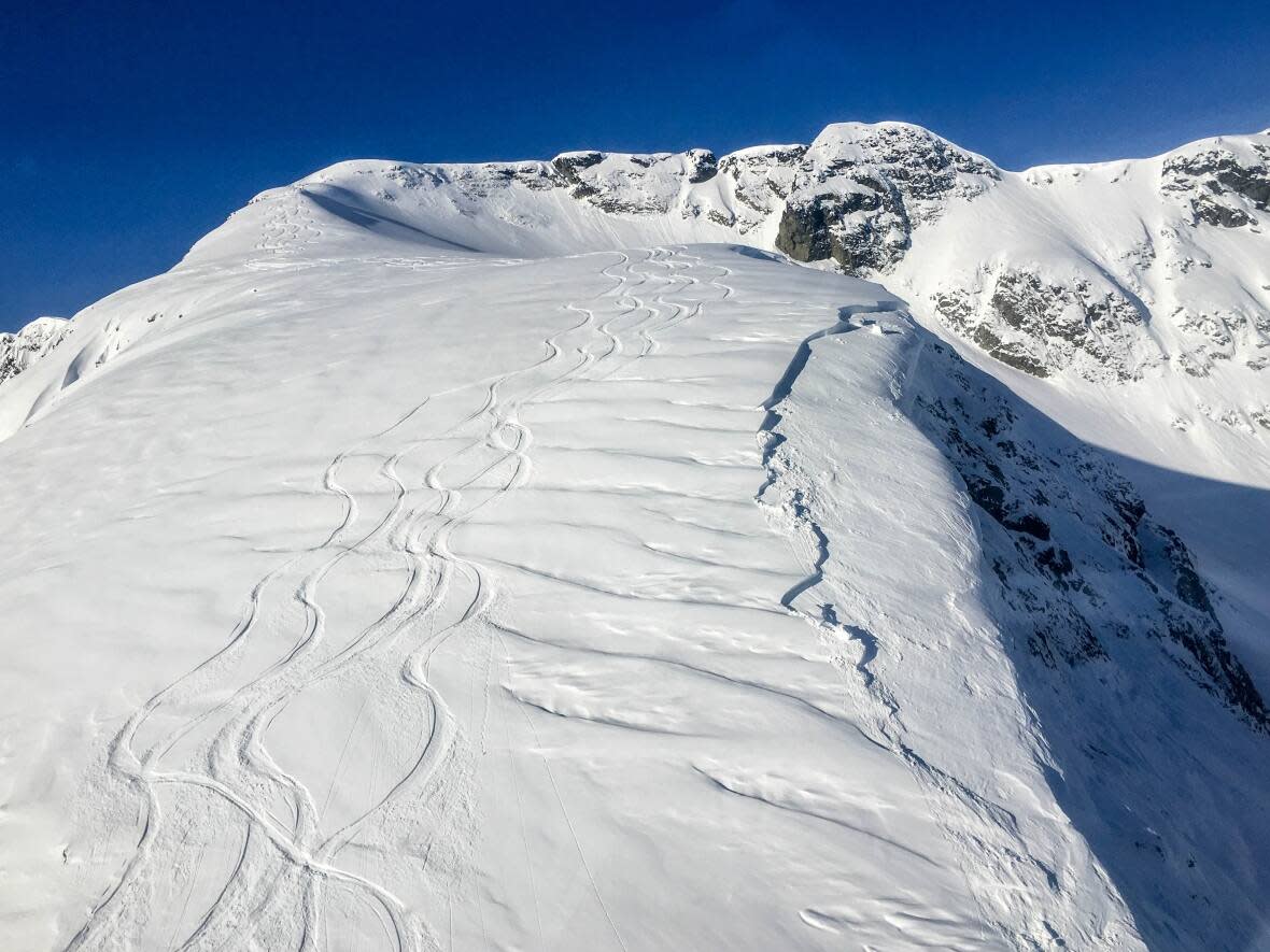
Several centimetres of snow have reportedly accumulated on mountains along the North Shore and the Sea to Sky amid a storm surge event that hit B.C.'s South Coast through Wednesday and Thursday. This is in addition to an already above-average snowpack that has been recorded on B.C. mountains.
The unseasonable temperatures and additional snow are a welcome surprise for those who continue to take to B.C.'s peaks, but they have increased the risk of both floods and avalanches once temperatures warm.
Forecasters estimate that the average snowpack is about 28 per cent above normal levels, up from 13 per cent reported in a May 1 bulletin, according to hydrologist Jonathan Boyd with the B.C. River Forecast Centre.
"With very cold temperatures through April, averaging about 1.5 to 4.5 degrees below normal, it led to both a delay in snowmelt and further accumulation of the snowpack, " he said.
"The cooler wetter conditions have remained for the first half of May," he added. "So we're still seeing a little bit of extra snow accumulation on the mountains which is pretty rare at this time of year."
An official updated bulletin is expected to be released on Friday.
Increased flood risk
B.C. has grappled with a historically cool and wet spring while under the influence of La Niña, leading to temperature lows not seen in decades.
With snow continuing to accumulate and temperatures expected to eventually warm through the season, Boyd says a sudden influx of prolonged heat, the most dramatic example being last year's heat dome, would be a worst-case scenario that leads to flooding across the province.
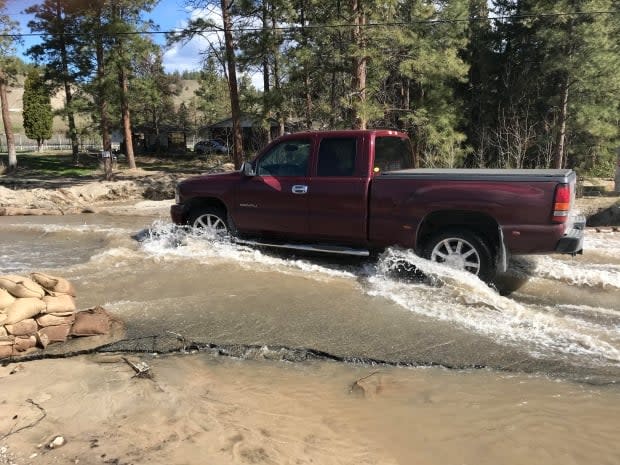
"If we got to a period of five, six, seven days of maybe six to eight degrees above normal, that could be quite a significant melt event that could lead to significant flooding, and it would impact many parts of the province simultaneously," he said.
Boyd says a more gradual increase in temperature would be the most ideal scenario. The province says there is no sign of an extended heat wave in the near future.
Avalanche risk
Meanwhile, Avalanche Canada, while no longer releasing avalanche reports for the season, says there are still risks for those taking to B.C.'s backcountry at higher elevations.
"Winter has been really slow to loosen its grip in B.C. this year," said Colin Garitty, a field technician and forecaster with AC. "Hikers really need to know there's lots of snow still on trails, even at lower elevations."
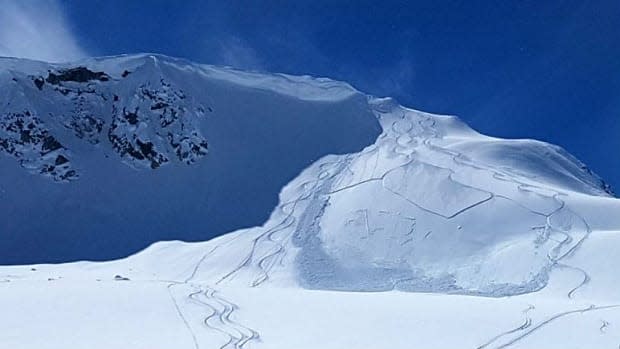
Garrity says new snow accumulation comes with a heightened avalanche risk until it settles and bonds. Then conditions are relatively stable until temperatures increase.
"When it does get really warm, we haven't seen this year, it's important to keep in mind that larger, and possibly quite destructive avalanches, could become possible," he said.
Garrity says alpine hikes are still weeks away for people unaccustomed to winter conditions in the backcountry, and that those who do take to the hills should still keep up avalanche safety habits, including carrying transceivers, shovels and probes.
