
Instability brings the threat for severe thunderstorms across Western Canada
A blast of early summer-like heat may be the perfect ingredient for severe thunderstorms and additional wildfires across parts of Western Canada this week. Widespread temperatures in the mid to high 20s have dominated the region, with major cities like Calgary and Edmonton even setting new records to start the week.
An omega block that has formed over Western Canada is what's allowing the warmer than normal weather to spread in, and also contribute to an extended period of hot and dry conditions.
Wildfires are burning throughout parts of the region, and with the chance of dry lightning as part of the storm potential, there is a growing concern of additional blazes getting ignited.
On Wednesday, there is the chance some of the storms could become severe in spots.
MUST SEE: Wildfires west of Edmonton continue to threaten rural homes, hamlets
Wednesday
Areas: Southern Interior of B.C., and the foothills of Alberta
Timing: Afternoon and evening
Weather: An upper-level trough and surface low will be the trigger for thunderstorms across the Interior of British Columbia and along the foothills of Alberta Wednesday
The main threats if storms develop: Heavy downpours, dry lightning (concern for wildfires), small hail and gusty winds

Confidence: Moderate. Isolated to scattered thunderstorms are forecast to develop through Wednesday afternoon and early evening. Some uncertainty as to where exactly the isolated storms will bubble up and track. People in the storm risk area should download The Weather Network app and stay on top of any local alerts that get issued for them
RELATED: Sudden summer or sputtering spring? May will deliver a month of contrasts
Thursday through Friday
Areas: Central and southern Interior of B.C. towards the Rockies, along with the foothills, central and western parts of Alberta
Weather: Scattered, multi-day thunderstorms are forecast across the region. While it is too early to determine the strength and severity of these storms, the ignition of new wildfires is top of mind and a main concern over the coming days.
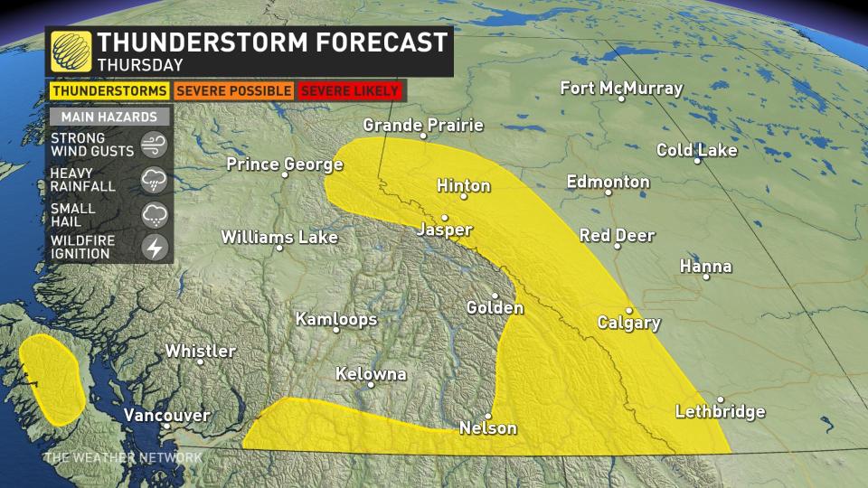
Thursday and Friday will feature temperatures in the mid-to-upper 20s for the region, helping build atmospheric instability to fuel thunderstorm development.
The upper-level ridge will break down towards the end of the week, bringing an end to the summer-like temperatures.
Alongside the cooler temperatures, wet weather will return, providing beneficial rain to the fires in Alberta, and even the possibility of low-elevation snow through southern Interior B.C.

Prepare
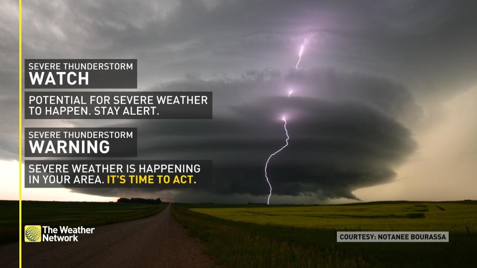
Stay alert and monitor the forecast for updates. Have a plan and a place to head indoors if the weather changes.
Watches mean conditions are favourable for the development of severe thunderstorms. Warnings mean they are imminent or are occurring in your area.
In communities with elevated or high wildfire danger ratings, residents should take time now to review emergency preparedness and evacuation plans in the event of a nearby fire. Individuals and families should be prepared to take care of themselves for at least 72 hours in case of evacuation due to wildfires.
Analysis
As the upper ridge breaks down across Western Canada, several mid-level troughs will swing through the region over the next several days leading to atmospheric triggers for thunderstorms to develop.
The heat will also still be present with temperatures in the low- to mid-20s, which will allow for daytime heating and instability to build in the atmosphere.
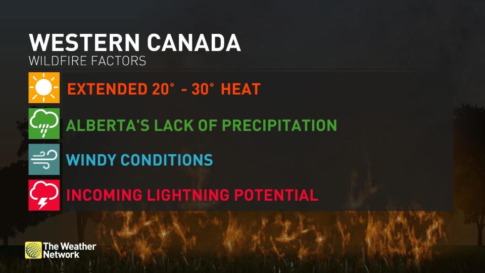
Rising temperatures and dry conditions in Alberta will worsen the situation in the days and weeks ahead as the province moves into the peak of its wildfire season.
The fire danger rating is currently very high to extreme across a large section of southern Alberta, made more dangerous by gusty winds.

