
The Whataburger App Has Become A Life-Saving Tool During Hurricane Beryl
Nearly 2 million Houston-area homes remain without power since Monday thanks to Hurricane Beryl. But residents have been unable to turn to CenterPoint Energy—one of the state’s largest electric companies—for information, due to “technical difficulties” caused by a storm that swept through the area in May, Houston Landing reported.
During a time of need, Texans are turning to an unlikely ally—Whataburger.
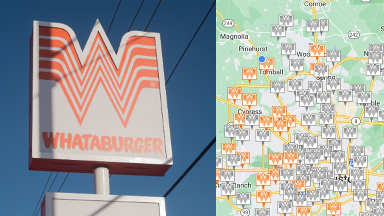
Specifically, CenterPoint customers are turning to the burger chain’s app as a de facto power-outage map. The map function indicates which restaurants are open and which are closed, presumably due to a lack of power, since Whataburger locations are typically open 24 hours.
The Whataburger app works as a power outage tracker, handy since the electric company doesn't show a map.
Still nearly 1.9 million power outages. pic.twitter.com/d8srWmw1oV— BBQ Bryan (@BBQBryan) July 9, 2024
“Whataburger is that friend by your side in good times and bad. We're glad the Whataburger app has been helpful to Houston residents to understand where power is available in the city," Whataburger President and CEO Ed Nelson said in a statement to Newsweek.
This isn’t the first time a fast food chain has been used to track power outages during a storm. In 2011, the “Waffle House Index,” coined by former FEMA administrator Craig Abate, was similarly used to determine which areas had power following Hurricane Irene, and continues to serve as an unofficial measure for how serious a natural disaster is.
"Keep in mind, the app should only be used as a general idea of power availability,” Nelson emphasized. “We encourage residents to call local units to see if they are open and operating. Everyone please be safe if you leave your home."
You Might Also Like

