
Atlantic Canada faces dramatic temperature swings for the first week of 2023
It’s a soggy start to the new year across Atlantic Canada as a system sliding up the East Coast brings soaking rains to the region.
The current system—and another hot on its heels—will give thermometers quite the workout as temperatures lurch back and forth between mild and seasonal heading through the first week of January.
MUST SEE: 'It's quite remarkable': Halifax is about to set a record for lack of snow
Rain will continue through the day Sunday as a low-pressure system continues trekking across the Maritimes, eventually reaching Newfoundland later in the day.
A rainfall warning is in effect for southeastern Newfoundland ahead of this slug of precipitation. “Heavy downpours can cause flash floods and water pooling on roads,” Environment and Climate Change Canada (ECCC) said in its warning for the Avalon Peninsula.

Precipitation will end from southwest to northeast during the second half of Sunday, possibly finishing off as a touch of snow for parts of New Brunswick and Prince Edward Island. Rain will continue into Monday morning for Newfoundland.
Additional rainfall totals of 15-25 mm are possible across the northeastern Maritimes, with 30-50 mm of rain still on the way for southeastern Newfoundland.
Colder air in place over central Newfoundland will allow for much of the precipitation to fall as snow. Snowfall warnings are in place for Gander and vicinity, where folks will see 10-20 cm of snow through Monday.

Temperatures will rise and fall like a leaf in the breeze this week as several low-pressure systems come and go.
Sunday’s highs will climb well above seasonal with the system bringing us a soggy New Year’s Day. Shifting winds behind that low will allow cooler air to arrive for the beginning of the week.
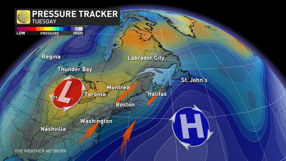
Temperatures will rise once again by midweek as another low-pressure system traversing the Great Lakes begins to influence the East Coast. Southerly winds will drag temperatures in the double-digits across the region.
Conditions will again take a dramatic turn by the end of the week as colder air from up north spills in behind the departing midweek storm, allowing temperatures to fall below seasonal heading into next weekend.
Thumbnail image courtesy of Glane Gorveatt in Peggy's Cove, Nova Scotia.
Stay tuned to The Weather Network for the latest across Atlantic Canada.
