
UK weather: Met Office issues yellow thunderstorm warning with up to 30mm of rain in an hour possible
Parts of Britain face a washout with a yellow weather warning for thunderstorms issued across England, Wales and Northern Ireland tonight.
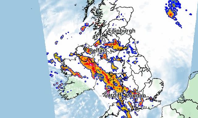
The Met Office warning will be in place from 8pm tonight until 4am on Monday, and covers parts of London, the south, southwest, the Midlands, together with Wales and Northern Ireland.
Some areas could see deluges of 20mm to 30mm of rainfall in less than an hour, the Met Office warned.
UK weather - click here to check your latest local forecast
Frequent lightning, hail and strong winds are predicted to accompany stronger thunderstorms, particularly in south-western England and Wales.
Motorists have been warned to prepare for more challenging driving conditions affected by hail and spray from standing water on the roads, while commuters should also expect delays on train services.
The storms could see homes and buildings flooded, with properties also at risk of damage and short-term power cuts due to lightning strikes and strong gusts.
Heavy showers and thunderstorms are initially expected to build across southwest England on Sunday before moving north across parts of Wales and Northern Ireland.
They are expected to clear during the early hours of Monday morning.
A separate area of thunderstorms is also likely to develop across central southern England on Sunday before crossing north into the Midlands.
And it appears the wet weather will continue, with low pressure - bringing unsettled conditions - likely to dominate the following week's forecast.
Met Office deputy chief meteorologist, Jason Kelly, said the day-to-day forecast is not yet certain, but added: "More generally, each day there will be a risk of showers or longer spells of rain for many areas of the country.
"It is likely that more prolonged showers will bring a risk of thunderstorms too.
"And in some areas, mostly likely the southwest, rainfall totals will build through the week."

