
Winter storm warning issued ahead of messy weather cocktail
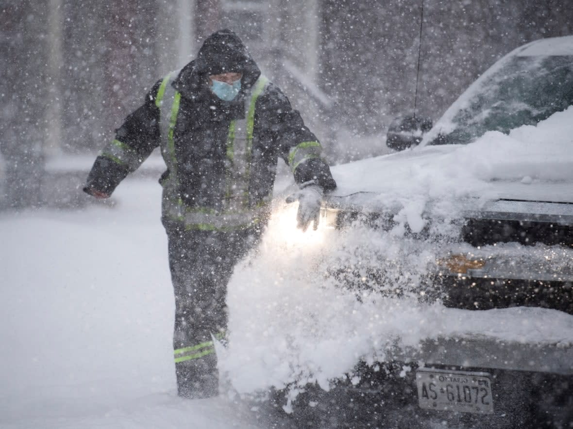
Eastern Ontario is now under a winter storm warning ahead of a messy mix of precipitation expected to make holiday travel treacherous over the next few days.
As of Thursday afternoon, a winter storm warning covers all of eastern Ontario, while some areas also have snowfall or rainfall warnings.
Weather warnings urge residents to look out for:
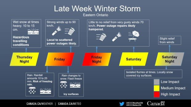
Damaging wind gusts of 100 to 120 km/h and blizzard-like conditions, both developing Friday afternoon and continuing into Saturday.
Snowfall amounts of five to 15 centimetres by early Saturday morning, with higher amounts possible around Lake Ontario.
A flash freeze producing icy and slippery surfaces on Friday afternoon.
Ottawa's forecast calls for a 40 per cent chance of flurries late Thursday afternoon with a high of –3 C, then sometimes-heavy snow Thursday night with the temperature rising to 1 C and risk of freezing rain before morning. About 10 to 15 centimetres of snow is expected.
On Friday, heavy snow is expected to change to rain in the morning, then back to snow late in the afternoon.
There's a risk of freezing rain as well as blowing snow in the afternoon. The high will be around 4 C, with a wind chill of –12 C in the afternoon.
Periods of snow are expected Friday night with a low of –9 C.
Saturday is expected to bring a 60 per cent chance of flurries, dropping to 40 per cent on Sunday, with highs of –7 C and –6 C, respectively.
Winter storm warnings were also issued early Thursday for the Renfrew, Pembroke, Barry's Bay, Peterborough, Smiths Falls, Lanark and Sharbot Lake areas.
"Snow, heavy at times, is expected to begin [Thursday] evening. As a cold front pushes through the area on Friday afternoon, rapidly falling temperatures and wind gusts to 70 km/h will result in local blowing snow. Snow and local blowing snow will persist into Saturday," Environment Canada said.
Environment Canada has issued rainfall warnings for the Belleville, Quinte, Northumberland, Brockville, Leeds and Grenville, Kingston, Prince Edward County, Stirling, Tweed and South Frontenac areas.
About 20 to 30 millimetres of rain and melting snow is expected by noon Friday, with the possibility of localized flooding in low-lying areas.

