
Satellite launches to keep an eye on space weather as solar activity ramps up
Sign up for CNN’s Wonder Theory science newsletter. Explore the universe with news on fascinating discoveries, scientific advancements and more.
Forecasters will soon be able to see real-time mapping of lightning activity on Earth and keep a closer eye on solar storms unleashed by the sun thanks to a new weather satellite.
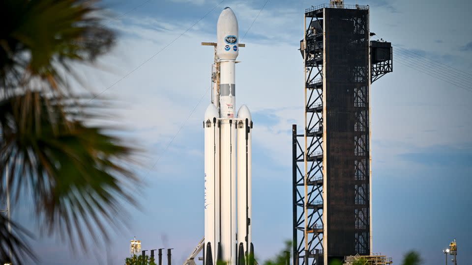
Together, NASA and the National Oceanic and Atmospheric Administration launched GOES-U, or the Geostationary Operational Environmental Satellite U mission, on Tuesday.
The weather satellite lifted off aboard a SpaceX Falcon Heavy rocket from Kennedy Space Center in Florida at 5:26 p.m. ET. The launch streamed live on NASA’s website. Weather conditions in Florida were 60% favorable for a launch at the beginning of the launch window.
GOES-U is the fourth, final satellite in the Geostationary Operational Environmental Satellites R Series, “the Western Hemisphere’s most sophisticated weather-observing and environmental-monitoring system,” according to NOAA.
“The GOES-R series of satellites has been a game changer for us,” said Ken Graham, director of NOAA’s National Weather Service, during a Monday news conference. “Since the first launch of the series in 2016, the latest generation of GOES has enabled new and improved forecasts and warnings services to help save lives and protect property.”
Once GOES-U reaches a geostationary orbit, or a circular orbit above Earth’s equator, the satellite will be renamed GOES-19, or GOES East. The satellite will replace GOES-16, the former GOES East satellite launched in 2016, and work in tandem with GOES-18, also called GOES West. Meanwhile, the GOES-16 satellite will essentially become an on-orbit backup for the system in case one of the satellites goes down.
Together, the GOES-18 and GOES-19 satellites will collect atmospheric, solar, climatic and ocean data and cover more than half the globe from the west coast of Africa to New Zealand.
What sets GOES-U apart from other satellites is that it’s carrying a new capability to keep an eye on space weather.
Tracking solar activity
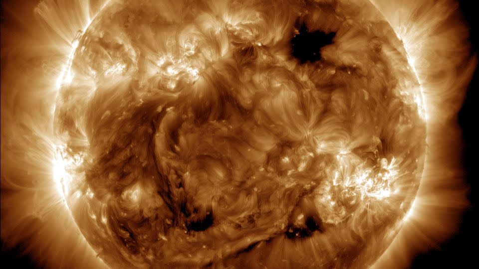
As the sun nears solar maximum — the peak in its 11-year cycle, expected this year — it becomes more active. Researchers have observed increasingly intense solar flares and coronal mass ejections erupting from the sun’s surface.
Coronal mass ejections are large clouds of ionized gas called plasma and magnetic fields that release from the sun’s outer atmosphere.
When these outbursts are directed at Earth, they can cause geomagnetic storms, or major disturbances of Earth’s magnetic field. With these events, there is always a chance that communications, the electric power grid, navigation, and radio and satellite operations will be affected.
The most intense solar storm to impact Earth in 20 years occurred on May 10, but fortunately it only caused auroras to shine over states that never see the northern lights.
Increased solar activity causes auroras that dance around Earth’s poles, known as the northern lights, or aurora borealis, and southern lights, or aurora australis. When the energized particles from coronal mass ejections reach Earth’s magnetic field, they interact with gases in the atmosphere to create different colored lights in the sky.
GOES-U carries multiple instruments that will improve the detection of space weather hazards, including the Compact Coronagraph-1 that can detect solar flares and coronal mass ejections, as well as characterize the size, velocity, density and direction of these solar storms.
The coronagraph will provide continuous observations of the solar corona, or the hot outer layer of the sun’s atmosphere, which is where space weather events originate, said Elsayed Talaat, director of NOAA’s Office of Space Weather Observations.
The instrument’s capabilities will allow NOAA’s Space Weather Prediction Center to issue warnings and watches one to four days in advance and “mark a new chapter in space weather observatoions,” Talaat said.
The Compact Coronagraph-1 is the world’s first-ever operational satellite coronagraph to better monitor the sun, said Steve Volz, assistant administrator for NOAA’s Satellite and Information Service.
“This new instrument will deliver imagery of the sun’s corona to our forecasters at the Space Weather Prediction Center within 30 minutes, and that’s compared to the previous time it used to take, about eight hours,” Graham said. “Geomagnetic storms can impact our infrastructure here on Earth by putting our power grid, communications, navigation systems, aviation and space-based assets at risk. Having a better and faster observation will help us better alert our infrastructure providers and potential hazards so they can take action.”
Lightning strikes in real time
From orbit, GOES-U will monitor weather, climate and environmental hazards across North, Central and South America, the Caribbean, and the Atlantic Ocean to the west coast of Africa.
From its unique vantage point, GOES-U will be able to spot tropical storms, send alerts to forecasters as the storms form in the Atlantic Ocean, and provide near real-time tracking and monitoring.
The satellite carries a suite of science instruments, including imaging and mapping technology, that will enable it to capture valuable data on hurricanes, including upper-level wind speeds, specific features about the hurricane’s eye and lightning activity, all of which can help forecasters better understand potential risks.
GOES-U will carry the first operational lightning mapper flown in geostationary orbit. As storms develop, they tend to show spikes in lightning activity. Understanding how storms develop and intensify can help meteorologists to better predict whether storms will be capable of causing flash flooding, producing hail, damaging winds or spawning tornadoes.
The lightning mapper will take pictures of the Earth at a rate of 500 times per second in order to track lightning like never before, Sullivan said.
The main camera on GOES-U can zoom in to track dangerous weather and environmental conditions as often as every 30 seconds, a capability that enables better warning systems, said Pam Sullivan, director of the GOES-R program for NOAA.
Forecasters can also use GOES-U’s instruments to identify the risks of wildfires, including hot spots, intensity, smoke output and air quality impacts, and even data that can help trackers predict the motion of the fires. The satellite can also use its lightning mapper to determine which lightning strikes are the likeliest of igniting wildfires.
Other environmental hazards GOES-U can track include real-time imagery of fog and low clouds that can impact air and sea travel, as well as detecting volcanic eruptions and the ash and sulfur dioxide belched out by volcanoes. GOES-U will also be able to monitor atmospheric river events, or large sections of Earth’s atmosphere that carry moisture from the equator to the poles, that are capable of causing flooding and mudslides.
In addition to early warning of hurricane formation, GOES-U can also collect climate data on Earth’s oceans such as signs of marine heat waves and sea surface temperatures, which impact the marine food chain and can lead to mass coral bleaching events.
For more CNN news and newsletters create an account at CNN.com

