
Western Canada engulfed by storm risk, rotation possible on eastern Prairies
We’re looking at a risk for thunderstorms from British Columbia to Manitoba, a vast swath of real estate that should stay on alert Sunday for rapidly changing conditions.
But it's areas in southeastern Saskatchewan and southern Manitoba that will be of most concern. People in these regions will need to be on heightened alert as conditions will be suitable for rotating storms, which can produce tornadoes and very large hail that can do damage.
DON'T MISS: Heading to the Calgary Stampede? Here's the weekend weather outlook
Sunday
Areas: Most of B.C. and Alberta, central, southeastern Saskatchewan, and majority of Manitoba
Timing: Afternoon and evening

Weather: A cold front draping over Manitoba is set to bring some severe weather into southern areas Sunday evening. A widespread risk for thunderstorm is in place or most of Manitoba but the greatest potential for supercells is located in the southern section and areas east of Saskatoon, Sask.
The day’s strongest thunderstorms could see large hail, strong wind gusts, and hefty downpours. The risk for large hail is heightened over southern Manitoba where dynamics are favourable for a few severe storms to rotate. Rotation helps a storm grow stronger, which can support the development of larger hailstones.
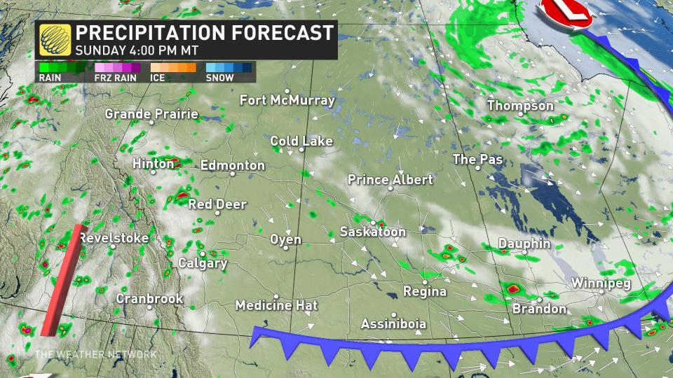
Depending on the timing of the cold front, combined with enough daytime heating, the severity of the storms may increase. The more potent storms are set to occur in the afternoon on the eastern side of southern Manitoba.
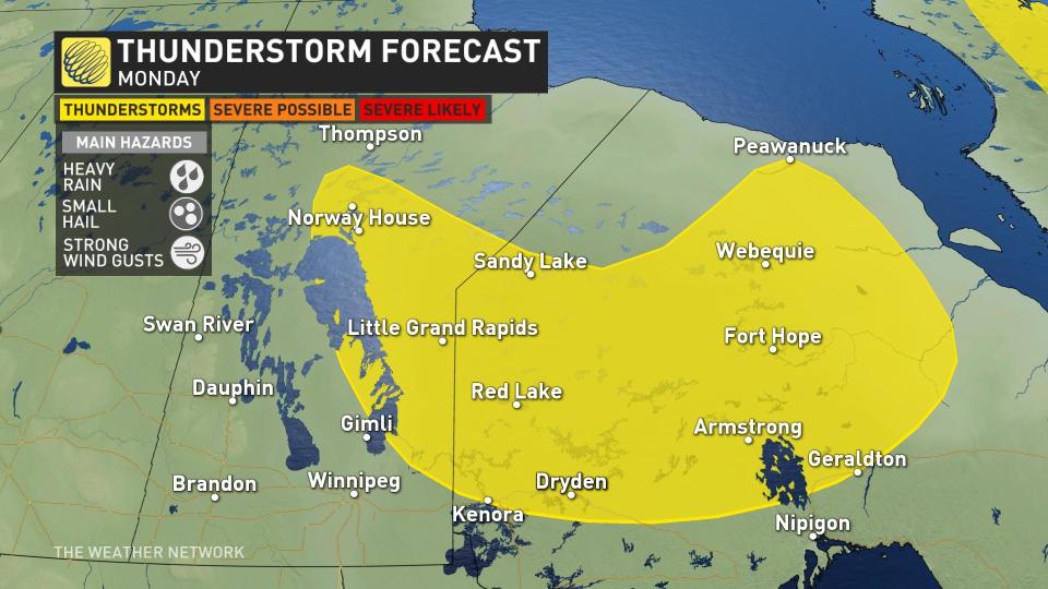
Monday
Areas: Much of B.C. and Alberta, southwestern Saskatchewan, and east-central Manitoba
Timing: Afternoon and evening
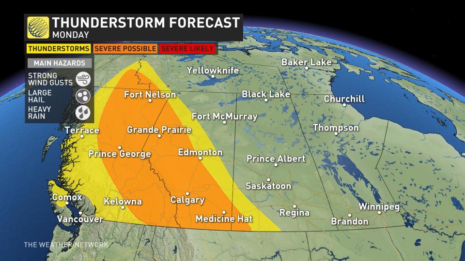
Weather (Alberta and B.C.): The unsettled pattern continues for B.C. and Alberta, bringing the possibility of severe thunderstorms to the areas of both provinces. The severe risk is widespread into Alberta, with the chance some of the those storms move into Calgary during the Stampede. The storms will be scattered in nature and are thanks to the daytime heating, which is causing the instability that allows for the storms to pop off.
Weather (Manitoba): The low is moving eastwards, but still hovering over northwestern Ontario with the remnants of the system to bring some non-severe thunderstorms to central Manitoba, east of Dauphin. Areas to the south get a break from all the precipitation and storms, getting some more drier conditions ushered in for the work week.
Southern Manitoba will be getting quite a cooldown behind this cold front t start this week, with temperatures dropping to the high teens and low 20s for Winnipeg and Brandon, but they will be bouncing back for mid-week.
Keep The Weather Network’s app handy on your phone to peek at the radar and keep up with watches and warnings as the day progresses.
Stay close to a safe shelter in case storms threaten your location. And remember, the greatest danger in any thunderstorm is lightning. If you can hear thunder, you’re close enough to be struck by lightning.
Stay with The Weather Network for the latest on the severe storm threat across the Prairies.
Thumbnail courtesy of Getty Images.

