
The 1973 Union City Tornado helped scientists better understand twisters
This Day In Weather History is a daily podcast by Chris Mei from The Weather Network, featuring stories about people, communities and events and how weather impacted them.
--
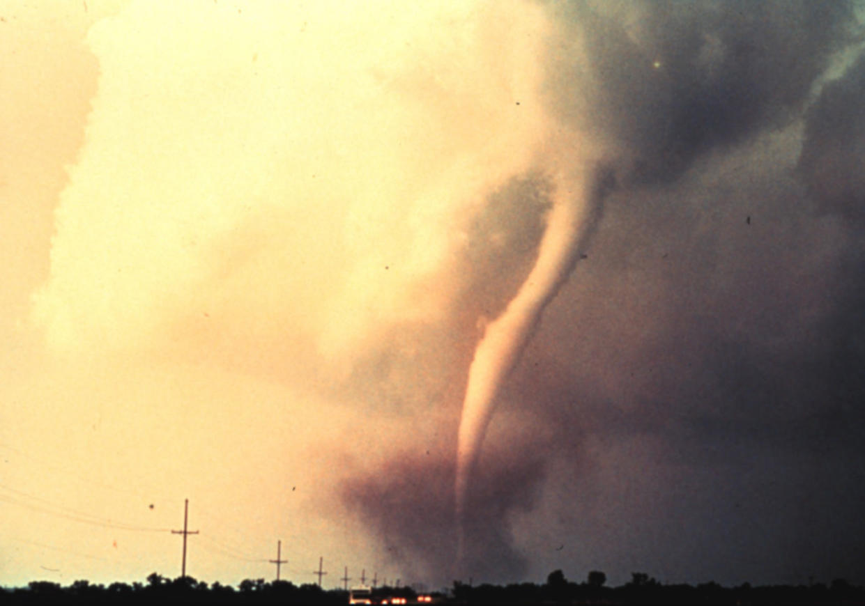
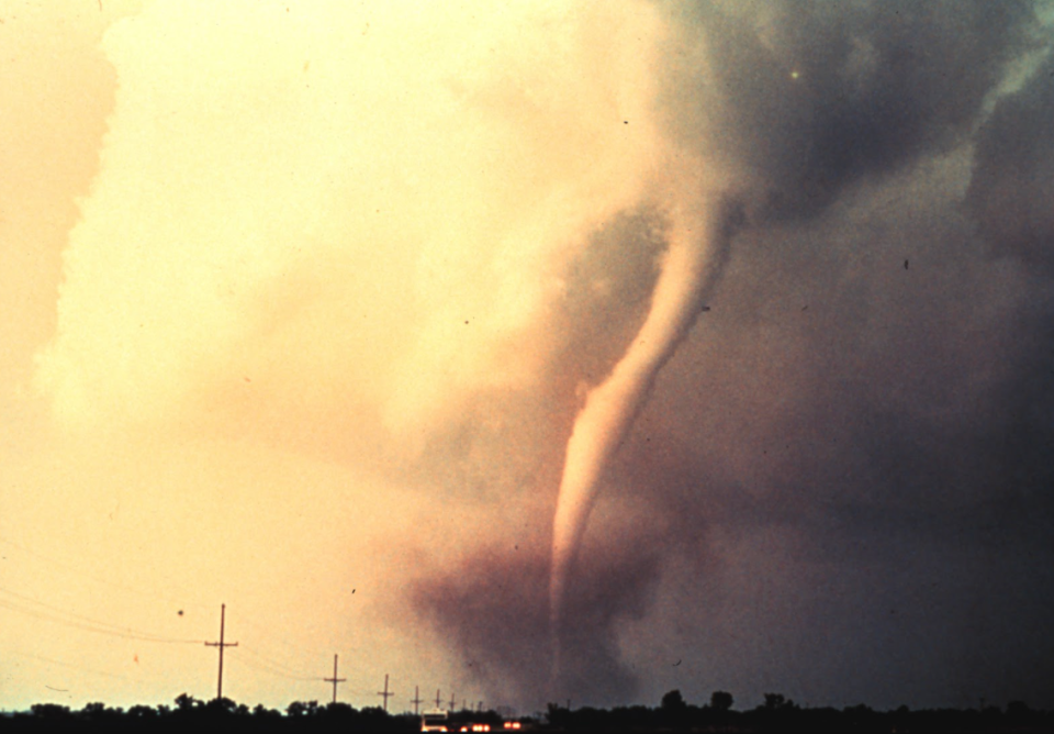
On Thursday, May 24, 1973, an F4 tornado tore through Union City, Oklahoma. This is the first tornado that was captured by The National Severe Storms Laboratory (NSSL) Doppler radar.
NSSL is a leader in Doppler radar research. In 1973, researchers discovered the Tornado Vortex Signature. It provides forecasters a visual pattern meaning a tornado is forming leading to better tornado warnings when new radars were built nationwide. #50YearsOfNOAA pic.twitter.com/qwzw3GpnoL
NSSL is a leader in Doppler radar research. In 1973, researchers discovered the Tornado Vortex Signature. It provides forecasters a visual pattern meaning a tornado is forming leading to better tornado warnings when new radars were built nationwide. NOAA National Severe Storms Laboratory on Twitter: "NSSL is a leader in Doppler radar research. In 1973, researchers discovered the Tornado Vortex Signature. It provides forecasters a visual pattern meaning a tornado is forming leading to better tornado warnings when new radars were built nationwide. #50YearsOfNOAA pic.twitter.com/qwzw3GpnoL / Twitter" NOAA National Severe Storms Laboratory on Twitter: "NSSL is a leader in Doppler radar research. In 1973, researchers discovered the Tornado Vortex Signature. It provides forecasters a visual pattern meaning a tornado is forming leading to better tornado warnings when new radars were built nationwide. #50YearsOfNOAA pic.twitter.com/qwzw3GpnoL / Twitter"
— NOAA National Severe Storms Laboratory (@NOAANSSL) NOAA National Severe Storms Laboratory on Twitter: "NSSL is a leader in Doppler radar research. In 1973, researchers discovered the Tornado Vortex Signature. It provides forecasters a visual pattern meaning a tornado is forming leading to better tornado warnings when new radars were built nationwide. #50YearsOfNOAA pic.twitter.com/qwzw3GpnoL / Twitter"
NSSL, located in Norman, Oklahoma, sent chasers to the scene to document the forecasted storm while they captured the storm's data.

"NSSL's first Doppler Weather Radar located in Norman, Oklahoma. 1970's research using this radar led to NWS NEXRAD WSR-88D radar network." Courtesy of NOAA
"We weren't expecting much that day, just storms, but not necessarily tornadoes," said Don Burgess, who was the NSSL researcher and division chief.
"We had the facility here at NSSL ready. As storms developed less than 100 miles away, the Storm Intercept Teams were located in the vicinity of the developing tornado, we were able to get the entire life cycle of a tornado documented for the first time ever," said Burgess.
Click here to subscribe to This Day in Weather History
On the day of the tornado, Rodger Brown, NSSL research meteorologist, was working in the new Norman Doppler Radar. Brown was looking to collect data from the storm but did not have the modern convenience of real-time displays.
Brown and Burgess turned to Les Lemon, a former NSSL researcher. Lemon helped the two capture the required data to track the storm.
"The first tornado captured by the NSSL Doppler radar and NSSL chase personnel. The tornado is here in its early stage of formation." Courtesy of NOAA
The team captured the Union City tornado data, but they could only see the results a few months later as the information was recorded on magnetic tape.
Because the tornado took place early enough in the day, the research team headed to Union City to see the twister's aftermath. "I think that's the first time we realized the extent and how devastating the tornado was," Brown shared.
The Doppler radar has had a huge impact on weather and tornado forecasting.
To learn more about the Union City tornado and its historical significance, listen to today's episode of "This Day In Weather History."
Subscribe to 'This Day in Weather History': Apple Podcasts | Amazon Alexa | Google Assistant | Spotify | Google Podcasts | iHeartRadio | Overcast'
Thumbnail: "The first tornado captured by the NSSL Doppler radar and NSSL chase personnel. The tornado is here in its early stage of formation." Courtesy of NOAA

