
St. John's area, Bonavista bracing for up to 50 cm of snow Thursday
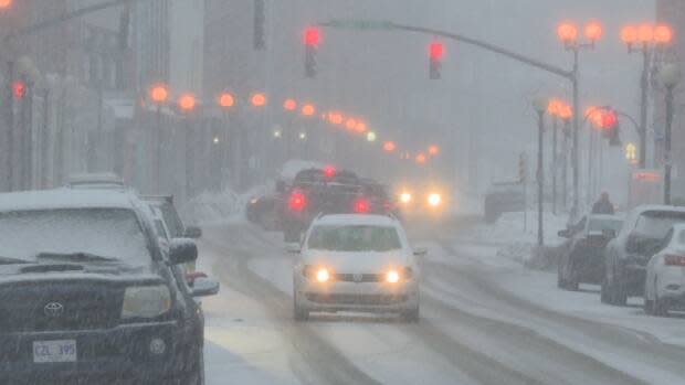
Parts of Newfoundland's northeast coast could see the first major storm of the winter, with significant snowfall and high winds possible on Thursday evening and Friday morning.
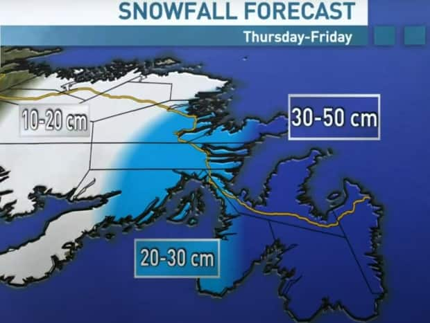
CBC Metereologist Ashley Brauweiler said Tuesday evening that early models are showing 30 to 50 centimetres for most of the Avalon peninsula and the Bonavista area.
Inland, "there's a sharp gradient in that snowfall," Brauweiler said, with expected amounts tapering to 20 to 30 centimetres for the Clarenville area, and 10 to 20 centimetres for parts of central Newfoundland.
Brauweiler expects blizzard conditions Thursday afternoon and overnight, with snow letting up for the southern portions of the island around mid-day Friday.
Meteorologist Veronica Sullivan of Environment Canada's Gander weather office said Tuesday morning that a system developing over the Atlantic Ocean could dump "some significant amounts of snow" on St. John's, Clarenville and the Bonavista area.
She said the snow could be paired with wind gusts between 70 and 90 km/h, which could make for a messy ride home Thursday evening.
"There's still time for the system to change track slightly, and that could very well change the snowfall amounts that are expected," Sullivan said. "But it does seem, for now anyway, that it could be a significant snowfall."
Leading up to Thursday, Sullivan said the weather will be fairly mild, which a chance of flurries on Tuesday and Wednesday and lows near –4 C. Wednesday will feel colder across the island, with an expected windchill near –15 C.
