
Weather warnings in effect as 30 cm of snow, 50 mm rain on way for N.B.
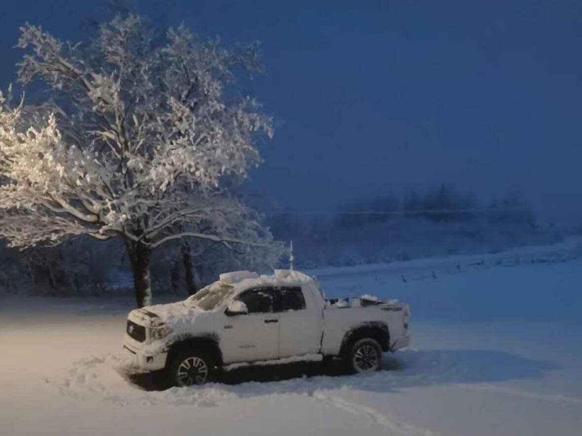
After digging out from a third snowstorm in a little over a week, New Brunswick is about to get more snow, and in some places, a lot of rain as well.
A new system is expected to bring as much as 30 cm of snow in the north and 50 mm of rain in the south and will start affecting the province Wednesday night.
CBC meteorologist Ryan Snoddon said the heaviest snow will be centred in the northwest of the province starting Wednesday evening, with some freezing rain and ice pellets possible later on Thursday.
"Snow arrives through Wednesday night and this will lead to another snowy and slick Thursday morning commute across the province," said Snoddon. "Leave yourself extra time and space."
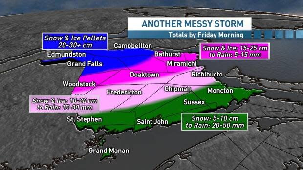
Snow in the south will turn to rain on Thursday, with the heaviest rainfall occurring along the Fundy coast. Between 20 and 50 mm are expected.
"Localized flooding is possible with the combination of melting snow and heavy rain," said Snoddon.
Woodstock through Doaktown to Miramichi, Bathurst and the Acadian Peninsula will likely see 15-25 cm of snow and 5-15 mm of rain, said Snoddon.
Keep up with the snow before rain freezes
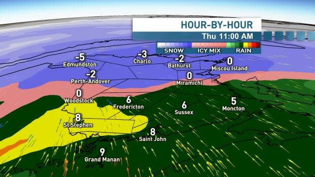
Jill Maepea, an Environment Canada meteorologist based in Fredericton, said snow will probably begin around midnight in the southwest, and rapidly move toward the northeast.
"By morning, we ... will have a good 10 to 15 centimetres probably on the ground," she told Information Morning Fredericton.
Maepea recommends people shovel that snow sooner rather than later on Thursday, because rain and above zero temperatures won't last.
"The period that it's actually going to be above zero is actually been quite short-lived. In the evening we'll already be begin to fall below zero.
"The idea would probably be to move that snow before the rain falls on it. It becomes very heavy and then it could freeze," she said. " So the idea would be to try and keep up with it, if you could, to remove it."

The transition from snow to rain would begin in the morning hours, Maepea said.
"We aren't anticipating any significant impacts from the freezing rain," she said. "The system is moving very quickly, so we will see those temperatures climb rapidly as well."
She said the transition to rain will also bring wind gusts of up to 70 kilometres per hour.
On Tuesday, Environment Canada was forecasting up to 50 centimetres of snow in the north, but Maepea said this has been revised to about 30 centimetres.
Forecasts and warnings
Environment Canada has issued snowfall warnings for northern, and parts of central, New Brunswick.
"Visibility may be significantly reduced at times in blowing snow before the change over to rain on Thursday, particularly in northeastern New Brunswick," the warning says.
The snowfall warning turns into a rainfall warning along a line between Woodstock and Fredericton.
The agency has issued a rainfall warning for southwestern New Brunswick as well as the Bay of Fundy.
"Heavy downpours can cause flash floods and water pooling on roads. Localized flooding in low-lying areas is possible. Watch for possible washouts near rivers, creeks and culverts," the warning says.
A wind warning was also issued for Grand Manan and the Acadian Peninsula, where winds are expected to gust to 90 km/h.
Special weather statements are also in effect for the south coast of the Bay of Chaleur where there is a chance of minor coastal flooding, particularly west of Bathurst, Thursday afternoon.
Parts of southern New Brunswick without warnings have special weather statements for 10-15 cm of snow, 15-20 mm of rain and wind gusts of up to 80 km/h.
This latest storm comes after a strange month of weather in the province.
In late December and early January, the province experienced little snowfall and above normal temperatures.
However, in the past two weeks, the province has seen three significant snowfall events which have transformed green pastures into snowy fields.

