‘Batten down the hatches’ says Gov. Cooper as North Carolina coast braces for Idalia
North Carolina Gov. Roy Cooper warned the state’s residents Wednesday afternoon to brace for “near tropical storm-strength” weather over the next few days as the tail end of Hurricane Idalia moved north from Georgia and South Carolina.
Cooper asked North Carolinians to “just batten down the hatches for a little while,” with tropical storm warnings in effect for the state’s coast.
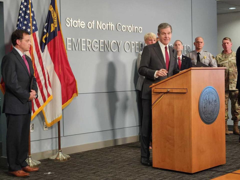
“We expect winds, rain and flooding to continue to impact our state even into Saturday,” Cooper said at a press conference at the Emergency Operations Center in Raleigh. He said people should stay off flooded roads and listen to emergency alerts.
Cooper also authorized National Guard activation, “which means soldiers and vehicles are staged in key areas ready to deploy when and if they’re needed,” he said.
Swift water rescue teams are also ready to deploy.
“I encourage people to listen to local officials and make sure you have a plan if you’re in an area with a flood risk,” Cooper said, asking people to visit ReadyNC.gov for more information about hurricane resources and preparedness.
Cooper said he spoke with President Joe Biden about an hour before the press conference.
“It’s important for us to coordinate with our federal partners in times like this,” he said. “We’re hoping for the best, preparing for the worst.”
Hurricane Idalia made landfall in Florida Wednesday morning as a Category 3 storm. Flash flooding and river flooding is likely across Georgia and eastern North Carolina and South Carolina through Thursday, according to the National Hurricane Center.

Cooper, a Democrat, declared a state of emergency on Tuesday. He said the Triangle can expect rain, but that most of the storm’s heavier effects will be east of Interstate 95. He said there could be storm surge and flooding.
North Carolina Emergency Management reports that wind gusts of up to 40 to 60 miles per hour are expected along the coast on Thursday, with gusts of 25 to 40 miles per hour possible inland, across the Piedmont and Coastal Plain. Emergency Management advises that there could be power outages and downed trees as a result.
Cooper said that previous storms showed state leaders that they need more information about rivers and potential flooding, so need to more closely monitor river levels.
“Local officials can provide information and warnings and evacuation to people that may live on the river and may be in danger of flooding,” he said. “We’ve learned a lot about what we need to do with our transportation system, and getting roads open as quickly as possible. I think North Carolina’s experience in this area has shown us that coordination is most important.”
UNC-Wilmington will hold classes online on Thursday. Near Wilmington, the North Carolina Aquarium at Fort Fisher will close to the public on Thursday, citing the forecast of “adverse weather impacts in the Cape Fear region” from the hurricane. The aquarium’s operations and animal care teams will remain onsite, and the aquarium plans to reopen on Friday.
Cooper said with hurricane season now reaching North Carolina, “getting ready for the next one, I think, is really important for people to do.”
Those visiting North Carolina beaches need to be careful, Cooper said. They should stay inside and off the roads during the bad weather.
“Just batten down the hatches for a little while,” he said.
“Hopefully, that if we get through this, they can still have a weekend that will be positive,” Cooper added, referencing coastal tourists. “But until the storm has passed, everybody needs to be careful and stay safe.”


