
Blowing snow impacts travel on the Prairies, as temperatures take a major hit
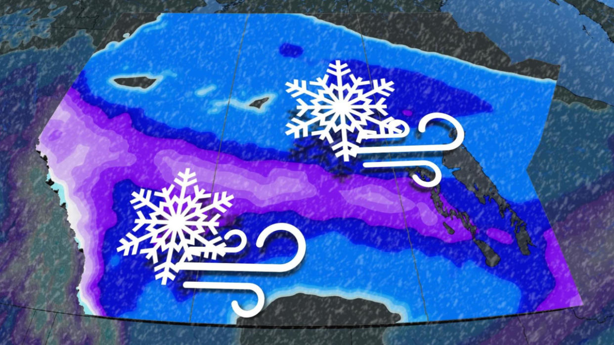
Gusty winds and blowing snow will put winter driving to the test across parts of the Prairies to start this week, with the northerly winds ushering in much colder temperatures and bitter wind chills by Tuesday.
A low-pressure system kicked off the snowfall on Sunday, with some areas expected to see the heaviest accumulations of the season so far. Although the snow will wind down from west to east throughout the day on Monday, gusty winds and reduced visibilities are expected with the freshly fallen snow.
Several schools across western and central Manitoba opted to close their doors first thing Monday as a result of the deteriorating conditions.
DON’T MISS: Earth just experienced its hottest 12 months in recorded history
Poor travel amid blowing snow through Monday
The low will continue to track east, north of Saskatoon and into the Interlake region of Manitoba through the day on Monday. The heaviest swath of snow will tend to align with the Yellowhead Highway and into southern Manitoba.

An additional 5-10 cm of snow is expected throughout the day, with as much as 20 cm possible for extreme southern sections of Manitoba. Lower totals are likely north and south of the system’s track, with 5-10 cm of snow on tap for Winnipeg, and less than 5 cm for Regina.
Blowing snow will also remain a concern with this system as it tracks eastward. Widespread gusts between 40-60 km/h winds will be felt across the Yellowhead and Trans-Canada Highway. The gustiest winds will be in Saskatchewan.
Drivers are urged to adapt to the changing conditions, or to postpone any non-essential travel until conditions improve.

Temperatures take a dramatic hit by Tuesday
At the same time, as the system tracks east and northerly winds pick up, temperatures will drop to well below seasonal values through the first half of this week.
So far, we’ve seen an exceptionally warm winter across the Prairies this season despite the intense cold some communities endured in January. The relative lack of classic winter weather will likely make this burst of snow and frigid temperatures feel that much worse.
MUST SEE: What is a sluff? These common slides spell danger in the mountains
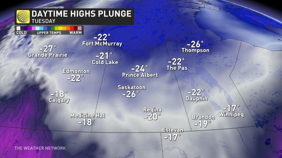
Daytime highs will only reach the minus 20s across much of Alberta and Saskatchewan by Tuesday, with a rapid warmup back above the freezing mark arriving by Thursday.
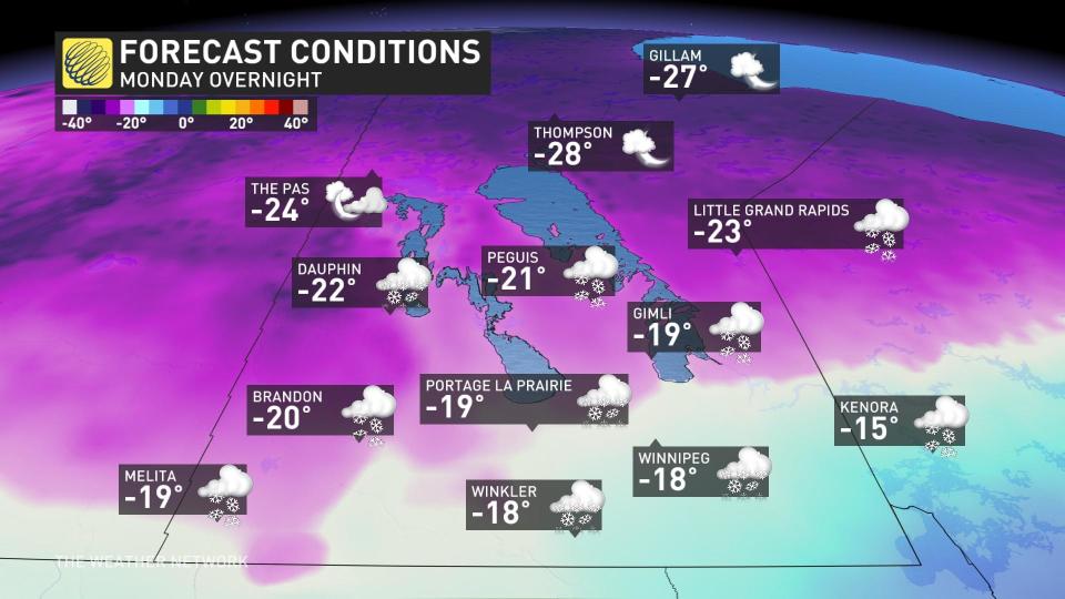
Manitoba will see a dramatic temperature swing during the day Monday, with communities near the international border seeing a 25+ degree temperature swing between Monday afternoon’s high and Monday night’s low.
Much as we’ll see on the western Prairies, Winnipeg’s high of -13°C on Tuesday will swing back to a relatively balmy 3°C by Thursday.
Check back for all the latest on your forecast across the Prairies.

