
'Blustery and messy' weather headed for N.L., says meteorologist
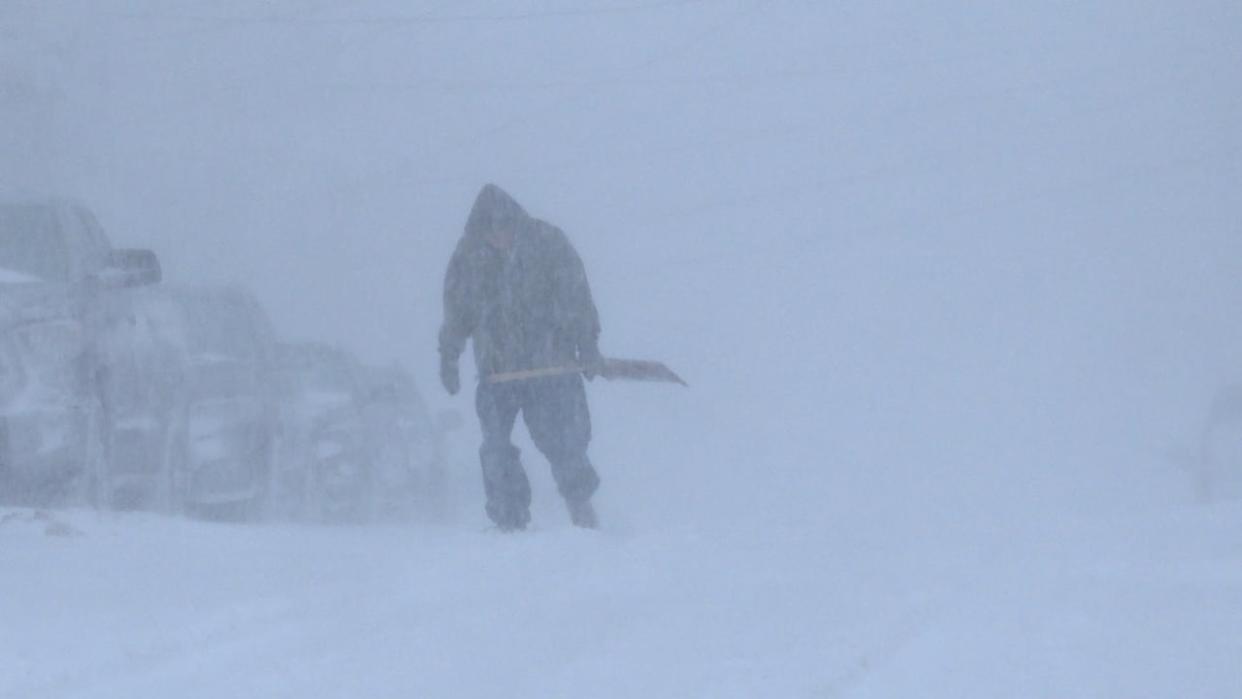
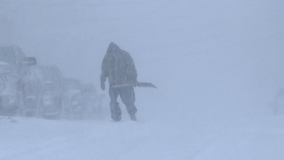
High winds and blowing snow expected to land late Tuesday evening and make for a messy Wednesday, says meteorologist Veronica Sullivan. (Meg Roberts/CBC)
A weather system is expected to impact most of the province Tuesday evening before turning from snowfall into rain to make for a "blustery and messy" Wednesday, says Veronica Sullivan, a meteorologist with Environment Canada.
The system will first land on the southwest corner of Newfoundland Tuesday evening and then make its way from southwest to northeast, she said.
"By the early morning hours of Wednesday, we can expect pretty much the entire island to be in that snowfall region," Sullivan told CBC News on Tuesday.
"And behind it we can expect… a brief period of freezing precipitation, some ice pellets and freezing rain and then some rain showers or flurries behind all of that."
Sullivan said it's expected that the worst of the weather, which includes high winds, will happen Wednesday during the commuter hours.
"So not ideal for those of us who are traveling," she said.
Environment Canada issued blowing snow advisories for most of the island and parts of Labrador. Rainfall warnings are in place for the southern area of the Avalon Peninsula and winter storm warnings are in place for northern Labrador.
Shift from snow to rain
Southeasterly winds will bring in warm air and the temperature will increase, leading to "different precipitation phases" like ice pellets and freezing rain.
"That means that once the snow has fallen and it transitions into either rain or pellets, it's going to become really heavy and dense and very hard to clean up," said Sullivan.
"So my recommendation would be; try and get it cleaned up before it changes, otherwise it's gonna get even messier."
The St. John's area is projected to get around five centimetres, she said, adding there will be a lot of blowing snow due to strong winds.
"But once that transitions over to ice pellets and freezing rain Wednesday morning and then to rain, I don't know if it's going to be enough to get rid of all the snow that will have fallen."
Sullivan also pointed out temperatures will rise to 7 C on Wednesday for the northern Avalon Peninsula.
"If you really have nowhere to go, nowhere to be, and you just sit in your house and let it happen, probably by the end of the day you might be OK."
Sullivan advised people to check storm drains to make sure they aren't clogged in preparation for all that melting snow.
"Just be aware of, you know, localized flooding in low lying areas, that kind of stuff," she said.
She added temperatures are expected to drop and stay below zero in the next few days, which could result in a lot of ice.
Download our free CBC News app to sign up for push alerts for CBC Newfoundland and Labrador. Click here to visit our landing page.

