
Arctic front drops up to 20 cm of snow in Alberta, plummeting temperatures
October in Alberta has been anything but normal this year, temperature-wise. The month started with above-normal temperatures that had people delaying putting their summer shorts away for the year and is now facing a sudden shift into below-normal temperatures that could bring about people's first snowfall of the season.
SNEAK PEEK: What El Niño means for Canada's upcoming winter season
The upper-level pattern that’s kept us warmer-than-normal will finally start to progress eastward, allowing a sharp trough to dig in and take its place. This will open the atmospheric floodgates and allow brisk air from Northern Canada to spill south, sending temperatures crashing down from their lofty heights.
Monday
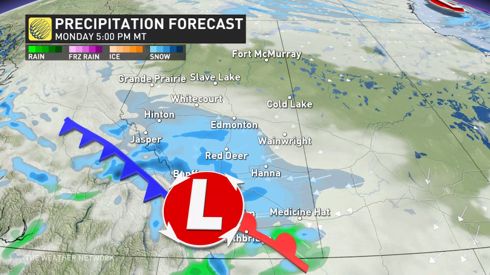
An Arctic front sweeping across the Rockies Monday will flip temperatures from above-seasonal to below-seasonal in just a couple of hours.
While the cold air is forced up the foothills, folks around the region can expect to see some snow falling for the first time this season. Upsloping snow has started across the foothills to start the week while a couple of clippers start to form.
An abundance of atmospheric moisture will bump up the snowfall rates and spread the snow toward Calgary and the rest of southern Alberta. This has prompted Environment and Climate Change Canada to issue a snowfall warning for the city of Calgary.
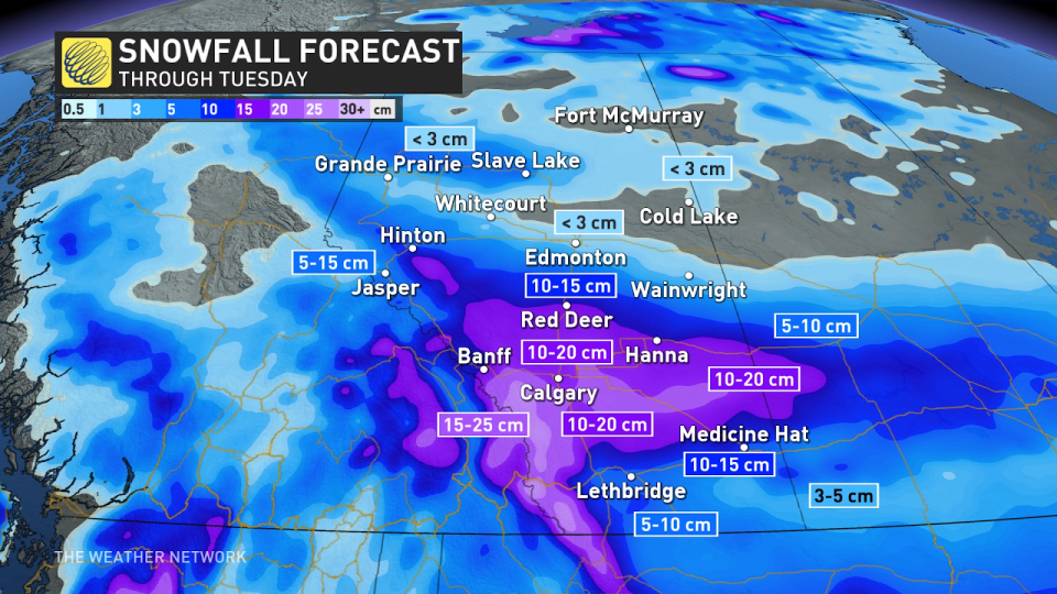
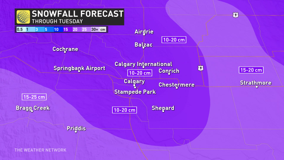
The heaviest snowfall on Monday and Tuesday will set up overtop of Red Deer and Calgary, with some localized totals pushing towards 10-20 of snowfall, and 5-10 cm for most other areas.
DON'T MISS: Largest solar storm ever revealed by ancient tree rings
Snowfall will be light for Alberta until Monday afternoon and evening, where the heaviest rates are expected. This will call for a slower commute on Monday. Conditions should improve a bit on Tuesday morning, but light snow will still be falling from the sky.
Tuesday and Wednesday
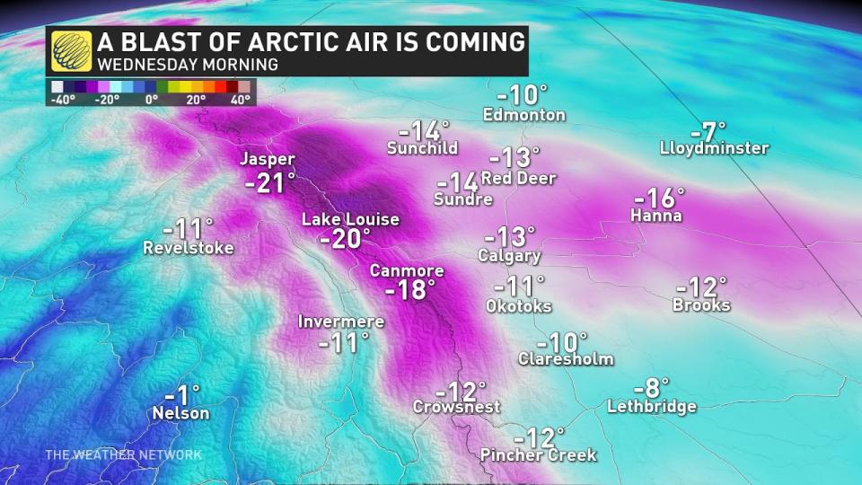
There is high confidence that Tuesday and Wednesday will produce the coldest daytime highs out of this first fall cold snap, with overnight lows falling into the minus double digits as the snowfall eases, while a band of Arctic air settles in from northern British Columbia across central Alberta.
That may not be the end of the snow for next week, either.
Low confidence exists for some additional snowfall late Wednesday into Thursday as an upper trough rolls in off the Pacific, but some computer models show the dense, Arctic air shifting the storm track well south. It will take a couple of days to resolve this feature, and we should have a better idea of this by Monday.
GET READY: Make these simple routine changes to prevent dry, brittle hair in winter
So has it been this cold, this early, before? Absolutely. Just go back to October of 2020 when the daytime high hovered near -10°C around this time of year.
This doesn’t mean Calgary is going to see the snowiest October on record. That record stretches back to just five years ago in 2018 when nearly 50 cm of snowfall fell throughout the month, more than 400 per cent of normal.
Keep checking back to The Weather Network for more forecast information and updates on your weather across Alberta.

