
Brace for more winter weather travel, as snow and winds return to Newfoundland

Special weather statements are in effect for a late-week spring storm that threatens powerful winds, ice and snow in Newfoundland. April snow was actually forecast in almost every province of the country this week.
DON'T MISS: No April fool: Almost every province could see snow this week
Dangerous whiteouts, and even blizzard-like conditions are possible over the island, as the snow and winds pick up throughout the day on Thursday. Although it will be brief, the few hours of wintry conditions could get intense.
Drivers are urged to plan ahead, and to stay up-to-date on the weather warnings as the storm draws near. Many have likely already removed winter tires, so travel conditions could get quite dicey at times.
Thursday into Friday: Strengthening system brings in wind, ice and snow
A system will stall and then strengthen offshore through Thursday, all thanks to a weakening Rex block over the Atlantic Ocean.
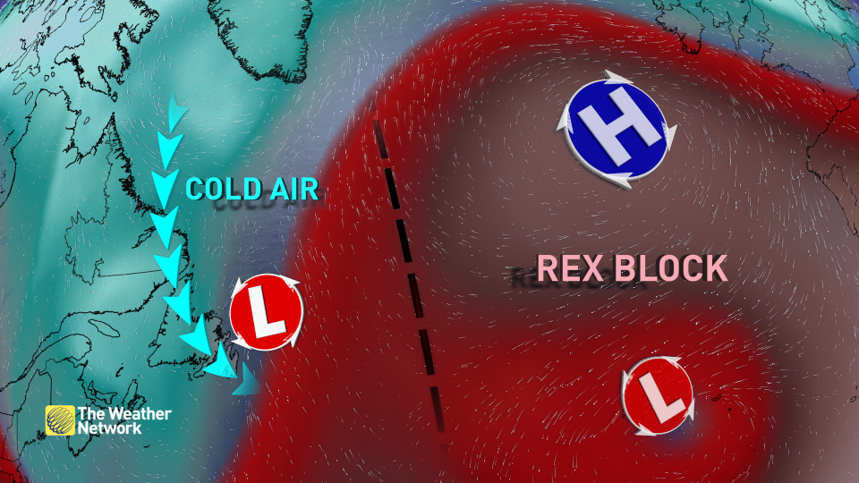
It will back into the north coast of the island by Thursday morning, bringing in snow flurries to start.
Snowfall rates will begin to pick up throughout the day, likely impacting drivers for the evening commute.
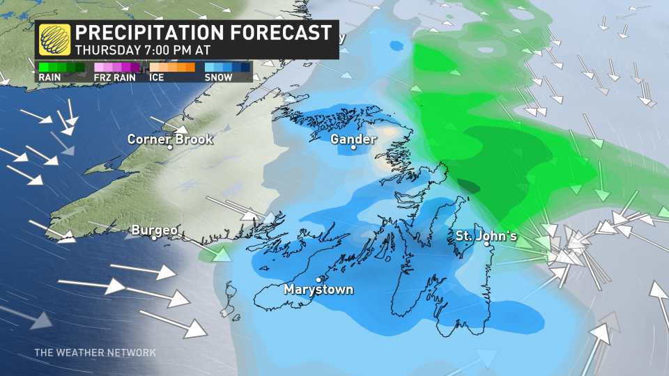
Winds from the north will also be strong, gusting to 70 to 90 km/h, threatening whiteout, and even blizzard-like conditions through the afternoon and evening hours.
"It looks like the snow will coincide with Thursday afternoon's rush hour," says Environment and Climate Change Canada (ECCC) in the special weather statement. "Road conditions could deteriorate quickly as snow begins to accumulate; it will only partially melt on roads and other surfaces."
The immediate coastlines will likely see a transition over to rainfall through the overnight hours on Thursday. Precipitation may mix with freezing rain and sleet as it changes from snow to rain, resulting in some slick and icy conditions into Friday morning.
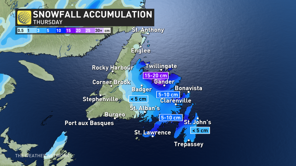
There is still some uncertainty with exact snowfall totals and locations due to the marginal temperatures, but between 10-20 cm is currently forecast to fall near Gander, or slightly south. A widespread 5-10 cm is likely elsewhere. Areas that do see rain following the snow however, will likely wash out any of the higher accumulations.
Quiet weather returns for most of next week, and no major systems are expected.
WATCH: Hearing 'Rex Block' in your forecast? What it means for your weather
Be sure to check back for the latest weather details across Newfoundland.

