Canada will see the world’s largest weather anomaly on Monday
A major storm sweeping into Eastern Canada will bring more than powerful winds and heavy rainfall north of the border.
When looking at a few common weather metrics, the sweeping low-pressure system is a global outlier. The maps below highlight what is so exceptional about the system ahead.
DON'T MISS: 'Weather bombs' are explosive storms that create ferocious conditions
Temperatures far above seasonal for mid-December
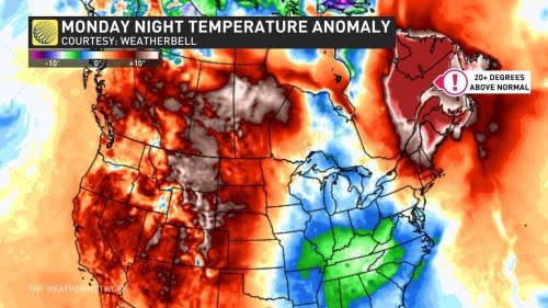
Across all of North America, where is the warmest air compared to normal on Monday? Right over Quebec and Atlantic Canada:
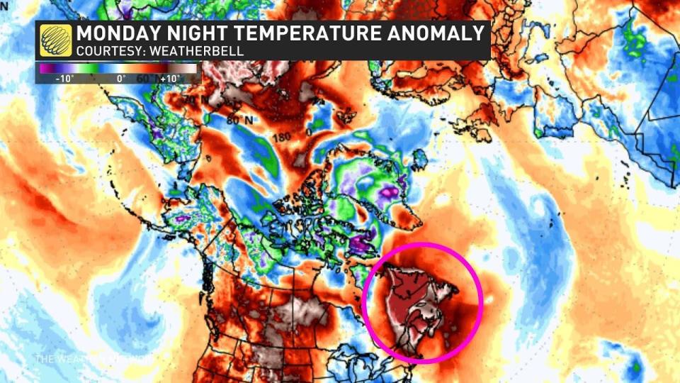
But what about the entire northern hemisphere?
You guessed it—still parked over Quebec, Labrador, and the Maritimes:
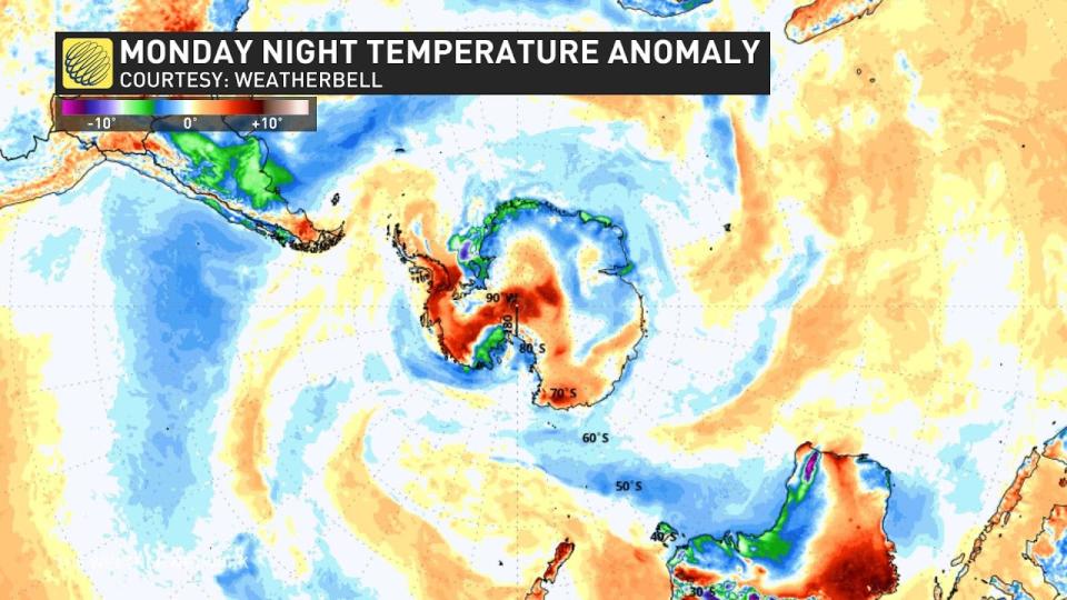
What about in the southern hemisphere, where it’s just days from the summer solstice?
It’s still not even close. The most significant temperature anomaly in the southern hemisphere on Monday is just 12 degrees above seasonal.
Quebec City is facing its warmest day in meteorological winter (Dec. to Feb.) on Monday, where temperatures are forecast to be as high as 15°C. An average daytime high there is -6°C. The wettest day in meteorological winter history is also possible in the provincial capital.
The warmth surges into Labrador where Happy Valley-Goose Bay will likely break their warmest December temperature on record.
Impressive moisture and record-low pressures
There is an unusual amount of atmospheric moisture moving into Eastern Canada, coming in higher than 600 percent of mid-December averages. This anomaly is the greatest in the northern and southern hemispheres.
The warmth will cause Labrador City to see upwards of 20 mm of rainfall, one of the largest winter rainstorms in history there.
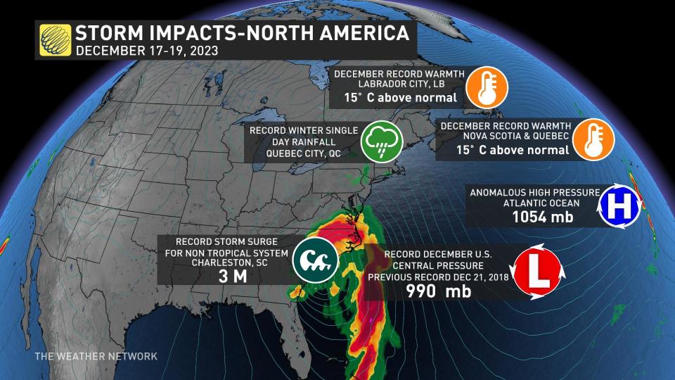
As the weather system moves across the southeastern U.S., it is expected to break the all-time low-pressure record for December as it deepens below 990 mb. This will surpass the more widespread pressure records set there on December 21, 2018.
Storm surge inundated a large portion of the southeast coast, as well, with Charleston, South Carolina, recording its fourth-highest tide on record, and the highest tide for a non-tropical system.
The forces driving such intense weather extremes
A conveyor belt of moisture is moving from the extreme south to the north, and its amplification is due to the extensive ridging in the North Atlantic.
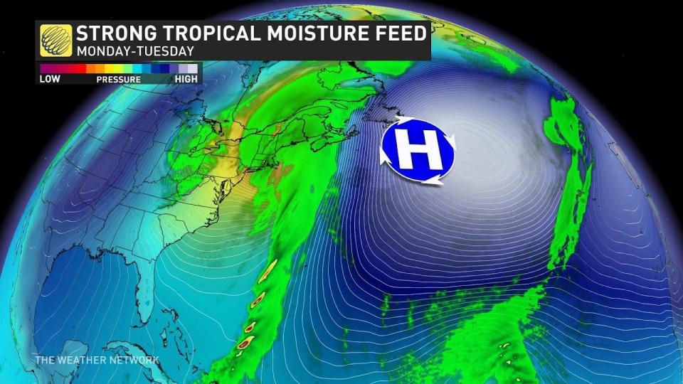
With nowhere else for the warmth and moisture to go, it’s moving toward the north. The moisture is streaming in from the Gulf of Mexico and the Caribbean, where there are some warm sea surface temperature anomalies.


