
New Canadian satellites to improve data collection across the North
Three Canadian Space Agency satellites heading into orbit Wednesday are set to greatly improve data collection in the North.
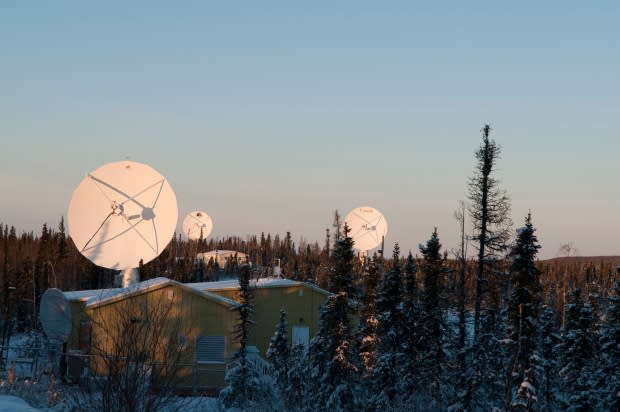
They will be launched from Vandenberg, Calif., and will connect with Inuvik, more than 5,000 kilometres north.
The Canadian Space Agency's third-generation of satellites are expected to transmit six times more data than now available.
They have the unique ability to capture images of the Earth at night and even in cloudy weather, said Dr. Roger De Abreu, acting director of the Canada Centre for Remote Sensing.
"It's a pretty unique perspective of our lands, and importantly, our coastal waterways on all three coasts," he said.
The satellites will collect images of Canada at least daily and even more frequently in the North, he said.
"When you're trying to monitor things such as local ice conditions or permafrost or you're trying to monitor something that's moving quickly like a flood down in the south, the more frequently we get the image, we can do a much better job in terms of understanding and responding to it," he said.
New satellites 50 times more effective
The Canadian Space Agency started designing this generation of satellite imaging in 2006.
Natural Resources Canada (NRCan) worked alongside the Canadian Space Agency to upgrade their ground monitoring stations to have six times more data capability than previously.
Inuvik houses one of three ground stations to make sure the agencies can collect as much data as possible from the RADARSAT Constellation Mission, as it's known.
"As you move these ground stations north, they get to see the [polar-orbiting] satellites more often … they have more opportunity to control it and bring the data down. That's why it was important, in this mission, that we build and ready a satellite [station] in Canada's North. Inuvik was just the right spot for it," said De Abreu.
The first- and second-generation satellites have already proven useful, he said.
"They are used to monitor sea ice conditions to help ships navigate safely in the North and coastal waters with icebergs," De Abreu said.
The data guides the resupply of northern communities, movement of goods out of and into mines, and monitors coastal waters for pollution, including illegal dumping and spills in Canadian waters.
It has also been used to help authorities track down polluters, he said.
"We think we're going to get better information from this new generation of satellites," said De Abreu.
The new satellites will produce daily images around Canada but could produce as many as four a day in the North. The new fleet is 50 times more effective than RADARSAT-1, launched in 1995.
NRCan will use the data to monitor critical infrastructure, including airports, pipelines, resource development, and natural hazards like floods and earthquakes.
It will also help scientists get a better understanding of how climate change is influencing ice cover, permafrost, water and wetlands, he said.
"We've been using it in the North to measure how the Earth moves seasonally as permafrost melts," said De Abreu.
"We've been working with communities to understand what that means to critical infrastructure in northern communities, whether it be roads or runways."
