Category 3 Hurricane Lee begins its turn north. What the forecast track shows
Hurricane Lee has started to turn north as its wind field exploded in size, big enough to potentially scrape Bermuda this week even as the storm stays hundreds of miles away.
Lee, still a powerful Category 3, was expected to keep tilting north and pick up the pace over the next few days. The forecast track puts the storm on a collision course with Maine and Nova Scotia over the weekend.
On Thursday, it should pass Bermuda, which was under a tropical storm warning. By the end of the week, its waves and winds could scrape the coast of New England.
READ MORE: Hurricane Lee’s waves and a cold front approach Florida. What it means for our weather
“Regardless of the details, there is high confidence that Lee will be a large hurricane near the coast of New England Friday night and Saturday,” the National Hurricane Center wrote in the 11 a.m. discussion Wednesday.
By the weekend, the National Hurricane Center said Lee could weaken to a Category 1 storm or tropical storm, but its wind field could balloon even further, spreading damaging winds and waves far from the center.

Puerto Rico, Hispaniola, the Bahamas and the east coast of the U.S. could feel rough surf and rip currents from Lee all week as the massive storm churns northward.
As of the 11 a.m. Wednesday advisory, forecasters said Lee carried 115 mph maximum sustained winds — a Category 3 storm. It was headed north-northwest at 9 mph and was about 430 miles south-southwest of Bermuda.
Hurricane-force winds extended to about 115 miles from the center, and tropical storm-force winds extended up to 240 miles.
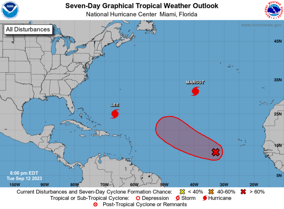
Hurricane Margot and a disturbance
Elsewhere in the Atlantic, the hurricane center was tracking Hurricane Margot and a disturbance with a good shot of developing over the weekend.
Margot, a Category 1 storm, was on a path to nowhere this week. As of Wednesday’s 11 a.m. update, its forecast track was northward and far away from land in the middle Atlantic. The track was a confusing knot, as forecasters expect the storm to curl around nearly in a circle over the week.

By the weekend, forecasters said the hurricane could weaken back down to a tropical storm in colder, northern waters.
The hurricane center is also tracking a disturbance with a 90% chance of developing into a tropical depression by the weekend. Its chances of strengthening in the next two days were up to 70% by Wednesday afternoon.
Gradual development is expected as it moves west-northwest across the Atlantic. The next storm name on the list is Nigel.