
City staff propose 'gold belt' to hem in future Ottawa development
The City of Ottawa is about to have a second marathon debate about where to allow future suburbs to be built, and this time staff propose hemming in development by creating what's being dubbed the "gold belt."
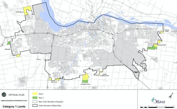
Eight months after city council decided to expand the urban boundary by 1,281 hectares to help house a growing population, senior city planners have released the map of which properties should be developed — and which property owners stand to see values soar if their lands are rezoned.
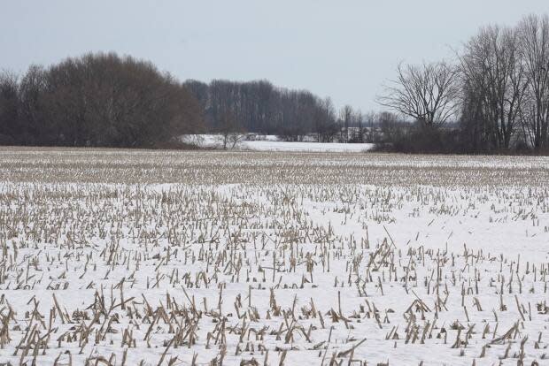
They include areas north of Kanata on March Road, near the future Bowesville O-Train station in the south end, and at the southern edge of Orléans.
Scoring rural properties on such things as how close they are to transit and how costly it would be to build pipes and roads proved a challenge over the past several months, however.
"The easy land has been gobbled up in years past, in previous boundary expansions," said Coun. Scott Moffatt, who belongs to a group of councillors that meets about the new official plan. "So now we're looking at those leftover pieces and where we can [grow], knowing council was clear we would not be touching agricultural lands."
270 hectares short of goal
Staff struggled to come up with all 1,281 hectares council approved adding in May 2020 because they had too many issues with "sub-optimal" lands.
Instead, they recommended converting 1,011 hectares of rural land to urban for now to meet provincial requirements, and then spending the next five years studying three options for making up the 270-hectare shortfall.
That opens the door to creating an entirely new suburb.
For instance, one option involves a huge parcel near the Amazon warehouse southeast of the city where the Algonquins of Ontario envision a community of 35,000 to 45,000 people called Tewin, which they would build with developers Taggart.
An outer Greenbelt
With council determined to protect farmland, staff have also proposed a way to rein in urban development through to the end of the century.
They recommend establishing a "gold belt" or "countryside belt" of farm fields and mineral deposits that would separate existing Kanata, Orléans, Barrhaven and other new communities from rural villages.
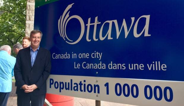
It's possible to keep urban Ottawa from growing beyond that belt or decades, staff said, so long as Ottawa manages to house more of its growing population — projected to rise from one million to 1.4 million by 2046 — within existing neighbourhoods.
In addition to the proposed residential lands, city staff also have mapped out an extra 140 hectares for future e-commerce distribution warehouses and other industries at Highway 417 and Carp Road and between Highway 416 and Barnsdale Road.
Marathon meeting Jan. 25
Last May, a joint meeting of Ottawa's planning and rural affairs committees went on for three days and heard from more than 100 people.
The discussions are watched closely because there's money to be made when the city brings land inside the urban line and allows it to be developed.
Coun. Jan Harder, who chairs the planning committee, said this week she expects another "marathon" for this sequel to last year's urban boundary discussion. The Jan. 25 meeting could well spill over multiple days as well, she said.
City council ultimately votes on the matter Feb. 10, and the approved urban boundary map will be used in the upcoming new official plan, a major document that affects all planning decisions and is set to be tabled in June.
