Cold air, snow will give southern Ontario a wintry start to November
It's about that time of year when Canadians start to reminisce the warm summer months and dread hauling out their shovels and winter jackets, and as 'spooky season' comes to an end, it's time to face the spookiest thing of all: reality. The chill in the air is here to stay and it's bringing snow with it.
A steep temperature drop in Ontario is just the beginning of a pattern change that led to the first snowflakes of the season falling in parts of the region Monday. The snow accumulated in parts of the snowbelt through Tuesday to end off the month and will continue into Wednesday to welcome the new one.
DON'T MISS: Why the first snowfall of the season can catch drivers by surprise
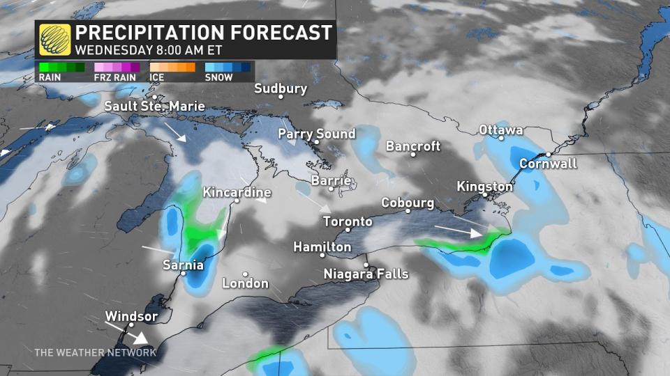
With the cold will be a risk of wet lake-effect snow setting up around the typical snowbelt regions.

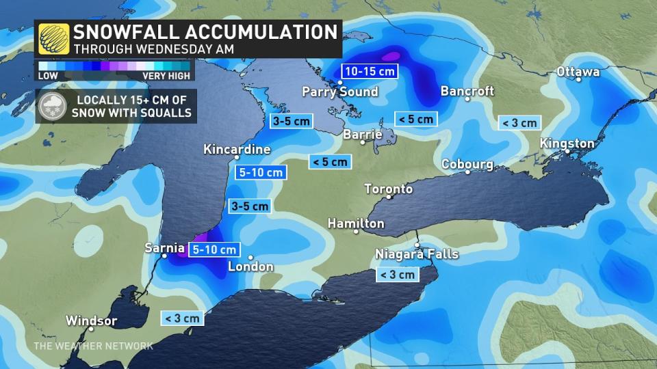
Areas inland at higher elevation have the chance to accumulate over 10 cm near the snow belts, cottage country and between Sarnia to London.
Shoreline communities will struggle to accumulate significant snow due to mixing and marginal temperatures, all thanks to the warmer water.

Conditions ease into Wednesday, but some snow showers may persist between London and Sarnia through the afternoon, where a potent band sets up during the overnight.
Cold and active start to November
A system is expected to track across the region on the weekend with a period of showers, and possibly some wet snow for northern areas, but the timing and track are still uncertain.
A couple shots of colder weather are expected for next week – especially late next week and into the weekend. Also, we're watching the potential for an active pattern, which would mean that parts of the region could see some wintry weather next week.
Check back for all the latest on conditions across Ontario.


