
Winter awakens on the Prairies with a bout of heavy snow and cold air
Winter has been a back-and-forth battle with the Prairies so far, with one of the warmest Decembers on record followed up by the extreme swings of January.
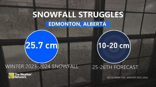
While there has been plenty of cold periods, what has been lacking is the snow. Prolonged warmth and stretches of dry weather has meant a drastic reduction in snowfall amounts this season, with most of the region solidly below seasonal through this point in February.
Sunday will see winter come back with a hefty shot of snow and a considerable temperature nosedive.
A low-pressure system is developing across Alberta on Sunday, and it’s poised to bring some of the heaviest snowfall of the season for some.
DON’T MISS: Earth just experienced its hottest 12 months in recorded history
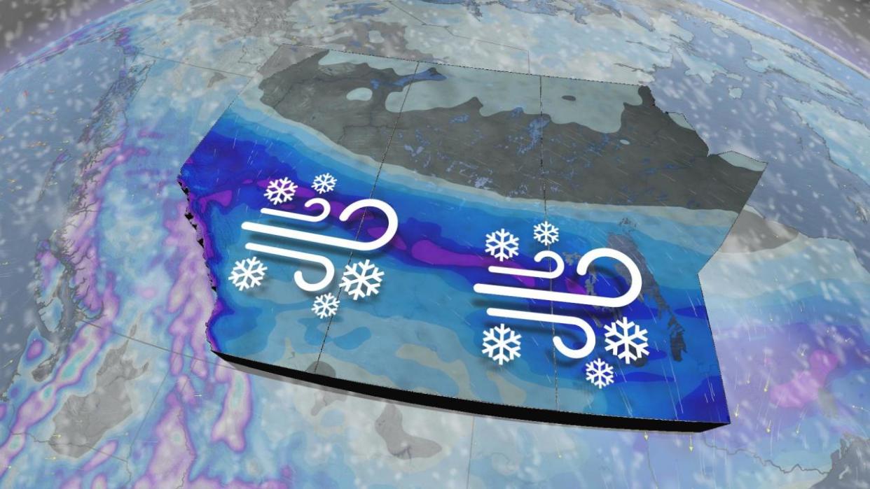
Sunday has an incredibly dynamic temperature profile across Alberta, with temperatures near double-digits across the south while Edmonton begins to accumulate snowfall.
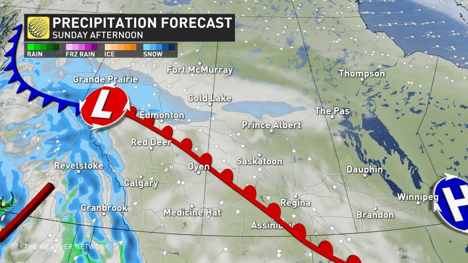
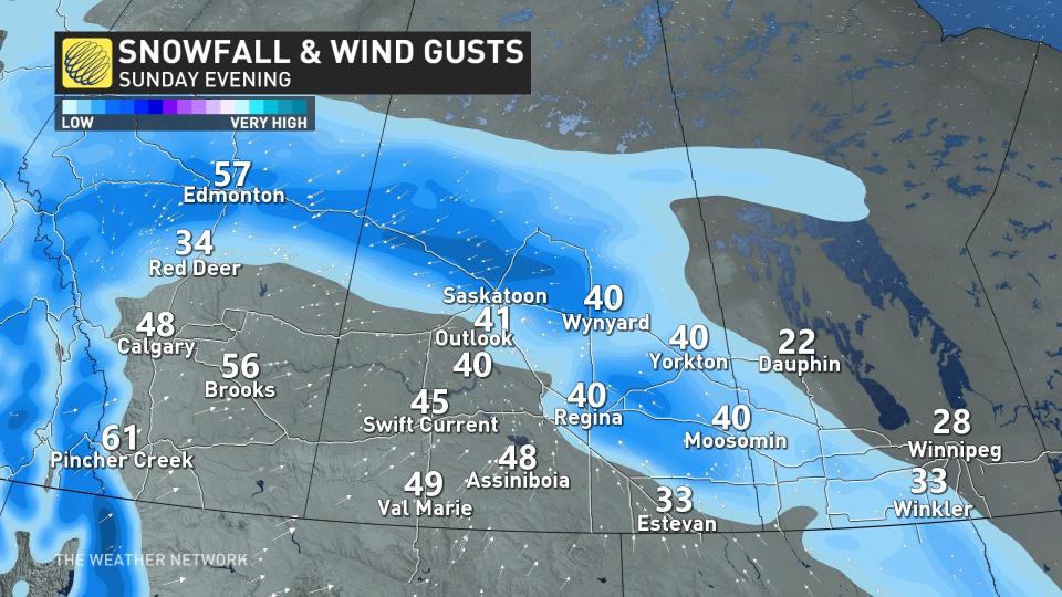
The heaviest snow will fall to the north of the low, largely missing southern sections of the Prairies.
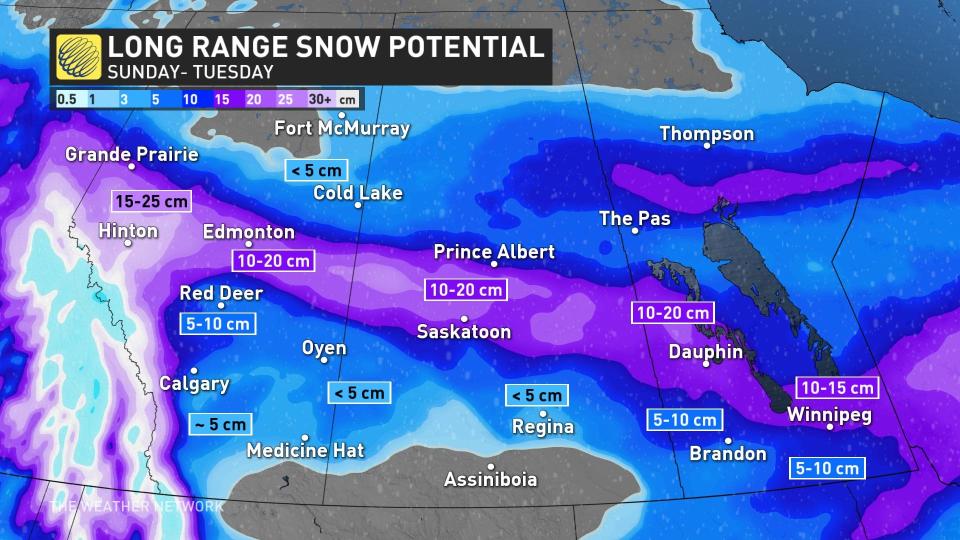
We’ll likely see 15-20 cm of snow on the ground around in Edmonton by the time it concludes. Similar totals will slice through central Saskatchewan, clipping both Prince Albert and Saskatoon to start the week.
Rapidly accumulating snow could make travel difficult over some locations. Visibility may be suddenly reduced at times in heavy snow.
Prepare for quickly changing and deteriorating travel conditions.
Snow will spread across southern Manitoba through Monday morning, bringing a blanket of 10-15 cm to the Winnipeg area. Slightly higher totals are likely north toward the lakes.
MUST SEE: What is a sluff? These common slides spell danger in the mountains
The low will be responsible for gusty winds, so blowing snow is a concern with this system as it tracks eastward.
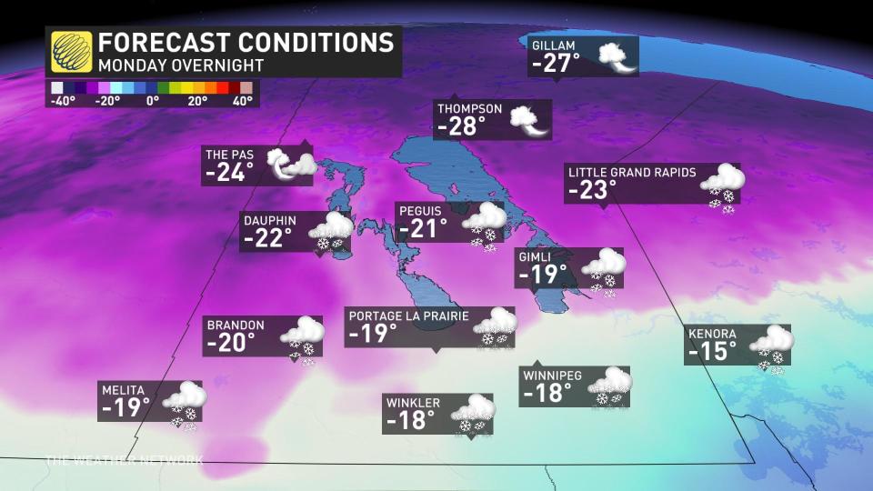
Northerly winds moving in behind the system will drag much colder temperatures across the Prairies to start the week. This will deliver a wintry feel with the fresh snow on the ground.
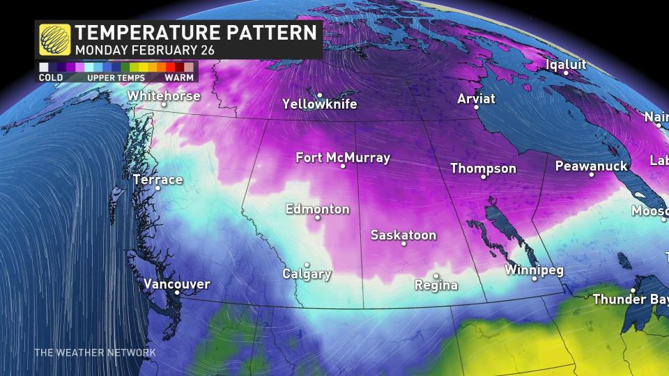
The coldest temperatures will linger through the first half of the week, with slightly below seasonal readings continuing toward next weekend.
Manitoba is in line for a dramatic temperature drop between Monday and Tuesday. Communities near the international border could see a nearly 30-degree temperature swing between Monday afternoon and Tuesday morning.
Check back for all the latest on your forecast across the Prairies.

