
2 dead, thousands without power as storms, tornado pummel Charlotte region
THIS STORY WAS UPDATED AT 6 P.M. FRIDAY, MAY 10, 2024, WHEN THE NWS CONFIRMED A THIRD TORNADO IN WESTERN NORTH CAROLINA DURING THE WEEK’S SEVERE STORMS.
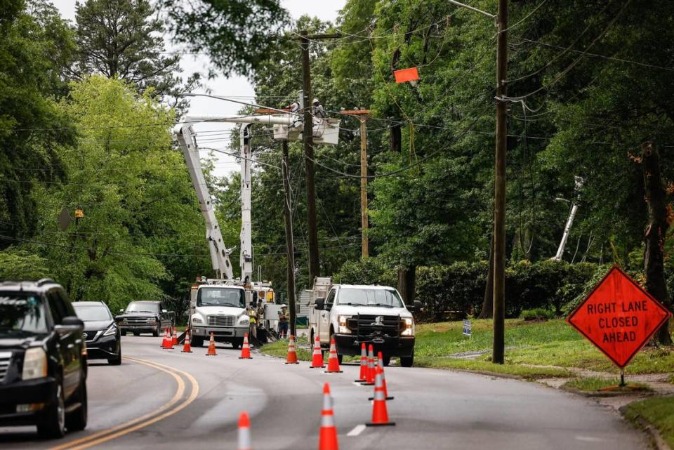
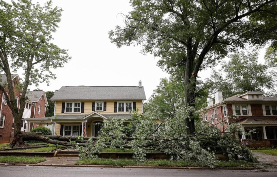
A day after severe storms pummeled the Charlotte region, killing two people, more unsettled weather is forecast Thursday as more than 31,000 Mecklenburg County homes and businesses remained without power.
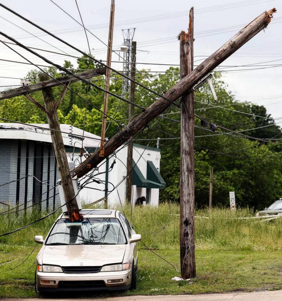
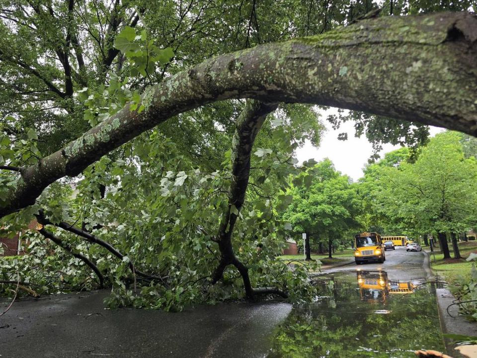
And a National Weather Service team confirmed Thursday that an EF-1 tornado with 110-mph winds tossed trees onto homes along a 22-mile path during the storms.
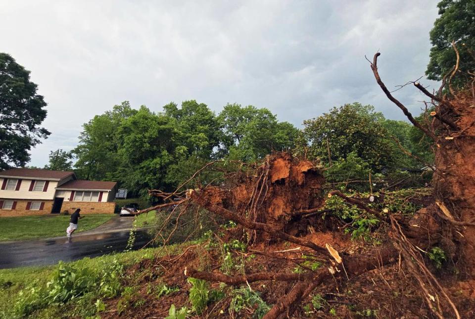
In Gastonia, a weather service team was surveying damage Thursday afternoon from a second possible tornado in the region, meteorologist Thomas Winesett told The Charlotte Observer.
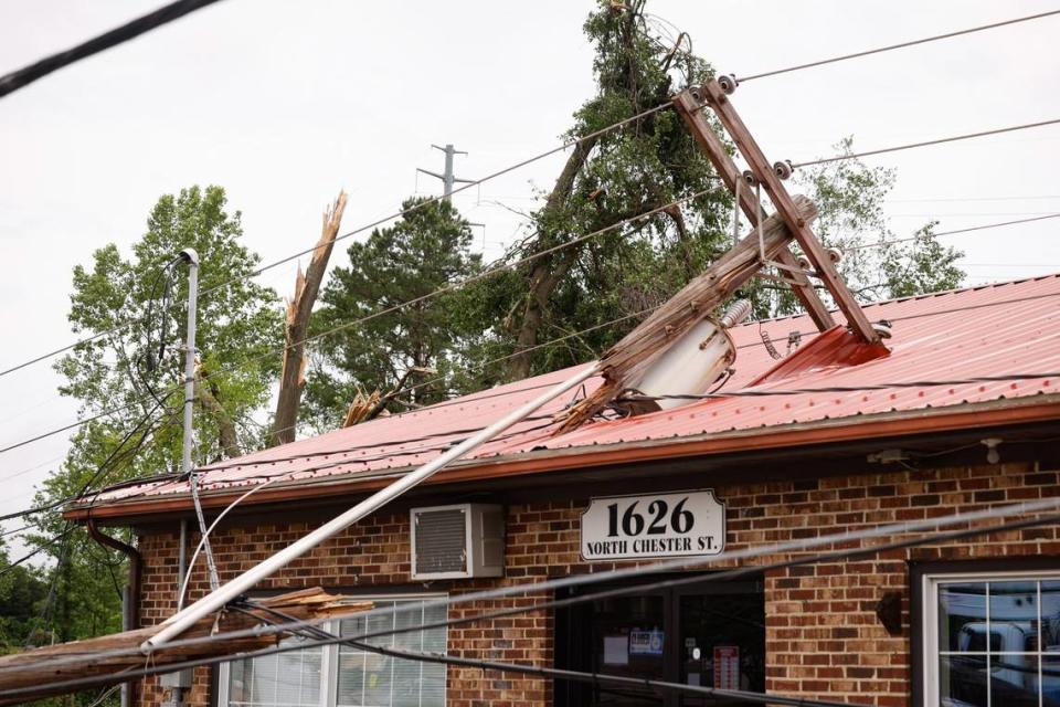
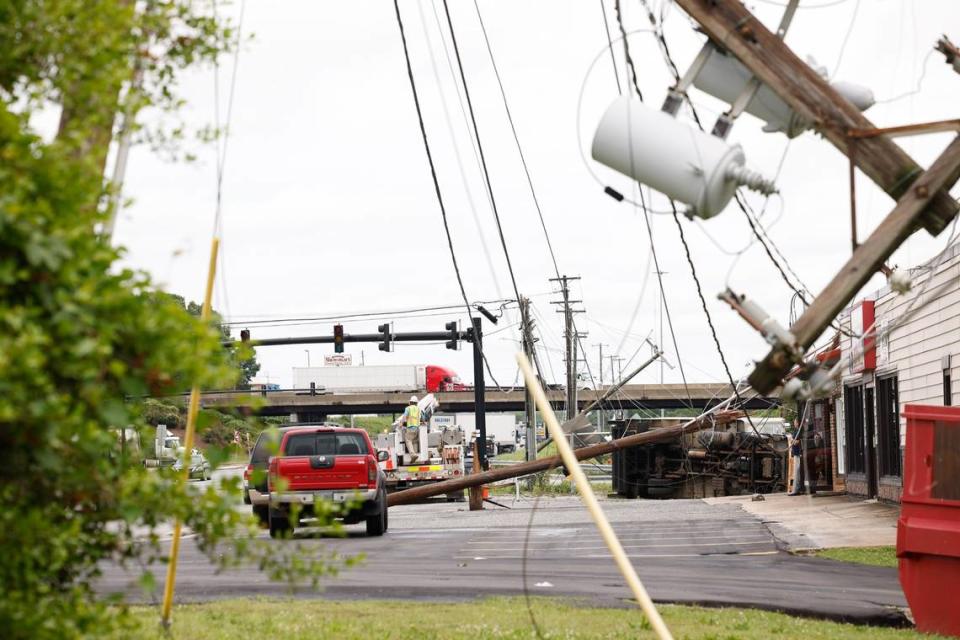
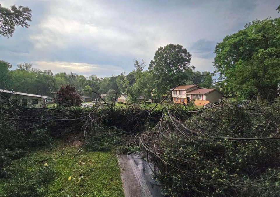
Homes and buildings were damaged in that second area, near the Interstate 85-U.S. 321 interchange, Charlotte Observer reporters found at the scene Thursday.
The path of the EF-1 tornado included Belwood in Cleveland County and Cherryville and High Shoals in Gaston County, Winesett said.
One person was killed Wednesday and a second injured when a tree fell on a vehicle south of Belmont in Gaston County, Observer news partner WSOC reported.
And a 24-year-old woman died when she veered off a rain-slickened road in Lenoir, in Caldwell County, during another batch of severe storms early Thursday, State Highway Patrol Trooper Christopher Casey said.
Lenoir resident Estefani Socorro Mendoza Merlos was traveling west on Indian Grave Road when she crossed the center line, drove off the left side of the road, overturned and hit a tree, Casey said.
“The initial investigation indicates excessive speed for conditions to be the contributing factor in the collision,” Casey said in a statement.
Thousands remain without power
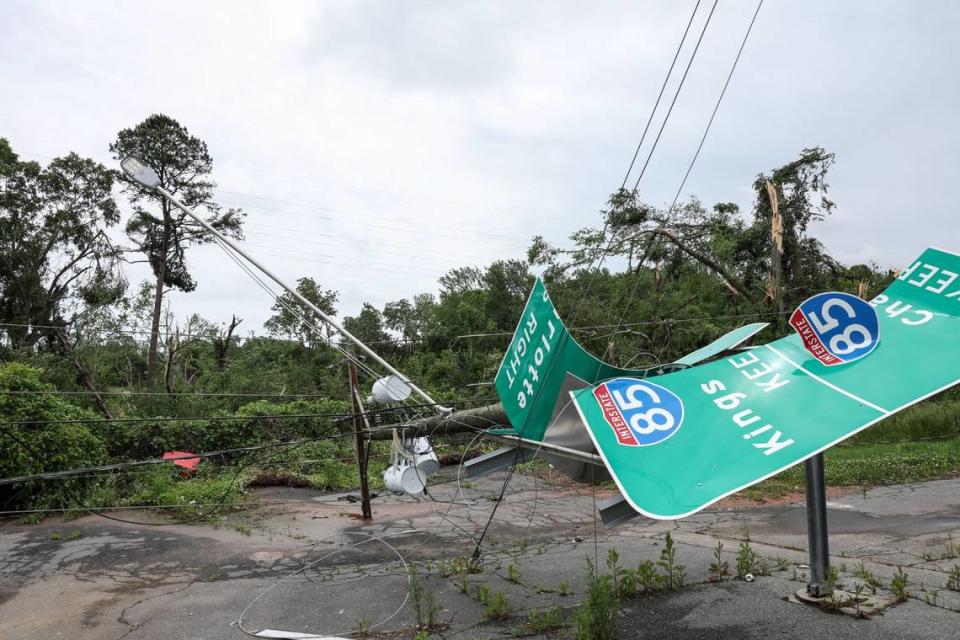
Duke Energy asked for patience as crews worked to restore electricity Thursday morning. More than 100,000 customers in the Carolinas had no power at 10:30 a.m., including more than 23,700 in Gaston County, the Duke Energy outage map showed.
Thursday’s outages in Mecklenburg were down from at least 72,000 reported at 5:15 p.m. Wednesday.
“The severe storms that continue to impact the Carolinas are causing significant damage to trees, power lines, poles and other electrical equipment,” company officials said on the outage map. “Crews have begun making repairs from the initial wave of storms, but additional severe weather is expected throughout Thursday.”
Storms Thursday “will likely cause more outages and slow the pace of restoration,” Duke Energy officials said.
Thunderstorms are expected throughout Thursday in Mecklenburg and surrounding counties, the mountains and Upstate South Carolina, according to a National Weather Service bulletin just before 6 a.m.
The severity of the storms was still uncertain, although “a few storms may become strong to severe, with the main hazards being damaging wind gusts and small hail,” NWS meteorologists said in the alert.
“Heavy rainfall may lead to localized flooding, and cloud-to-ground lightning will accompany any thunderstorms that develop,” according to the weather service.
The weather service issued a tornado watch until 1 p.m for parts of Georgia, Tennessee and Cherokee and Clay counties in the extreme western North Carolina mountains.
Charlotte flight delays
The storms also grounded hundreds of flights at Charlotte’s airport.
Due to thunderstorms, the FAA grounded departures at Charlotte’s airport from 4:12 p.m. to 5 p.m. Wednesday.
At 4:45 p.m. Wednesday, nearly 500 flights were delayed at Charlotte Douglas International Airport, according to Flight Aware.com, which tracks flights at airports.
Airport officials urged passengers to check the status of their flights before leaving for the airport.
Delays were down to about 250 Thursday morning, although it’s unclear how many of those were weather related.
FULL LIST: Updating list of CMS, other schools closed due to storm
Storms downed trees, power lines
Straight-line winds pummeled the Charlotte region on Wednesday, with hail “larger than golf balls” reported in counties west of Mecklenburg, according to the National Weather Service.
At 3:10 p.m., the weather service issued a tornado warning until 3:45 p.m. for Cherryville and High Shoals in Gaston County and Belwood in Cleveland County, saying radar indicated a tornado had formed. Quarter-size hail also was possible, the NWS said on social media.
A severe thunderstorm warning was issued until 4:45 p.m. for Charlotte and Gastonia.
“This storm will contain wind gusts to 70 MPH!” the NWS warned.
In Charlotte, “traffic lights are out, trees are down, roads are flooding,” WSOC reported just before 4:30 p.m. “It’s a mess near Uptown right now.” Additional information about the person killed was not immediately available.
Severe thunderstorm warnings began in Burnsville, Weaverville and other parts of the mountains at 1:30 p.m.
“Very large hail developing with these storms today,” the NWS said. “Take cover if under a Severe Thunderstorm warning!”
Overnight storms
More bad weather hit the region overnight, according to the NWS, which cited “a complex of strong to severe storms” crossing the area.
The threat continues through Thursday, meteorologists said in an alert.
“Scattered storms could redevelop Thursday afternoon, potentially posing another threat of isolated severe weather and locally heavy rainfall,” according to a bulletin.
Gaston County was hit hard, and branches and power lines remained down on Thursday, including near the Bimbo Bakeries plant on Cox Road. Crews were fixing the lines.
Police had blocked off Cox Road between Court Drive and Lowell Road.
The Belmont Drive-In theater in Gaston County posted on social media that it was closed until further notice because of storm damage.

Huge weather system to blame
Wednesday and Thursday’s storms are part of a severe weather system that spawned a deadly tornado in Oklahoma on Tuesday, NWS meteorologist Doug Outlaw said.
The system lost strength on its eastward trek but was strong enough to bring damaging winds to the Carolinas, Outlaw said.
Third tornado confirmed
On Friday, the weather service confirmed a third tornado in Western North Carolina.
The twister formed just after midnight Thursday in rugged terrain between Cullowhee and Glenville in Jackson County, in the N.C. mountains, according to an NWS report.
Charlotte forecast
Showers are likely in Charlotte throughout Thursday, with the chance at 80%, according to the NWS Charlotte forecast at 11 a.m. Thursday.
Showers and thunderstorms have a 40% chance of continuing on Friday, NWS meteorologists said.
The NWS predicts highs to drop from 80 on Thursday and Friday to 75 on Saturday, before increasing to 78 on Sunday and 79 on Monday.
This is a developing story. Check back for updates.
Observer reporter Jeff A. Chamer contributed to this story.
Isolated severe storms are expected this PM. Large hail will be the main threat. Damaging winds and perhaps a brief tornado are also possible. A complex of strong-to-severe storms is then expected to move across the area tonight, posing an elevated risk of damaging winds. pic.twitter.com/x2fUuLUwcr
— NWS GSP (@NWSGSP) May 8, 2024
lots of questions here but we'll need our guard up Thursday for some trouble from up in the Ohio Valley #cltwx pic.twitter.com/BMZozIymXG
— John Ahrens (@JohnAhrensWSOC9) May 7, 2024
— CLT Airport (@CLTAirport) May 8, 2024

