
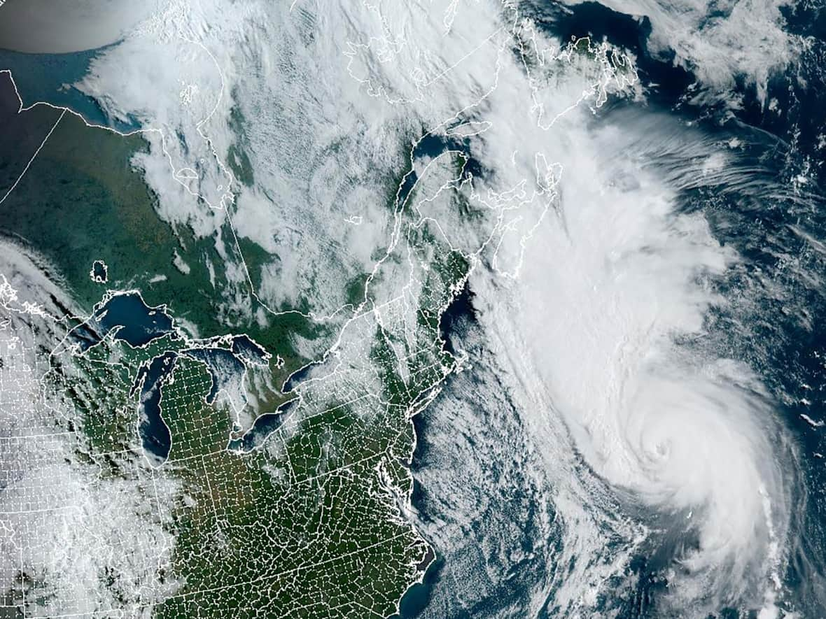
'Dangerous weather conditions' forecast as Hurricane Fiona approaches N.B.
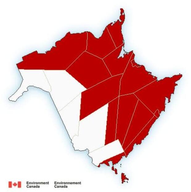
Environment Canada issued Hurricane Fiona-related warnings for regions across New Brunswick on Friday.
Moncton and southeast N.B. have the most warnings out of any area in the province and are expected to bear the brunt of the storm in this region.
The Environment Canada says "Hurricane Fiona is expected to bring dangerous weather conditions tonight and Saturday."
According to its website, regions with storm surge warnings can expect higher than normal water levels with very large waves.
"Even [a] minor surge may cause flooding," said the weather alert. The storm surge is expected to begin Saturday morning and last until noon on Saturday, Environment Canada said.
The tropical storm warning says sustained winds near 65 km/h or more could be caused by Hurricane Fiona. The warning also comes with the threat of local flooding, according to Environment Canada.
The rainfall warnings are for tonight into Saturday afternoon. The total expected rainfall is 60 to 80 mm with local amounts possibly reaching 120 mm.
Wind warnings are issued when there is significant risk of damaging winds. The maximum gusts listed are northerly at 50 to 70 km/h, with gusts of 90 to 100 km/h.
"Similar storms in the past have resulted in prolonged utility outages, hazardous driving conditions and toppling of high sided vehicles," said the alert.
Tropical storm and wind warnings have been issued for:
Acadian Peninsula,
Bathurst and Chaleur region,
Campbellton and Restigouche County,
Fundy National Park,
Grand Lake and Queens County,
Grand Manan and coastal Charlotte County,
Kent County,
Kouchibouguac National Park,
Miramichi area,
Moncton and southeast New Brunswick,
Mount Carleton - Renous Highway,
Oromocto and Sunbury County,
Saint John and County,
Stanley-Doaktown-Blackville area,
Sussex-Kennebecasis Valley and Kings County.
Storm surge warnings
Environment Canada has also issued storm surge warnings for the following areas:
Acadian Peninsula.
Kent County,
Kouchibouguac National Park,
Miramichi area,
Moncton and southeast New Brunswick.
Rainfall warnings are in effect for Moncton and southeast New Brunswick and Fundy National Park.
The tropical storm warnings went into effect around 3:30 a.m. Friday, while the wind, rainfall and storm surge warnings were issued around 10:45 a.m.
Cruise cancellations, municipal contacts
There are also two cruise ship cancellations for Port Saint John. The Celebrity Summit and Caribbean Princess, both originally scheduled for Saturday morning, have been cancelled.
The Silver Whisper has added a visit for 10:15 a.m. on Saturday and there are no changes to the inaugural Norwegian Getaway visit on Sunday.
Some municipalities have posted updates for their residents regarding the storm and what should be done to prepare.
The City of Saint John released a statement Thursday with numbers for residents to call in case of power outages, fallen power lines or flooding. To report flooding, contact Saint John's customer service centre at 506-658-4455.
To report a fallen power line or power outages, call Saint John Energy at 506-658-5252.
The Town of Shediac put out a statement telling residents to call the municipal operations department at 506-533-4037 for fallen trees, blocked catch basins or water pooling on public roadways.

