
Did a tornado hit Canyon County? No. But this weather phenomenon is just as dangerous
In our Reality Check stories, Idaho Statesman journalists seek to hold the powerful accountable and find answers to critical questions in our community. Read more. Story idea? Tips@idahostatesman.com.
As powerful gusts hit Canyon County during a storm last week, some observers mistook the extreme weather as a possible tornado — a rarity in Idaho.
But the culprit of the dramatic winds was a lesser-known phenomenon.
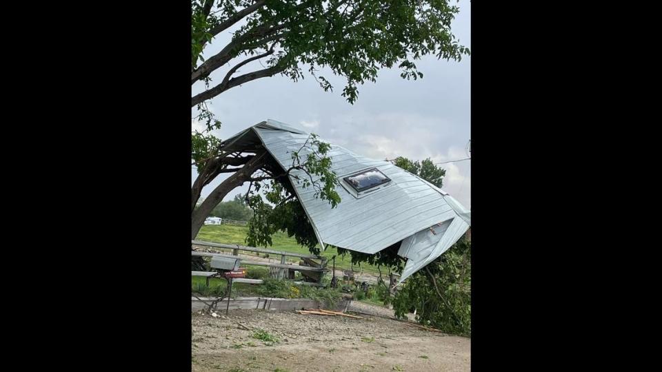
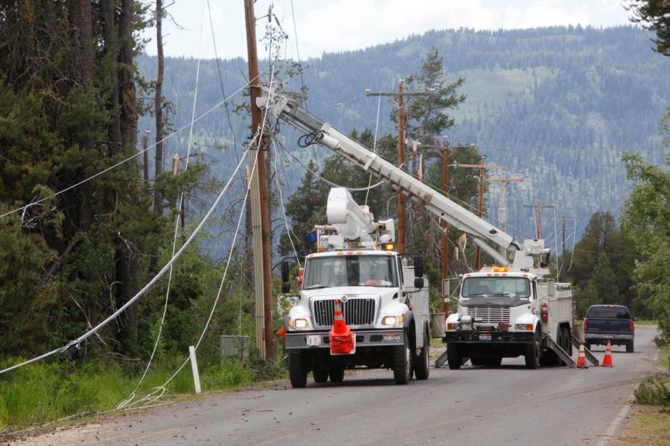
What was described as a possible tornado that touched down within the radius of a disaster emergency area in Canyon County was actually a microburst, according to the National Weather Service in Boise. The weather service last week issued the emergency over a severe thunderstorm cell that passed through the county. The strong winds downed trees and power lines and tore up outbuildings. One person was injured, the Statesman previously reported.
Microbursts occur when a column of air in a thunderstorm rapidly falls, slamming into the ground and sending “intense” winds in every direction, National Weather Service Science Operation Officer Jaret Rogers told the Idaho Statesman.
Winds from microbursts can reach up to 150 mph, equivalent to a moderate tornado, though the Canyon County microburst was similar to a minor tornado and had an estimated 70-80 mph wind peak, Rogers said.
The Treasure Valley averages five to 10 days a summer when the conditions are right for microbursts to happen, according to the Federal Aviation Administration, making them much more likely than tornadoes.
How do microbursts happen?
There are two different kinds of microbursts, both of which cause fast winds.
Canyon County experienced a wet microburst, according to the National Weather Service. That’s when heavy precipitation falls from cooler, high-altitude air, pulls that air into lighter, warmer air and causes it to descend, Rogers said. Because of gravity, it only picks up more speed the farther it falls — resulting in a catastrophic downdraft.
Dry microbursts happen in areas with low humidity and are the most common in Idaho, Rogers told the Statesman. In a dry microburst, there’s still precipitation, but it evaporates before reaching the ground and causes evaporative cooling. The surrounding air absorbs heat and becomes cold and heavy.
According to the Federal Aviation Administration, all microbursts need specific conditions to form:
A rapid decrease in temperature as the altitude increases;
Dry air near the surface to promote evaporative cooling;
And cold precipitation caused by near-freezing temperatures inside clouds.
What makes microbursts different from tornadoes?
There are two big differences between tornadoes and microbursts: the direction of the draft and the damage.
Tornadoes also form during thunderstorms, but in a tornado, lots of warm air rises, causing a strong updraft. When cold air comes down against the winds moving upward, it can tilt air that’s rotating horizontally into a vertical position, forming a tornado, according to the NOAA National Severe Storms Laboratory.
Microbursts are instead characterized by their strong downdraft that comes from sinking air, Rogers said. The pattern of damage is different, too.
“We can look at the damage characteristics and tell what happened,” Rogers said. If everything is pointed outward from one spot, then it was a microburst, but if the damage is in a circular pattern, then it came from a tornado, he said.
Tornadoes can cause far more damage, Rogers added, with winds sometimes exceeding speeds of 200 mph and a path of destruction several miles long that can last up to an hour. The range of microbursts is pretty small, usually within a range of 2.5 miles, and are often over within 15 minutes, according to the National Weather Service.
But in Idaho, Rogers added, tornadoes are rare, weak, and comparable to the strength of microbursts.
Both can be hard to predict. While radar scans can forecast microbursts, there is often not much warning. Once you see a storm on the radar, it gets a little easier, Rogers said. Although advanced notice can sometimes be only 10 minutes.
The real danger of both a microburst and a tornado is not the winds themselves.
“It’s the stuff they blow over,” Roger said. To stay safe in either event, he added, it’s best to “seek shelter and get inside.”

