
Strong winds, blowing snow continue in Toronto Saturday, but storm conditions expected to improve
The latest:
More than 71,000 Hydro One customers remain without power as of Saturday afternoon.
CAA South Central Ontario reports "extremely high demand" and encourages people to stay off the roads.
Toronto Public Health has closed city-run immunization facilities. They'll reopen on Dec. 28.
OPP reports almost 7,000 calls for service in 36 hours.
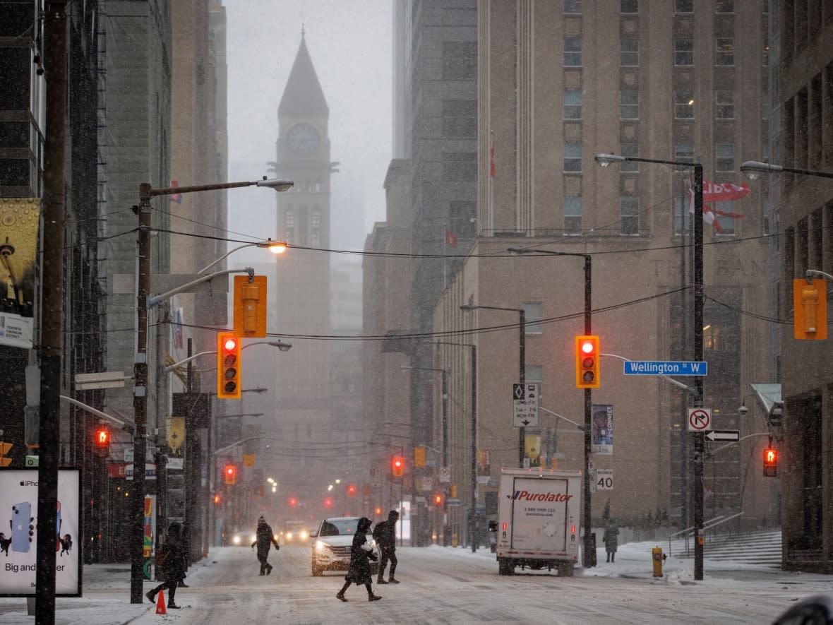
Environment Canada officially ended its winter storm warning for Toronto early Saturday, but blustery weather and high service demands have officials continuing to recommend people stay home as much as possible.
"The worst of it seems to have passed," said Mayor John Tory on Saturday morning, adding that "the amount of snow in particular was much less intensive than expected."
In total, Tory said, the city experienced an average of five to eight centimetres of snow.
Environment Canada currently has the city under a less severe weather advisory, and an extreme cold weather alert.
Strong winds and blowing snow will continue but the snow is expected to taper off to flurries in the afternoon, according to the agency's forecast. It will be quite cold, however, and Torontonians will have to bundle up to stay warm.
"It's still not going to be very pleasant outside," Monica Vaswani, lead meteorologist for Environment Canada, told CBC Toronto on Friday.
Saturday will be better than Friday, but not by much, she said.
"Saturday is expected still to be, unfortunately, not ideal for travel, given the fact that there could still be some blowing snow out on the roads and given the fact that we'll still have accumulating snow. That being said, conditions will slightly improve on Saturday relative to what was experienced on Friday."
Strong winds are expected to ease by early Sunday. However, some areas like the Municipality of Chatham-Kent say it "could take hours, if not days" to deal with the storm's impact.
The municipality declared a state of emergency on Saturday, "due to the effects of the winter storm" that it said caused numerous accidents and left many people stranded, their vehicles abandoned
WATCH | Some delays still expected Saturday at Toronto airport amid winter storm:
Ontario Provincial Police (OPP) say in the last 36 hours, call-takers and dispatchers have tirelessly managed more than 6,970 calls for service.
"Thank you to officers across #Ontario who have braved these unpredictable conditions to attend to stranded motorists and investigate hundreds of collisions," the OPP said on Twitter.
OPP Sgt. Kerry Schmidt says people are still encouraged to stay home as a result of "treacherous driving and highway road closures and whiteout conditions in many parts of the province."
Sections of Highway 401 remain closed between Tilbury and London.
There is "extremely high demand" on Saturday for service, according to CAA South Central Ontario.
A spokesperson said the roadside assistance provider is "working at full capacity while we prioritize emergency calls and members in unsafe situations." CAA echoed others in advising people to stay home unless necessary.
Across Ontario, roughly 71,776 Hydro One customers were without power as of Saturday mid-morning. In Toronto, Tory said most outages were managed on Friday and only "a handful" remain.
He said Toronto Hydro is "keeping a close eye" because of high winds.
The forecast on Saturday calls for:
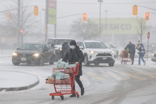
Light snow that is expected to end near noon, then a 40 per cent chance of flurries in the afternoon. There will be blowing snow. Snowfall amounts could be two to four centimetres.
Strong winds with gusts up to 70 km/h all day and into the evening.
The high temperature is expected to be – 6 C.
Wind chill values will make the weather feel like – 21 in the morning and – 15 in the afternoon.
At night, the forecast on Saturday calls for flurries and blowing snow, strong winds gusting up to 60 km/h. The temperature is expected to remain steady at – 6 C, but the wind chill will make it feel like – 15.
The city has closed city-run immunization clinics as a result of the storm, and they will reopen on Dec. 28 following the holiday break.
The city is keeping warming centres open. The mayor said people who stayed in warming centres last night will be moved into other indoor housing on Saturday to accommodate any additional walk-ins.
Tory said warming centres were at 76 per cent capacity across the city on Friday.
Vaswani said the snow on Saturday will be lake-effect snow coming off Georgian Bay and Lake Huron. Some drifting snow is possible and the snow could accumulate.
Areas north and east of Toronto, including York and Durham regions, could see snow squalls from Georgian Bay. Snowfall amounts in those areas could be five to 10 centimetres by Sunday morning.
As for winds, they will remain gusty throughout Saturday, into the evening and into Sunday morning. Any relief from the winds will be early Sunday, she said.
The forecast on Sunday calls for:
A mix of sun and cloud with 60 per cent chance of flurries.
It will be windy.
A high temperature of – 4 C and a low temperature of –10.
Travel conditions will still require "attention on the roads" because there could be low visibility at times, she added.
She urged people to heed weather watches and warnings on the weekend.
'This storm is particularly strong'
Vaswani said the winter storm is combining falling snow with strong winds and the intensity of the storm makes it unusual.
"This storm is particularly strong," she said.
"I, myself, in about 10 years of experience, haven't really seen a storm produce such widespread strong winds in the province of Ontario and then additionally blizzard-like conditions."
The storm for Toronto is expected to be over by Monday morning. The low pressure system is heading in a northeastern direction into Quebec, she said.
On Friday, the storm made travel difficult because there were strong winds and blowing snow all day and into the evening. The temperature also dropped during the day.
Vaswani said it will be a white Christmas, defined as two centimetres of snow on the ground.

