
Parts of B.C. in for rude spring awakening with temperature drop, snow
One step forward, two steps back.
After a painfully slow warm-up this month that began with wet snow across lower elevations, the South Coast will see a temperature freefall later this week.
First, let’s reminisce about the temperatures over the past weekend. Temperatures peaked into the upper teens as a ridge of high pressure provided an ample warm-up.
DON'T MISS: Canada’s spring forecast: Sluggish spring slowly comes to life
Although temperatures were several degrees warmer in March 2019, daytime highs stayed elevated throughout the remainder of the month. It will be quite a shock to the system because, by Thursday, a cool trough visits from the Bering Sea.
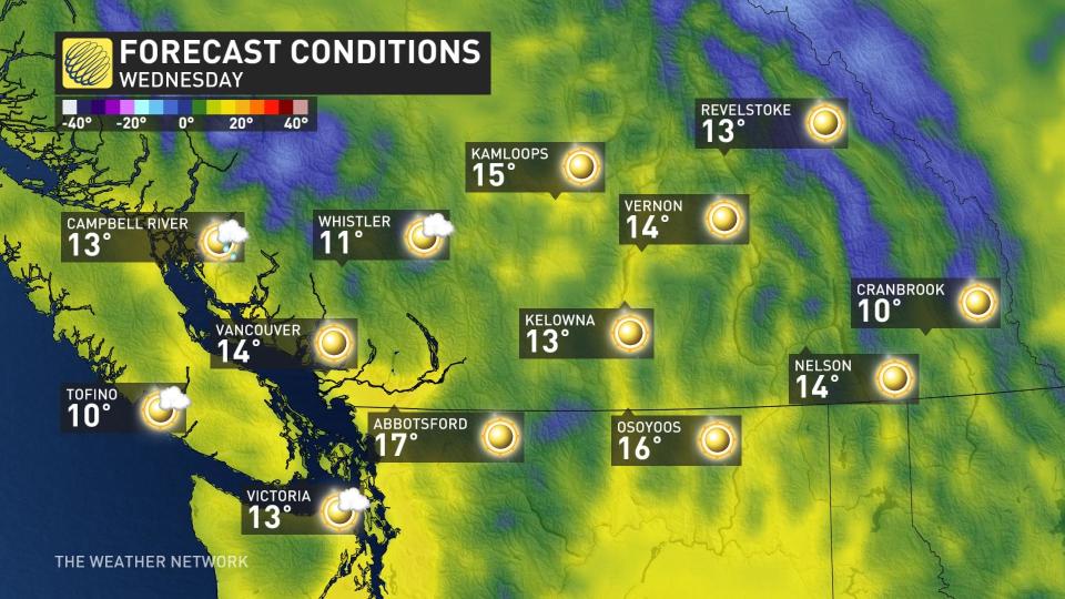
Wednesday should not be overlooked with regards to another day of warm temperatures. Temperatures in the Interior will peak into the mid-teens, making it the warmest day of the year.
An average high for the third week of March is about 11°C for much of the South Coast, and as we push toward the weekend, highs will struggle to get above 6°C or 7°C for several locations.
Here are some first details for some lower-elevation snow threats.
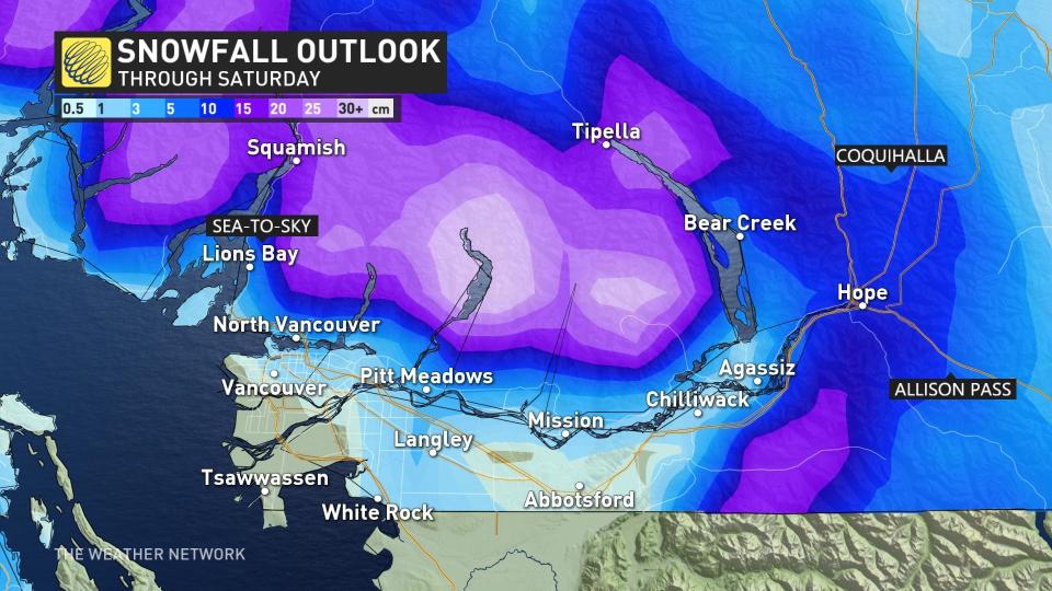
As the cool trough moves inland Thursday, we'll see periods of wet snow develop across inland Vancouver Island. By Thursday night, parts of Metro Vancouver could get into some wet snow, especially above 200 metres.
This pattern is fantastic for those looking to extend their ski season, with numerous chilly frontal systems moving across the South Coast through the end of March.
No major storms are in sight as the storm track continues to be aimed at California.
Another crack at snowfall across Vancouver Island
Thumbnail courtesy of DriveBC.
Stay tuned to The Weather Network for the latest forecast updates for B.C.

