
Will flooding get worse in Whatcom County in the future? This project makes a bold prediction
Several communities in Whatcom County are going to be affected with future sea level rise.
That’s the prediction of a model created to determine how the county will react to flooding, and it is now up to county officials to determine how this problem is going to be addressed.
“The big takeaway is that, based on climate projections, we have several communities in Whatcom County that are vulnerable, certain residences are highly vulnerable to these impacts” Project Manager Chris Elder told The Bellingham Herald in an interview. “It certainly forces county staff and council to start considering what is an appropriate response.”
The project, officially titled the Coastal and Riverine Compound Flood Vulnerability and Risk Assessment Project, was created to determine how much damage Whatcom County will see as a result of flooding. It was completed June 30, and then presented to the Whatcom Climate Change Impact Committee on July 11.
An interactive map shows how Whatcom will be impacted by flooding. The map shows sea level rise scenarios for three flooding events (king tide, 20-year storm, 100-year storm) and reference layers including parcels and feeder bluffs. The map can be found through the Whatcom County website under climate change risks.
The king tide is an unofficial term for a large tidal event. It can raise sea level between 0.9 and 3.1 feet. The 20-year event can cause the same amount of sea level rise as a king tide, but even more if the two are combined. The 100-year storm has up to 6.6 feet of sea level rise in the most-extreme case.
Flooding events are going to get worse and more common not just because of higher sea level rise, but because it combines a higher water level with bigger and more frequent storm events.
“It is hitting us from a bunch of different angles,” Elder said.
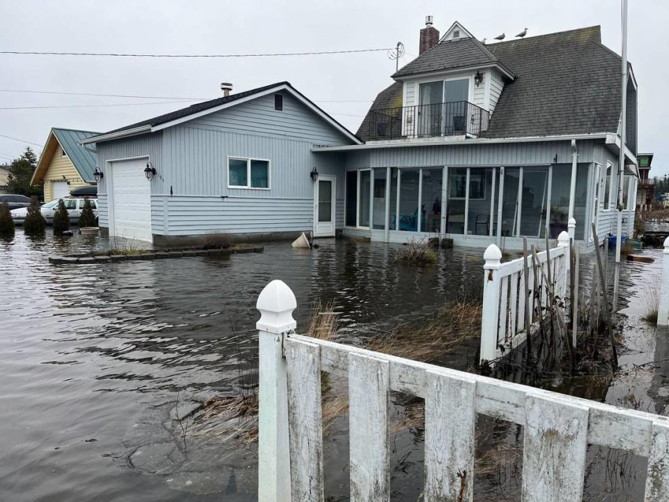
These 20-year and 100-year events are only going to happen more often with climate change. Combined with an increase in sea level rise, storm-related flooding events are going to become more common, and more devastating. The Whatcom County Vulnerability and Risk Assessment study predicts the 20- to 25-year events will occur every 10 years sometime between 2040-2060. It also predicts that flooding similar to the 100-year storm will become the 20-year storm in the same time period, and occur every year by 2080-2100.
“If the sea levels come up, a minor storm has a more significant impact than with today’s sea level rise where it would take a major storm to have the same impact,” Elder said. “It’s not saying we are going to have a 100-year storm every year, it’s saying that based on a change in sea level surface, or a change in big, inland precipitation events, the impacts of what today would be a 100-year storm, would be experienced more often.”
The model was created because even though climate change is going to make sea levels rise, it is hard to predict exactly when and by how much.
“The whole thought was to take the various climate projections that had been developed by the UW (University of Washington) climate impact group, and just model it across the whole coastal and Nooksack riverine shorelines,” Elder said. “That’s what we did with the most-likely scenarios from today out to a little bit beyond (the year) 2100. We did a sweep of different scenarios to demonstrate likely impacts over time and to hopefully give council some options to consider as the make their decision moving forward.”
While the project was able to map how far the water will go under a number of scenarios and locations in Whatcom. Two areas that got an extra look were Birch Bay and Sandy Point. These locations were chosen because they are going to be extra exposed during sea level rise.
Two additional steps were taken for these locations — a sensitivity analysis and an adaptive capacity assessment, Elder said. This closer look mapped not just how far the water would get, but what kinds of resources these areas have that are going to be damaged by the flooding, such as homes, roads and trails. This took a look at what kind of damage the water will do when these areas flood.
Areas in Sandy Point that are going to react poorly to floods include the fire station, wetlands and ponds, roads and parks such as Sandy Point Gardens. Sensitive areas in Birch Bay include the Bay Market Center, sewer infrastructure and wetlands and ponds.
The project was paid for through a $100,000 grant from the Washington State Department of Ecology. Elder said they want to continue this project, and Ecology will soon be releasing a second round of grants for which the county plans to apply.

