
Forecast predicts 'moderate' sized algal bloom for western Lake Erie this summer
The National Oceanic and Atmospheric Administration (NOAA) is predicting a moderate bloom with a severity level of 2-6 on a scale of 1-10 for western Lake Erie this summer.
The U.S. federal agency issued a bulletin last week after collecting data of phosphorus discharge into the Maumee River which dumps into the lake.
"The range in forecasted severity reflects the uncertainty in forecasting precipitation for late June and July," the NOAA bulletin stated.
"We will update the early season projection weekly with new information, and will issue a comprehensive seasonal forecast on June 29."
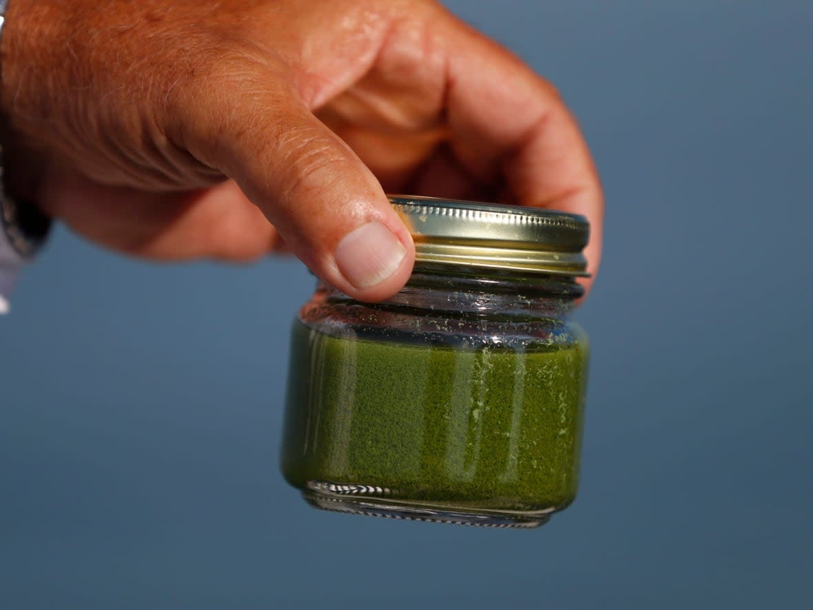
Algal blooms are caused when algae grows quickly in water systems from excess nutrient runoff, like phosphorus or nitrogen from fertilizer. The blooms — often a green scum that smells bad — produce toxins that can be harmful to humans, fish and wildlife.
One of the largest recently recorded algal blooms in western Lake Erie occurred in 2017.
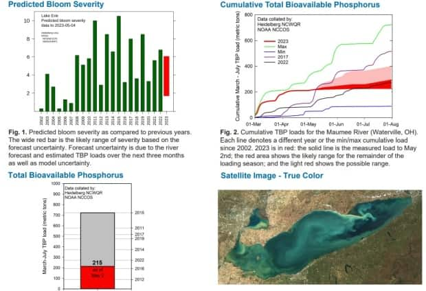
Mike McKay, the director of the University of Windsor's Great Lakes Institute for Environmental Research (GLIER), says NOAA has a strong track record of accurately predicting blooms for over a decade — tracking phosphorus levels from the beginning of March to the end of July.
McKay says this year's early forecast is on par with recent years.
"So, it's fairly similar to what we experienced last year in the western basin of Lake Erie, but not like some of the massive blooms that we've seen in the past decade," McKay said.

GLIER is Canada's only research institute that solely focuses on the Great Lakes, and McKay says NOAA's forecast relies largely on the amount of rainfall in the watershed — with that region having a very wet March and drier than normal April.
"We get a little concerned when the bloom starts encroaching into Canadian waters, typically because the source of the bloom is mainly the Maumee River."

Raj Bejankiwar says NOAA's early prediction means you would still be able to see the bloom from a satellite.
The International Joint Commission scientist expects it to stretch a fair distance.
"So, if you take a picture through the satellite imagery during the summertime, you can see the extent of the green algae bloom from Sandusky, Ohio, to the mouth of Maumee River all the way to Pelee Island," Bejankiwar said.
"That western basin area, I would say you'll be seeing almost 50 per cent of the area covered."
"That is the physical extent, like in the geographical sense. But the severity of the algae bloom is a completely different story."
Bejankiwar expects more definitive models to be available by mid-June.
McKay says aside from Lake Erie, they're also working with water utilities at Lake St. Clair because of a "similar phenomena there," mainly due to nutrient loading coming from the Thames River.
"We have monitoring utilities in Stoney Point and Belle River to provide an early alert to blooms that might be encroaching on the U.S. side of Lake Erie. Every water utility in southeast Michigan and northwest Ohio has some sort of sensor placed over top of the water."

Katie Stammler with the Essex Region Conservation Authority (ERCA) says they take samples once a month, or more frequently, to monitor the amount of phosphorus coming out of their watersheds — ending up going into Lake Erie.
"We've seen moderate blooms the last couple of years," Stammler said, who's a water quality scientist and project manager for source water protection with ERCA.
"We have more persistent and more toxic volumes actually for us in Lake St Clair. So our water treatment operators at Stoney Point have to be keeping a much closer eye on the amount of toxin around there. It doesn't extend too far out from the shore."
Stammler says their tracking models show each year is independent of another, and greatly depends on how wet of a spring the region has.
"Why that matters is because when it rains and rain hits fields that don't have anything growing on them, it picks up all of the dirt and stuff, and dirt holds phosphorous — so it's bringing everything out into the watershed."
If there's a rainy spring, that brings out the nutrients, Stammler says, and feeds the algae leading to a more severe bloom.

