
As wind dies down, biting cold moves in to Tri-Cities. More snow possible
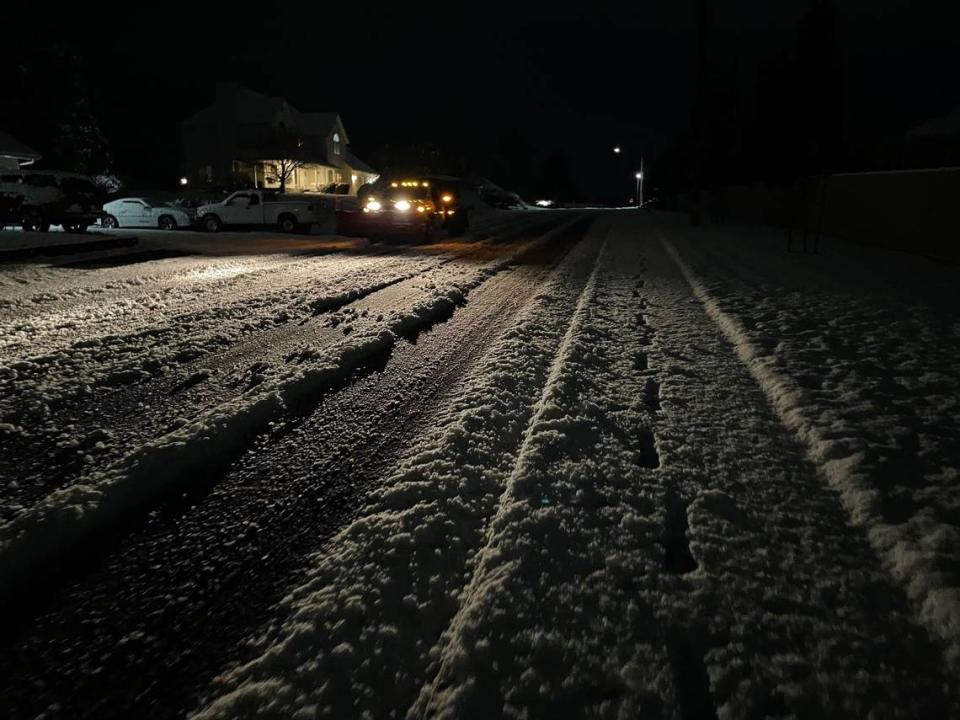
Tri-Citians woke up to one to two inches of snow on Wednesday, and more snow could be coming.
A winter storm watch was issued for the Tri-Cities starting Thursday night, with snow and much colder weather forecast for the end of the week, according to the National Weather Service.
Lows could drop to 1 degree and highs could be as cold as 12 degrees.
“It looks pretty interesting for the weekend,” said weather service meteorologist Rob Brooks.
A winter storm watch has been issued for the Cascade Mountains with subzero lows forecast there and continuing snowfall.
Overnight Tuesday, the first storm system dumped snow throughout the Mid-Columbia region, causing some school delays in outlying areas like Paterson and a two-hour delay for the Kennewick School District on Wednesday morning.
Sixteen crashes were reported on area roadways, said the Washington State Patrol.
The compact snow on Interstate 82 caused several semis to jackknife near Locust Grove Road about 5:45 a.m., Trooper Chris Thorson told the Tri-City Herald. That shut down the southbound lanes for about two hours.
No one was reported hurt.
Much of the snow melted Wednesday — the last day for awhile with a high forecast in the 40s.
Tuesday before the snowfall the Tri-Cities had confirmed wind gusts as high as 55 mph and sustained wind speeds as high as 40 mph.
The weather service had an unconfirmed report of a 67-mph gust in the Richland area and wind speeds in the 60s at the Hanford site north of Richland, with higher blasts on Rattlesnake Mountain, Brooks said.
Reports of wind damage were limited, but the weather service had a report of branches about 2 to 3 inches in diameter breaking off trees in the Finley area.
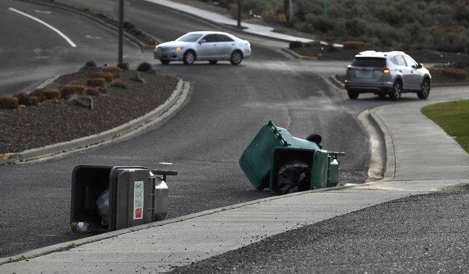
The wind caused a late afternoon power outage in Finley for about 400 Benton PUD customers. They lost power at 3 p.m. and power was restored by 40 minutes later, but crews continued to contend with other outages.
Another outage took out electricity for about 500 Benton PUD customers in the area of Nine Canyon Road and Highway 397 south of Kennewick from 3:20 to 4:40 p.m.
About 130 Franklin PUD customers in downtown Pasco also lost power about 1 p.m., with service restored in about 45 minutes.
A boat also broke free and drifted away at Crow Butte Park on the Columbia River.
Tri-Cities snow, cold
More snow in the Tri-Cities is possible starting late Thursday as a storm system moves down from British Columbia bringing cold air, according to the weather service.
A 40% chance of snow is forecast through 4 p.m. Saturday.
The weather service predicts the temperature could drop to 16 Thursday night, 6 on Friday night, 3 on Saturday night, 1 on Sunday night and 5 Monday night.
Days will not be much warmer.
Friday the high is forecast at 20, dropping to the mid to low teens from Saturday through Tuesday. The coldest days likely will be Sunday and Martin Luther King Day with a high of 12 forecast for both days.
Due to the cold weather the Special Olympics Polar Plunge into the Columbia River in Richland scheduled for Saturday has been postponed until March 16.
I-90 WA pass forecast
A blizzard warning for the Cascade Mountains of Washington, including Interstate 90 at Snoqualmie Pass, expired Wednesday but more snow is forecast.
A winter storm watch has been issued for 4 a.m. Thursday through 4 a.m. Sunday. Heavy snow and areas of blowing snow are forecast.
Thursday new snow accumulation of 4 to 8 inches is possible, with another 1 to 3 inches that night.
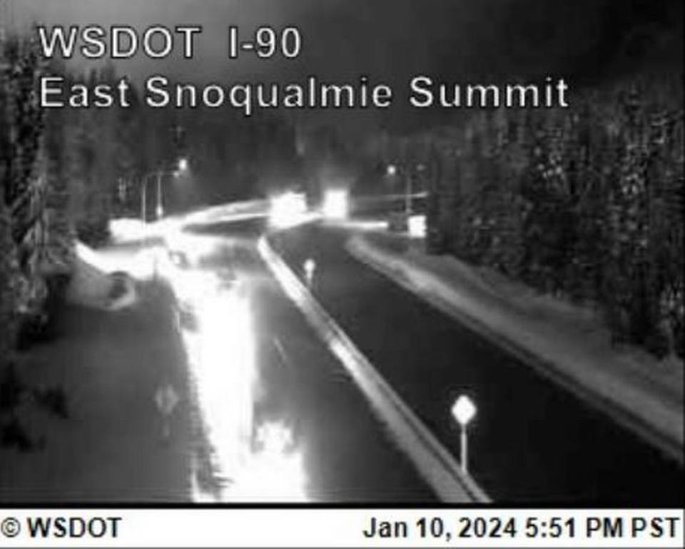
Friday the chance of snow is 60%, with 1 to 2 inches of snow possible before the chance of snow drops to 30% to 20% through Sunday. A slight chance of snow is forecast on Martin Luther King Day.
Travelers should be prepared for subzero temperatures. Friday, Saturday and Sunday nights lows could range from 0 to -3.
I-84 OR pass forecast
A winter storm warning has been issued through early Sunday morning for Interstate 84 in the Oregon Blue Mountains.
The weather service forecast 7 to 11 inches Wednesday afternoon and another 4 to 8 inches overnight at the I-84 pass near Meacham 30 miles east of Pendleton.
Thursday 3 to 7 inches of new snow is possible with another 5 to 9 inches overnight.
Friday could see 3 to 5 inches of snow, Friday night 5 to 9 inches and Saturday another 5 to 9 inches, according to the weather service.
Temperatures are forecast to drop below zero to -5 Saturday night and -4 Sunday night.

