
Intense winter storm likely to snarl holiday travel plans in Quebec
A far-reaching and impactful winter storm is taking aim, with people in Quebec being urged to consider postponing non-essential travel ahead of the holiday weekend.
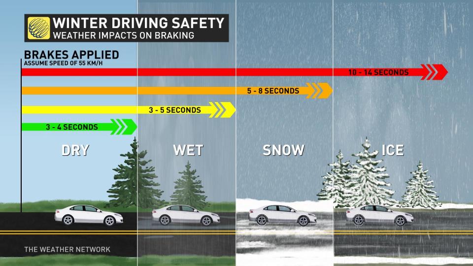
Rapidly accumulating snow will make travel difficult, along with rain and blustery, potentially damaging winds, and the chance of a flash freeze and whiteout conditions. Plan your holiday travel accordingly.
RELATED: Holiday havoc: Vast, 3,000-km-sized storm puts travel plans in peril
Precipitation starts Thursday overnight into Friday
Winter storm warnings and watches, as well as special weather statements are in place across Quebec.
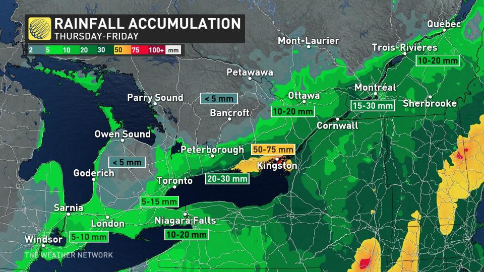
The storm will travel east through Central Canada arriving in Quebec Thursday. Snow will begin spreading across southern Quebec late Thursday into Friday.
"As the system progresses north and east, a sliver of warm air will nudge its way into the Eastern Townships and along the St. Lawrence, transitioning snow to mixing and rain through the day," says Kelly Sonnenburg, a meteorologist at The Weather Network. "Temperatures are forecast to climb to the mid-to-upper single digits."
Winds will increase through the day on Friday, with gusts hitting speeds of 70-90+ km/h.
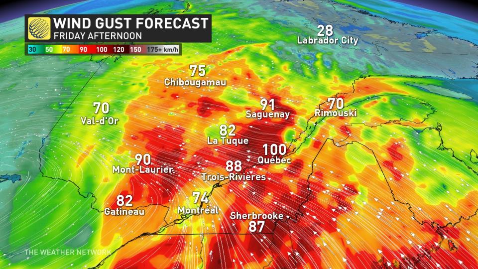
As the cold front sweeps through late-day, temperatures will tumble quickly leading any wet surfaces to ice or freeze over.
"Flash freeze possibilities are likely for roadways and communities across southern parts of the province late Friday into the overnight," adds Sonnenburg.
Significant snowfall rates are forecast through Friday for the Laurentians, and communities along the St. Lawrence including Montreal. Impacts Friday include possible power outages and hazardous driving conditions.
Residents are reminded to pack emergency kits in their vehicle if travel abosolutely cannot be avoided.
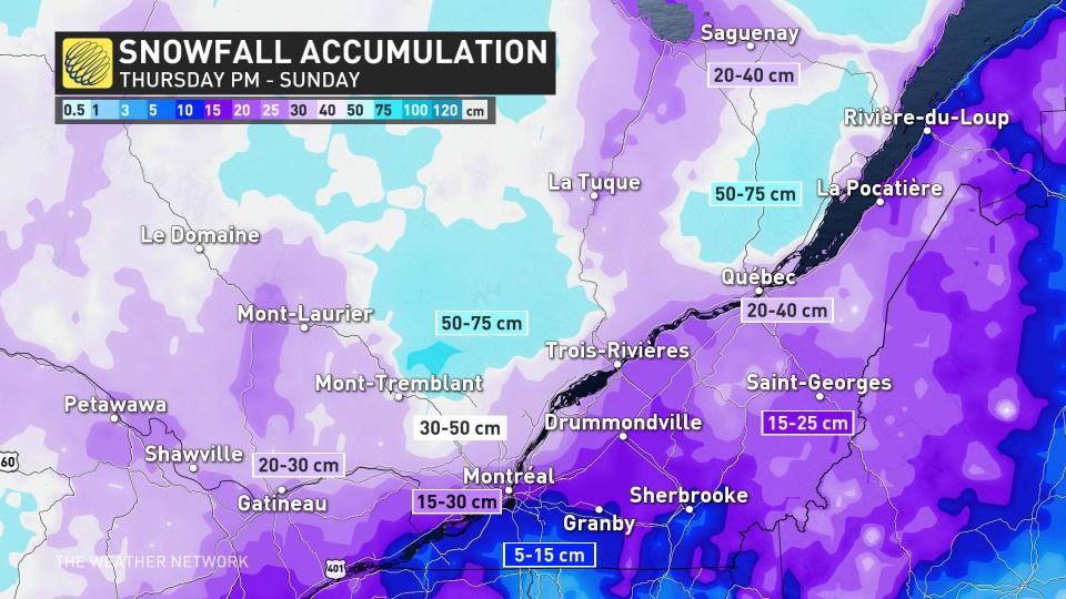
Blustery winds and snow Saturday for Christmas Eve
Although snowfall rates will lighten, weather threats will make travel difficult Saturday as winds will remain blustery through Christmas Eve and widespread snow will continue. With blowing snow in place, whiteouts will still be possible.
Saturday temperatures are forecast to be much colder, with minus single digits for daytime highs.
Cold temperatures persist, but light snow for Christmas on Sunday
Blowing and drifting snow with snow flurries will continue across the province Christmas Day, however snowfall will be rather light.
Temperatures will remain quite cold and hold at minus double-digit highs across the northern half of the province Sunday through early next week.
WATCH: To have a 'White Christmas' specific criteria needs to be met
Check back for the latest on the forecast across Quebec.

