
Isolated storms with large hail possible in Dallas-Fort Worth. Here’s the timeline
North Texans could be in for more severe weather Monday and Tuesday, according to the National Weather Service in Fort Worth.
Monday could see isolated storms form over North and Central Texas, ushering in chances for more widespread severe weather. The highest chance of severe weather will be south of Dallas-Fort Worth, from Cisco to Waco to Killeen.
On Monday, a few storms that form will have the potential to become severe, according to the National Weather Service. The storms are expected to begin developing around 5 p.m. to 6 p.m. with the biggest threats being large hail, with a slight chance of strong winds and the slim possibility of tornadoes.
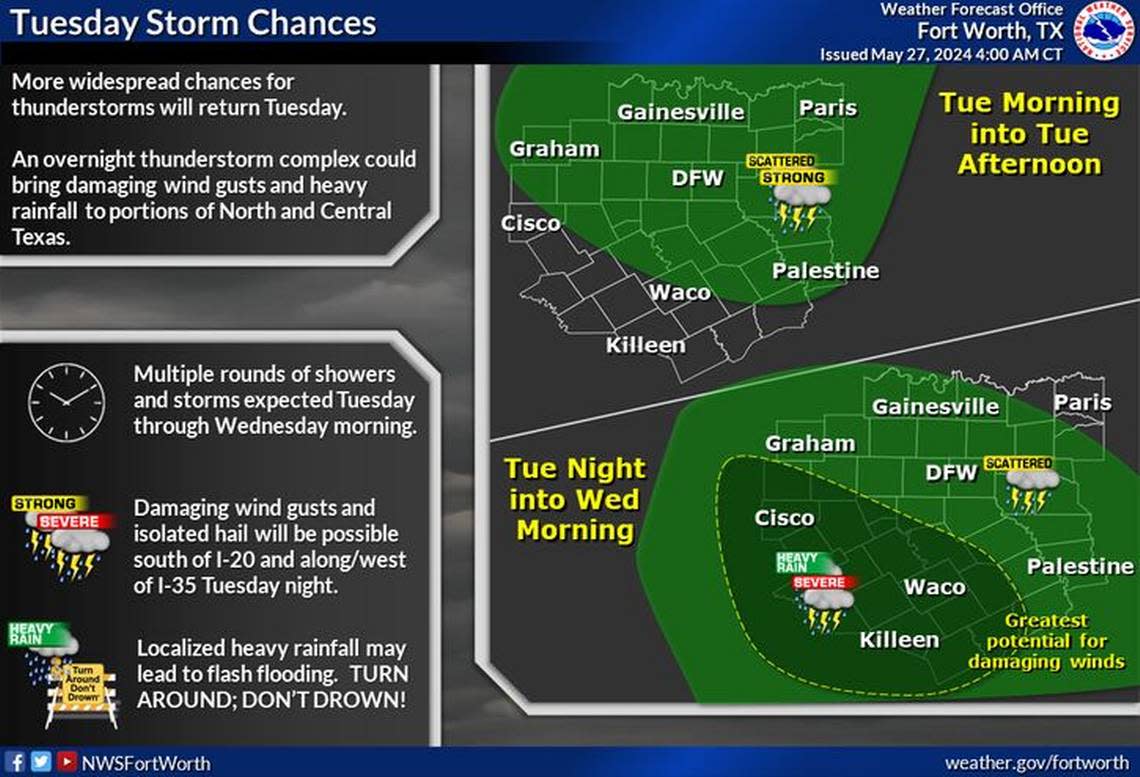
Those storms Tuesday are expected in the morning and afternoon, but a thunderstorm complex could also arrive overnight bringing damaging conditions.
The Tuesday morning and afternoon storms present risks of damaging wind gusts and hail, primarily south of Interstate 20, according to the National Weather Service. Flooding is possible in isolated areas, so be careful when driving. If you don’t know how deep the water is, turn around and find an alternate route.
The new round of potentially severe weather comes after a tornado in Valley View, in Cooke County, killed seven and wounded more than 100.

