
Mackenzie Valley Highway environmental assessment back on after years-long pause
The Mackenzie Valley Highway is one step closer to becoming a reality after the N.W.T. government submitted its developer's assessment report to the Mackenzie Valley Environmental Impact Review Board.
The report outlines the project's anticipated environmental impact, proposed mitigation measures and effects on communities. It also shows a handful of changes to the proposed route, including steering clear of a moose pasture near Wrigley, N.W.T., and veering further away from Bear Rock.
"It's basically our path forward," said Seth Bohnet, director of strategic infrastructure for the territorial government.
The environmental assessment process had been on pause for years as the territory worked through studies and consultation with communities to put together this latest report.
Construction estimated to take 10 years
Successive territorial governments have discussed for decades a highway connecting the N.W.T's southern border to the shores of the Arctic Ocean.
The idea for a road that traversed the Mackenzie Valley was first floated in the late 1950s, but the first studies on a route were only done in 1972. Construction of a permanent road still never materialized, however. Up until 2013, the proposal was for a road that would end hundreds of kilometres further north, in Inuvik, N.W.T.
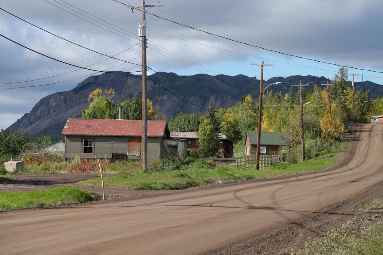
The latest iteration of the project has been shortened considerably to 281 kilometres and would run from Hodgson Creek (about one kilometre north of Wrigley) to Prohibition Creek (about 28 kilometres southeast of Norman Wells). The highway would largely follow the existing winter road route, and connect to the Canyon Creek all-season road, Prohibition Creen access road and Great Bear River bridge, whenever that's built.
In the past, territorial officials said they decided to break up the project into smaller portions to reduce the cost and allow for local companies to bid on contracts at smaller scale.
A summary of the latest developer's report shows the highway would be built in three parts. The first from Wrigley to the Dehcho-Sahtú border, the second would go south from Tulita to the border, and finally north from Tulita to Prohibition Creek. The territory estimates overall construction time of 10 years and says the winter road would stay open throughout that whole time.
All of that work isn't likely to begin until at least 2027, with the environmental assessment taking an estimated year and a half to complete — and it depends on the board recommending approval. After that, the summary states, it'll be another two years to finalize the design, get regulatory checks, secure funding and assign construction contracts.
The most optimistic scenario would see 281 kilometres of permanent highway complete by 2037.
'I'm still waiting'
It's a long time still to wait for Frederick Andrew, the president of the Tulita Renewable Resources Council.
He said elders in the community are satisfied with the route changes, keeping it further from Bear Rock.
"Everybody was happy with it because there's a lot of legends and a lot stories," he said of the area.
He's just tired of waiting.
Andrew remembers being a spry man in his 20s and part of a crew that slashed through trees from Blackwater Lake to Prohibition Creek.
"And I'm still waiting," says Andrew, who's now 73. "That's very important to us, that highway."
Bohnet, the territory's director of strategic infrastructure, said one of the goals of the project is to "improve the resiliency of our current transportation network in the Northwest Territories."
"You know, we've been seeing challenges with later freeze-ups and earlier thaws," Bohnet said.
Despite the wait, Sahtú Grand Chief Wilbert Kochon says the highway would be a boon for the region — and hopefully mean a drop in food prices.
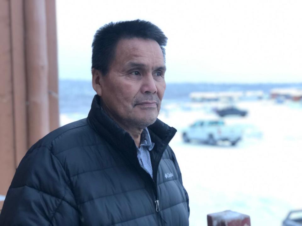
Sahtú Grand Chief Wilbert Kochon, pictured here in 2020, said he's also concerned about residents' safety when driving the new highway. (John Last/CBC)
"If we don't live on the land we would be broke all the time," he said. "And we're lucky to be living off the land. A lot of our northern people, it's not like that."
In 2013, when the project was first referred to environmental assessment, the review board set out terms of reference for information it needed from the territorial government to complete the process. Those included understanding how the highway would affect communities' ability to harvest.
The summary of the developer's report states the highway would cross moose and boreal caribou habitat but isn't expected to have a major impact, and would make harvesting easier.
Andrew agrees that the road is unlikely to have a negative impact on community harvesting.
"We know the area is good," he said. Still, he urges caution and balance to ensure whatever negative impacts there will be are minimized as much as possible.
Preparing communities
Bohnet said the territory has learned from previous road projects —for example, the Tłı̨chǫ Highway and Inuvik–Tuktoyaktuk Highway—how to better support communities. That ranges from involving residents in monitoring socioeconomic impacts of construction to helping them prepare for increased tourism.
"We're dealing with a couple of communities that are fairly small," he said. "They don't have a lot of capacity at the moment for a project of this scale. So there is going to be a need there to help develop and train people and prepare them for the construction activities."
The summary report also mentions community concerns around increased access to drugs and alcohol once the highway is built.
"We've taken that to heart and really worked hard with our other GNWT departments to identify mitigative measures that we feel could potentially address the issue," said Patricia Coyne, manager of Mackenzie Valley Highway environmental affairs. "But again, we're open to feedback."
Bohnet said the territory is still looking for funding for the project. The last estimate, dating to 2015, put the price tag at $700 million.
"We do anticipate it has gone up," he said, adding that a final estimate will depend on the finalization of the road's design and environmental mitigation measures.
The federal government has previously funded a portion of the project to the tune of $102 million.
The review board is now conducting an internal conformity check to see how well the developer's report took the terms of reference into account.
Once complete, it will publish a draft work plan and seek input from communities on how to proceed.

