
Snow, ice and severe thunderstorms target Ontario this week
If it’s another week in early spring, it’s another major storm gearing up to barrel into Ontario.
Folks across the province will face a spectrum of disruptive weather conditions by the middle of the week, with heavy snow in the north, freezing rain for central Ontario, and the year’s greatest warmth and a threat for thunderstorms covering the south.
RELATED: Canada, who ordered 20 degrees and a blizzard this week?
Another powerful Colorado low developing over the central United States this week will bring a widespread threat for severe thunderstorms south of the border. Tuesday’s severe weather threat will target many of the same areas reeling from a deadly, high-end severe weather outbreak this past Friday.
Much like last week’s storm, this low-pressure system will strengthen in a hurry as it approaches the Great Lakes region overnight Tuesday into Wednesday. The centre of this low will track over Lake Superior, providing heavy snows to northern Ontario and a variety of active weather to folks across the south.
CANADA’S APRIL OUTLOOK: Will spring’s sluggish start continue this month?
Heavy snow, blizzard conditions, possible icing across the north
A moisture-laden storm running into cold air parked over northern Ontario is a recipe for snow—and plenty of it.
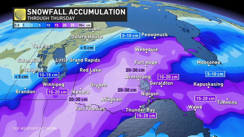
Heavy snow will build across southern Manitoba and northwestern Ontario overnight Tuesday and into the day Wednesday as this sprawling system pushes across the region.
The heaviest snow may linger over the same communities for hours at a time, bringing the potential for up to half a metre of snow in spots.
Dangerous travel is likely as gusty winds will accompany the heavy snowfall. Large swaths of Highway 11 and Highway 17 between Winnipeg and Thunder Bay will be extremely tough—if not impossible—to navigate for a time during the storm due to low visibility and snow-covered surfaces.
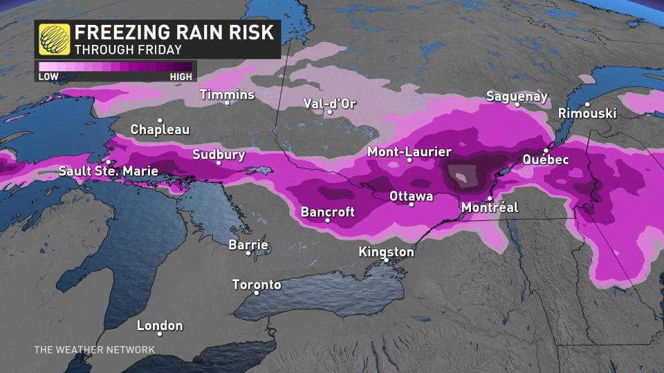
Warmer air closer to the track of the low will lead to an extended period of freezing rain for parts of the Nickel Belt and northern cottage country.
Ice accretion here could make roads dangerously slick, along with the potential for isolated tree damage and power outages.
WATCH: Another round of Dangerous storms set to sweep across America
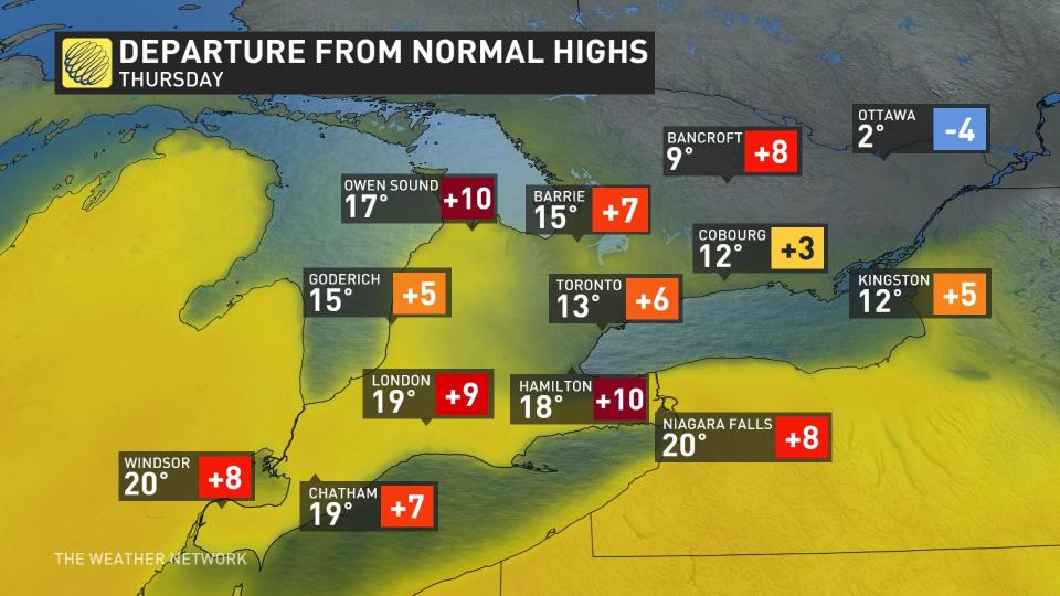
Warmth fuels storm risk in the south, year’s first 20°C possible
A strengthening storm tracking over Lake Superior will lay the groundwork for strong winds, warm temperatures, and a chance for storms across southern Ontario.
Blustery winds hustling north of the border will bring one of the most spring-like days we’ve seen so far this year.
DON’T MISS: A cavalcade of Colorado lows can send Canada’s forecast into upheaval
Temperatures will easily rise into the upper teens from Windsor through the Greater Toronto Area, with some areas away from the lakes possibly hitting 20°C on Wednesday afternoon.
If this happens, it’d be the first time anyone’s seen the 20-degree mark in Canada in 2023.
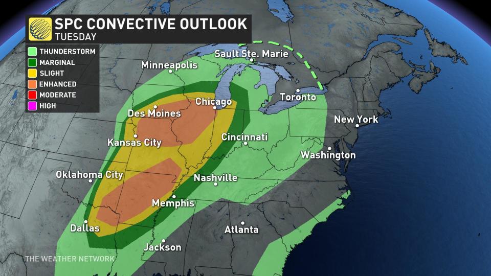
The surge of warmer temperatures and humid air will provide the instability needed to fuel a thunderstorm risk across southern Ontario. This risk is most likely on Wednesday afternoon as instability peaks and the strongest lift arrives to spark the storms.
Some of the thunderstorms could turn severe in southwestern Ontario if they manage to avoid the influence of the cooler lakes.
Stay with The Weather Network over the next couple of days as the finer details of this disruptive storm come into focus.

