
Massive storm to spread rain along 1,600-mile swath of US this weekend


A large storm will bring rain to at least two dozen states as it moves slowly along from the Great Plains and Midwest into the start of this weekend and on to coastal areas of the mid-Atlantic and southern New England where it will finish up later this weekend, AccuWeather meteorologists say.
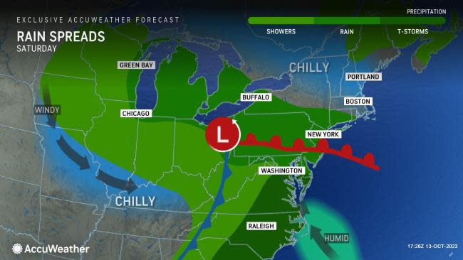
The storm will spread rain along a 1600-mile-long zone, from the High Plains to the Atlantic coast.
While the rain will be beneficial in terms of pausing the worsening drought conditions in the north-central United States, it will lead to disruptions in travel and outdoor plans for tens of millions from the Heartland to the Northeast.
 |
In the Midwest, the major metro areas and travel hubs of Chicago and Detroit will be drenched. Farther to the east, Pittsburgh, Philadelphia and New York City are among the many major cities and transportation centers that will be soaked. It's not only the big cities but also the million square miles that make up the suburban and rural areas in between that can expect pouring rain from the storm.
In the Northeast, the zone most likely to be drenched for many hours will include Pennsylvania, New Jersey, northern parts of West Virginia, Maryland, Virginia and Delaware and the southern tier of New York and New England.
 |
Rain will break out, expand slowly over the central Appalachians on Saturday and continue eastward to the upper mid-Atlantic into Saturday night. A general 1 inch of rain with localized amounts to 2 inches is likely from the storm.
"There is some indication that the drenching rain in the Northeast will have a northern edge to it, due to a wedge of dry air over Canada that will try to hold on," AccuWeather Senior Meteorologist Adam Douty said.
The widespread rain and clouds on Saturday will likely obscure the views of the upcoming solar eclipse for many across the Northeast and Midwest.
The latest data suggest this dry air may even try to push farther south.
"Boston and much of New England look even drier than they did a few days ago with any rain likely holding off until later in the day on Saturday or even Saturday night," AccuWeather Meteorologist Dean DeVore said. Most or all of the rain should end up sliding south of Boston.
"Some steady rain should move into at least part of the New York City metro area during the day Saturday and could produce some localized ponding on roads and sidewalks as the heaviest moves in during Saturday night," DeVore said. Fallen leaves could compound that issue in New York City or anywhere it pours in the central Appalachians and mid-Atlantic.
 |
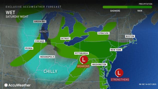
Despite the storm, it does not look as impactful as the rain around the same time over the past couple of weeks where flooding ensued, DeVore added.
Just as in the Midwest, south of the storm track where a wedge of warm air develops, thunderstorms are likely to rumble in portions of eastern Virginia and the Delmarva Peninsula. Some of the storms may be feisty at the local level with brief torrential downpours and locally gusty winds from Saturday afternoon to Saturday evening.
 |
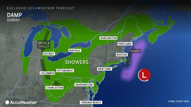
Steady rain will move away from the mid-Atlantic and southern New England coasts on Sunday.
The dynamic, potent nature of this storm will generate some gusty winds during the rain, but more widespread wind is likely on the backside of the system as it departs.
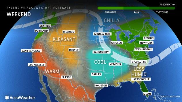
Blustery conditions over the Midwest through much of this weekend will spread to the Northeast as the storm begins to pull away on Sunday and continue into Monday.
AccuWeather RealFeel® Temperatures will dip into the 50s and 40s at times during the day.
|
As winds blow in from Lake Michigan and chilly air arrives, Chicago may remain wet and cool through the weekend, DeVore said.
Elsewhere in much of the Midwest and in the Northeast, the combination of chilly air high in the atmosphere, moisture from the Great Lakes and a southward dip in the jet stream will promote extensive clouds and periodic showers in the wake of the storm into early next week.
As a result, it will look and feel like the middle of November in a lot of locations from the Midwest to the Northeast and especially in the Southeast following the storm.
 |
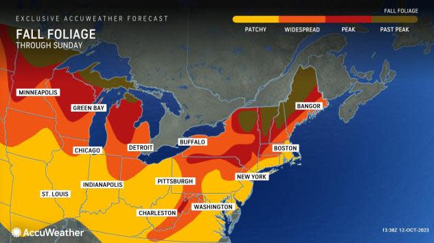
Where it does rain with a stiff breeze, a blizzard of leaves will rain down, and autumn foliage may fail to rebound in some locations in the storm's wake. In areas where fall color was delayed, the wet conditions followed by cloudy and chilly weather may expedite the autumn splendor.
Record-challenging warmth into Saturday will be swapped with record-challenging chill in Florida from Sunday to Monday. Ninety-degree highs will be followed by lows in the 60s in South Florida.
Some of the first snowflakes of the season may be spotted over the ridges in the southern Appalachians from Sunday to Monday. Grandfather Mountain and Mount Mitchell, North Carolina, are among the most likely places to experience some snowflakes.
Want next-level safety, ad-free? Unlock advanced, hyperlocal severe weather alerts when you subscribe to Premium+ on the AccuWeather app. AccuWeather Alerts™ are prompted by our expert meteorologists who monitor and analyze dangerous weather risks 24/7 to keep you and your family safer.
