
Meteorologist explains why stormy prediction flopped — a 'perfect storm of not being a perfect storm'

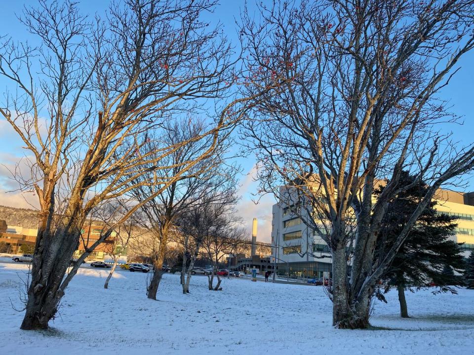
Much less snow fell Wednesday in St. John's than Environment Canada had forecast. (John Gushue/CBC)
On Wednesday, people across the Avalon Peninsula braced for heaps of snow to fall — and then the storm didn't happen. Meteorologist Robert Grove explains why there wasn't a dumping of the white stuff like expected and it comes down to a lack of information.
While people woke up to the sounds of snow plows and having to scrape ice off their vehicle windshields, it wasn't nearly nearly the snowfall amount that was predicted on Wednesday, when a snowstorm warning prompted more than 90 schools to close early or altogether.
Snowfall was expected to reach 10 to 20 centimetres in most areas, with as much as 30 centimetres over higher terrain.
Grove said it all came down to data, what information they had access to and what they didn't know.
The low pressure system — which was supposed to bring the snow to the Avalon Peninsula — formed late Tuesday night over an area in the ocean where Environment Canada wasn't able to see.
"So without any real time data in real time observations, the model guidance's just sort of guessing based on its previous solutions, which in this case were also wrong," Grove told CBC News.
Weather blind spot
Grove said the blind spot over eastern Newfoundland is because the Holyrood radar is currently out of commission. He said it's been experiencing operational issues for the last several days and recent high winds have meant no one has been able to fix it, which makes a meteorologist's job difficult
"So basically it was a perfect storm of not being a perfect storm," said Grove.
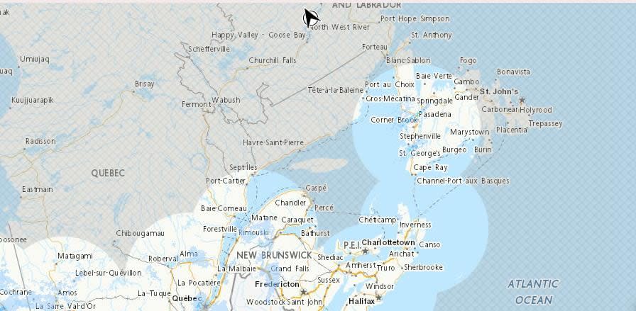
Due to the Holyrood weather radar being down, there is a blind spot in Environment Canada's weather radar over eastern Newfoundland. (Submitted by Environment Canada)
He added when the office made the call on Wednesday to issue a snowfall warning, "it seemed like that was the most probable solution. And then of course none of the model guidance had what it was. So, I mean, that's all we have to go off. I mean, we're trying to pick the future, right?"
He also hopes the radar is back up and running sometime today.
While the predictions for the Avalon were a bust, he said Burin, Terra Nova, Gander and Clarenville saw 15 cm to 20 cm. There were also public reports that Conception Bay South got 10 cm and Placentia with 10 cm to 20 cm.
He said those areas getting higher amounts of snow is because the low pressure system that was expected to wallop the Avalon Peninsula ended up forming 70 km west of that forecasted position and there was also more warm air over the Avalon, which shifted the snowfall away to the Clarenville area.
He also said Mount Pearl had about 5 cm whereas downtown St. John's and the St. John's International Airport had about 3 cm.
"So much lower than we expected, for sure."
According to the NL 511 app, the Western side of the Avalon Peninsula road conditions are poor. Grove said this morning there are "onshore flurries" that are forming over the water and are creating pockets of heavier flurries on the Avalon and reducing visibility.
Download our free CBC News app to sign up for push alerts for CBC Newfoundland and Labrador. Click here to visit our landing page.

