
Mont Blanc at lowest level in 22 years as hot summers shrink snowpack
By Geert De Clercq and Manuel Ausloos
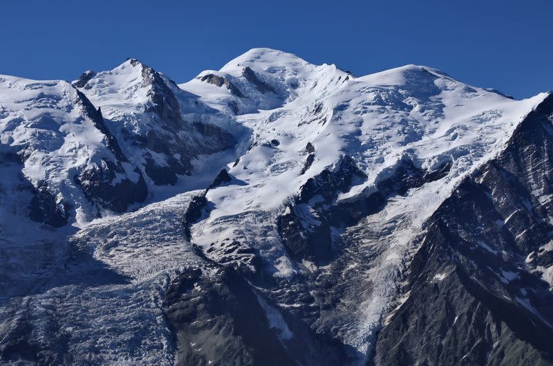
PARIS (Reuters) - The Mont Blanc, Western Europe's highest peak, has lost more than two metres (6.5 ft) in two years and shrunk to its lowest level since precise measurements started 22 years ago as warmer summers reduced snowpack size, researchers said on Thursday.
A team of topographers who perform measurements every two years told a news conference in Chamonix in the French Alps the mountain was now 4,805.59 metres (15766 ft) high, 2.22 metres lower than their last measurement of 4,807.81 metres (15773 ft) in September 2021.
"The top of Mont Blanc is like a dune, it moves, and it is not the first time we have measured height variations of more than two metres," said Cecile Taffin of the UNGE surveyors union.
She added this year's particularly low level was probably due to a lack of rain and a hot summer.
When precise GNSS satellite measurements started in September 2001, the Mont Blanc stood at 4,810.40 metres.
Between 2001 and 2013 it ranged between 4,808 and 4,810 metres with a record 4,810.90 metres (15,783.79 ft) in 2007, but from 4,810.02 metres in 2013 it has been on a downward trend.
The Mont Blanc's rocky peak culminates at 4,792 metres but total height depends on its snowpack, which typically increases over summer, as rain on its peak turns into snow.
Farouk Kadded at Leica Geosystems said that this year, for the first time since 2015 - when scientists started measurements in June too - Mont Blanc's snowpack in September had remained virtually unchanged from June.
"Normally, Mont Blanc gains one metre from June to September, but that did not happen this summer because several days of positive temperatures, even a record of 10 degrees Celsius," he added.
Topographers said it was not up to them to interpret their data and that climate change specialists would put forward theories to explain this phenomenon.
Before GNSS with its centimetre precision, scientists used GPS, trigonometric estimates and barometric measurements, which can be off by several metres.
"It is hard to believe we are going to recuperate a few metres over the next two years. There is a lot of variation, but there is a slight downward trend," Kadded said.
(This Oct. 5 story has been updated following an official correction of statistics provided by topographers to change the 2001 altitude to 4,810.40 meters from 4,010.40 meters in paragraph 5)
(Reporting by Kate Entringer, Dominique Vidalon, Manuel Ausloos and Geert De Clercq, Editing by William Maclean and Grant McCool)

