
More severe storms on deck as flooding progresses over central US


Rounds of downpours and thunderstorms will continue to threaten some communities of the central United States with flooding and severe weather into the first week of July, AccuWeather meteorologists warn.
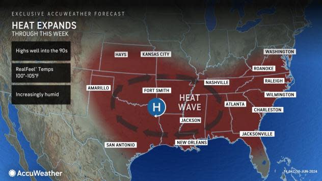
As fronts and weather disturbances continue to push from west to east along the northern edge of a dome of high pressure over the southern United States early this week, thunderstorms will erupt and turn severe at a local to regional level. Each system will bring an uptick in storms preceded by a surge in warmth and humidity, followed by a break of drier and cooler conditions from the northern Plains to the Midwest.
 |
On Saturday, the areal extent of severe thunderstorms spanned approximately 1,400 miles from northeastern New Mexico to New York and southeastern Michigan, including southern Ontario.
On Sunday, the severe weather threat zone will jump northwest and back across the northern and central High Plains.
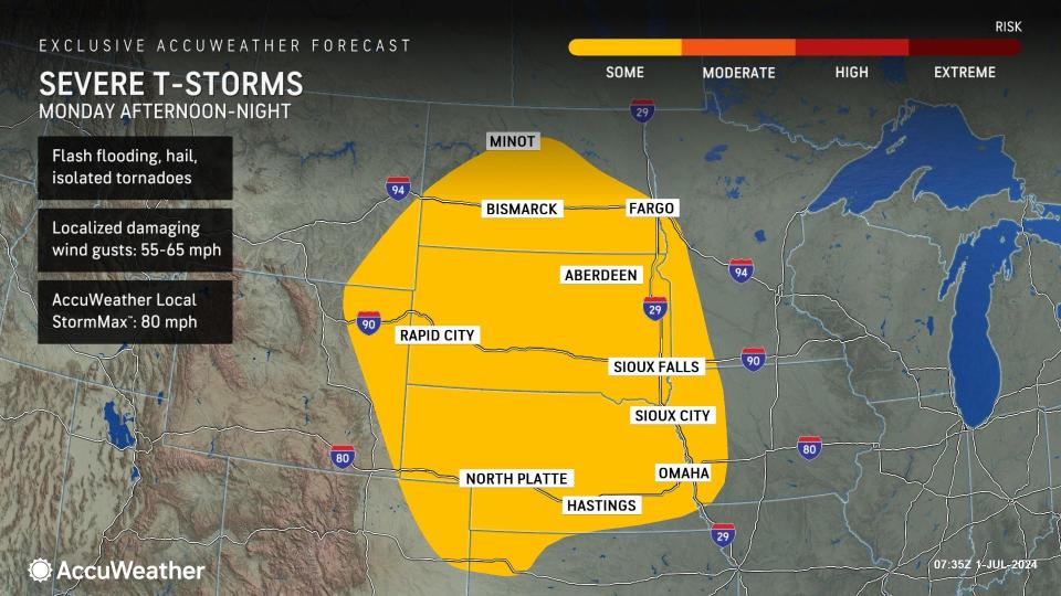
The risk of severe weather will migrate eastward across the North-Central states on Monday.
The storms will tend to focus from portions of the lower Missouri Valley to much of the Red River Valley of the North. Some of the storms will bring damaging wind gusts and hail with the potential for a few tornadoes.
 |
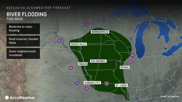
The storms on Monday will deliver drenching downpours over a region that has been hit hard by river flooding in the past couple of weeks.
Many of the rivers from northeastern Nebraska to northern and western Iowa, southeastern South Dakota and southern Minnesota have surged to major to record-high flood levels in recent days. Early indications are that another 2-4 inches of rain will pour down on part of this zone from Monday to Tuesday, which could bring new rises on some of the rivers.
As the surge of water from torrential rainfall earlier in June works downstream into the larger river systems in the region, water levels will surge even in areas that have largely missed out on heavy rain in prior days and weeks.
 |
Any additional rain as the surge moves through a region can worsen matters. Official National Weather Service forecast river levels have already trended higher compared to predictions from early last week at a number of locations along the lower portion of the Missouri River and the middle portion of the Mississippi River.
The Mississippi River at multiple points along Iowa and Illinois is projected to reach major flood stage during the first week of July. It may take a few weeks until waters drop below flood stage on some of the largest rivers in the region, including the middle portion of the Mississippi.
Want next-level safety, ad-free? Unlock advanced, hyperlocal severe weather alerts when you subscribe to Premium+ on the AccuWeather app. AccuWeather Alerts™ are prompted by our expert meteorologists who monitor and analyze dangerous weather risks 24/7 to keep you and your family safer.
