
More snow coming for Boise? A foot of snow is still possible. Here’s the updated forecast
The next round of snowstorms is set to blow through Southern Idaho starting Thursday afternoon, lasting until Saturday evening, and dropping several more inches of snow on Boise.
Boise received 5.2 inches of snow from a Wednesday morning snowstorm, and early estimations of the upcoming storm had Boise receiving up to 19 inches.
But those lofty snow totals have been tempered as meteorologists better understand what’s to come.
The National Weather Service in Boise is now forecasting 6-13 inches of snowfall for Boise, partly because different weather models show different results. Weather Service meteorologist Stefanie Henry told the Idaho Statesman that some models are colder than others, which impacts snow ratios and the precipitation type.
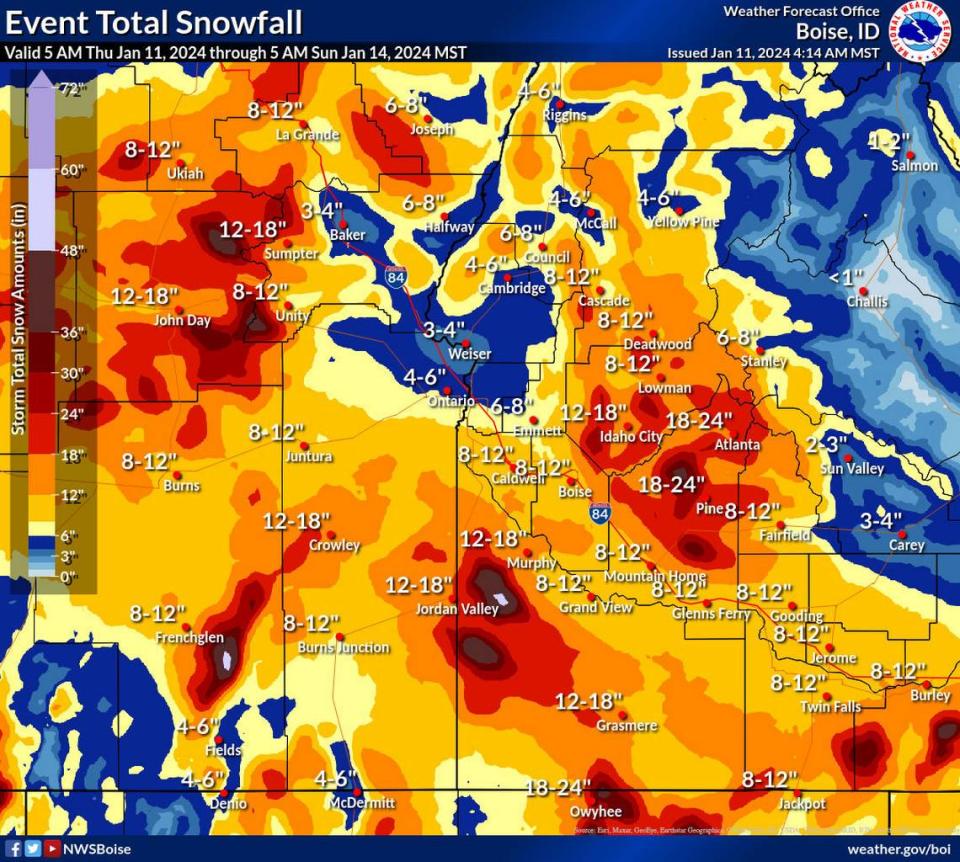
Despite the high and low range of the forecast and localized amounts varying, the Treasure Valley as a whole, from Boise to Caldwell and up Interstate 84 toward Oregon, will likely see 8-12 inches of snow.
“Most of the change is driven by new information that continues to come in from our forecast models and forecaster assessments,” Jaret Rogers, a meteorologist with the Weather Service in Boise, told the Statesman. “Especially as we get within two to three days of an event, the amount of information we have available increases drastically, so we’re able to refine our forecasts.”
What’s the new forecast for Boise?
Initial forecasts had the bulk of the snow arriving Friday night, but the updated models show a more steady series of storms, with less than 3 inches of snow dropping in each 12-hour period from Thursday through Saturday night.
Here’s what is now forecast for Boise starting Thursday afternoon:
Thursday day: New snow accumulation of around 1 inch
Thursday night: New snow accumulations of 1-2 inches
Friday day: New snow accumulations of 1-3 inches
Friday night: New snow accumulation of around an inch
Saturday day: New snow accumulations of 1-3 inches
Saturday night: New snow accumulations of 1-3 inches.
Winter storm and blizzard warnings in Idaho
The Weather Service has issued a winter storm warning for much of Idaho, including Boise, from 11 p.m. Thursday to 11 p.m. Saturday. The warning outlines the possibility of 5-10 inches of snow and wind gusts up to 45 mph on Thursday and Friday.
A blizzard warning was also issued for much of Owyhee County and the Magic Valley, including Twin Falls. Total snow accumulations are only 4-8 inches, but wind gusts of up to 60 mph could cause whiteout conditions.
“Travel should be restricted to emergencies only,” the warning states. “If you must travel, have a winter survival kit with you. If you get stranded, stay with your vehicle.”

