Here’s how much rain and snow is expected as 3 storms head to Fresno and Yosemite
The Fresno area is set for a series of storms forecast to grow in intensity into early next week, bringing rain and snow, meteorologists said Wednesday.
The first rainfall was forecast to fall Wednesday evening with another expected Saturday, according to Carlos Molina, a meteorologist with the National Weather Service in Hanford.
“That third storm is going to be targeting central and Southern California,” he said.
The first two could drop about a quarter inch of rain each on Fresno and parts of the central San Joaquin Valley like Merced and Madera, meteorologists predict. Slightly less precipitation was forecast for the southern part of the Valley in Visalia and Bakersfield.
The third storm late Sunday through Monday and potentially Tuesday morning could see an inch to 1.5 inches, Molina said.
That’s around 2 inches of rain during three storms in seven days.
A series of atmospheric disturbances are anticipated to move through the region in the week ahead, with the first wave arriving this afternoon. Here are the forecasted rain values through Tuesday of next week. #CAwx pic.twitter.com/VZEFhwEvcW
— NWS Hanford (@NWSHanford) February 14, 2024
All three storms were expected to come down from the Gulf of Alaska, passing through the Pacific Northwest on the way to Fresno.
The third looks to pick up the most steam and moisture once it gets to California, hence the heavier rainfall and a “direct hit” to the Valley, Molina said.
While the moisture brings rain it also moderates the temperatures, Molina said, so the next seven days were forecast with highs in the low 60s and lows in the mid-40s.
A couple rounds of precipitation is expected to come through our area from Saturday through Tuesday. Here are the probabilities for select locations in Central California receiving 0.25 inches of rain or more over this weekend and into early next week. #CAwx pic.twitter.com/BuGPjJxTwn
— NWS Hanford (@NWSHanford) February 14, 2024
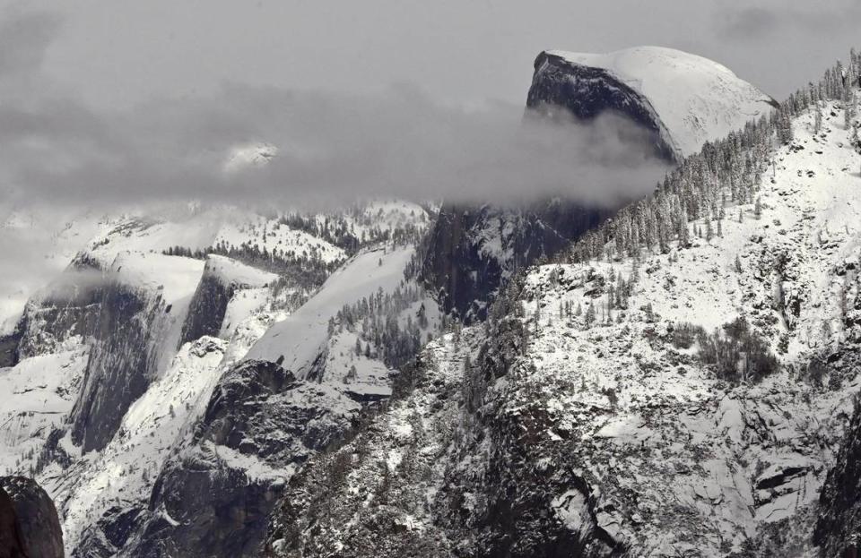
The foothills and mountains towards Yosemite National Park were forecast to be hit by the same storms, with snowfall of 6 to 12 inches in each of the first two wet weather events and as much as 2 to 4 feet during the third, meteorologists said.
The snow was predicted primarily at a 6,000-foot elevation or higher.
There’s a potential for the first two storms to wet down roads and other surfaces before the third storm brings the most significant rain. Molina said by the third storm roads and other surfaces could see flooding and potential mudslides.
The weather service also warned drivers to expect delays as travel may be difficult during the snowfall in the mountains.
“If you don’t need to drive, stay off the roads,” Molina said.
A Winter Weather Advisory has been issued for the Sierra Nevada from 4 PM this afternoon through 4 PM tomorrow. Total snow accumulations of 6 to 12 inches is expected, as well as wind gusts as high as 50 mph on the highest peaks. Travel may be difficult in these areas. #CAwx pic.twitter.com/HdyZyCHUVp
— NWS Hanford (@NWSHanford) February 14, 2024