
Muggy air, storm risk build in southern Ontario this weekend
An early tease of summer will spread over southern Ontario for the last weekend of April.
Multiple systems tracking across the western Great Lakes will drag a stretch of warm and humid air over southern Ontario heading into early next week.
The warm southerly winds will give rise to periods of rain and even opportunities for thunderstorms through Monday.
PHOTOS: Highway camera captures stunning tornado on the horizon
Storms possible for some on Saturday
After a chilly end to the week, warmer winds blowing in from the south will allow temperatures to rebound closer to normal for the day on Saturday. A hint of things to come will creep into far southwestern Ontario, though, where readings should come in above-seasonal.
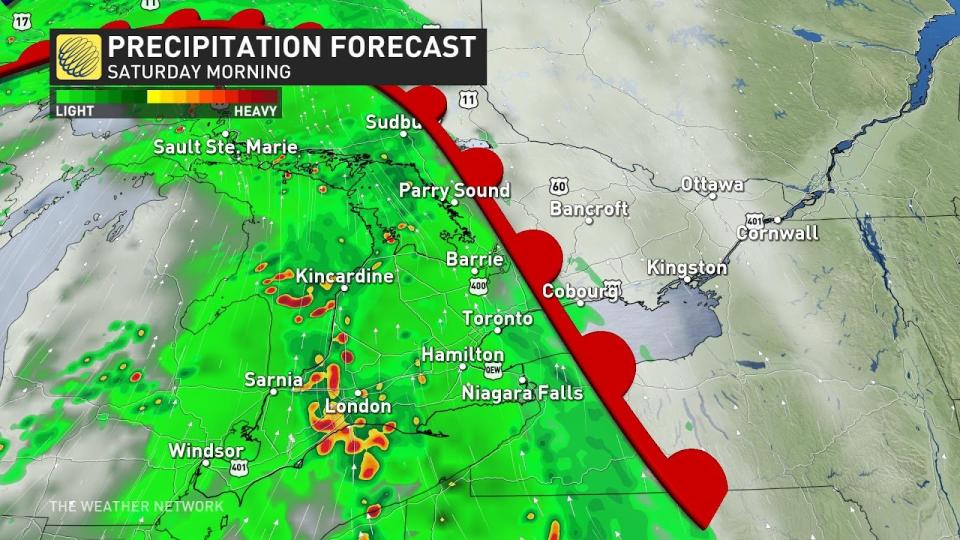
Rain and possibly a few embedded thunderstorms will spread into southern Ontario on Saturday morning as the warm front tracks into the region.
We’ll see a break in the precipitation develop for the Greater Toronto Area and areas southwest heading into Saturday afternoon as the rain pushes off toward the National Capital Region by the evening hours.
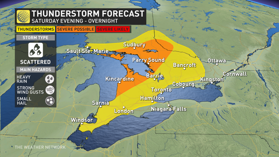
A second round of rain and thunderstorms will arrive late Saturday night into early Sunday morning as a cold front advances out of northern Ontario.
We’ll see a risk for thunderstorms along and ahead of the cold front throughout the Nickel Belt and into sections of cottage country.
Some of the storms around Sudbury, Parry Sound, and down toward the Bruce Peninsula could approach severe limits with heavy rainfall, strong wind gusts, and small hail.
Early-summer tease arrives Sunday
Sunday could be the warmest day of the year for much of southern Ontario as this May-like pattern arrives to end the weekend, although scattered showers and a thunderstorm risk could put a brief damper on the afternoon.
The warmest readings we’ve seen so far this year include:
26.1°C in Windsor on April 14
23.8°C in Hamilton on April 9
20.6°C in Toronto on March 13
19.9°C in London on April 14
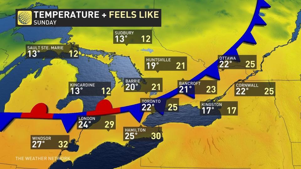
Daytime highs on Sunday will soar into the mid-20s for many communities, with humidex values possibly cracking 30 around Windsor and Hamilton.
Given the warmth in the forecast, Toronto, Hamilton, and London are on track to beat 2024’s high-mercury mark by Sunday, while Windsor might fall short by just a hair.
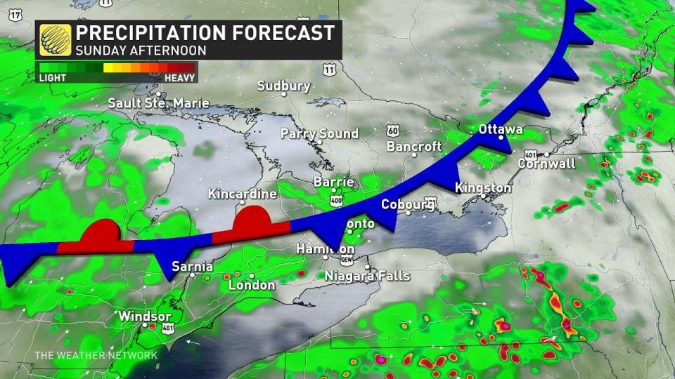
We’ll see a renewed risk for showers and thunderstorms over southern Ontario during the day Sunday as this warm and unstable air builds in. This includes much of the Highway 401 corridor from Windsor to Kingston, including Toronto, as well as north toward Bancroft and Barrie. Look out for heavy rain and gusty winds in any of the feistier storms that bubble up on Sunday.
Warmth sticks around into early next week
Another rainy system tracking into northern and central Ontario on Monday will keep the unseasonably warm air parked over the southern half of the province to start the week. However, there’s uncertainty in just how warm things will get on Monday. We could see big temperature variations over short distances with clouds and lake breezes.
We’ll see additional showers and possibly a risk for rumbles of thunder as that disturbance passes the region to the west.
Temperatures will likely start to moderate back toward seasonal as we head into the second half of the upcoming week. Warm-weather lovers may not have to wait long for above-seasonal conditions to return, as more unseasonable warmth could arrive in time for the beginning of May.
Stay with The Weather Network for all the latest on your forecast across Ontario.

