NASA's TEMPO sends first North American pollution data maps

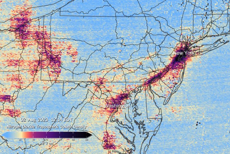
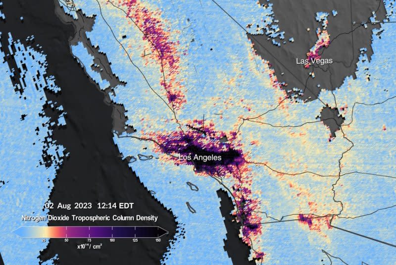
Aug. 24 (UPI) -- The first data maps from a NASA pollution-monitoring instrument were released Thursday. NASA's TEMPO device creates visual representations of pollution and air quality over North America from 22,000 miles above the equator.
"Neighborhoods and communities across the country will benefit from TEMPO's game-changing data for decades to come," NASA Administrator Bill Nelson said in a statement. "This summer, millions of Americans felt firsthand the effect of smoke from forest fires on our health. NASA and the Biden-Harris Administration are committed to making it easier for everyday Americans and decision makers to access and use TEMPO data to monitor and improve the quality of the air we breathe, benefitting life here on Earth."
According to NASA, the TEMPO instrument will greatly improve studies of pollution caused by rush-hour traffic, the movement of smoke and ash from forest fires and volcanoes and even the effect of fertilizer application on farmlands.
TEMPO stands for Tropospheric Emissions: Monitoring of Pollution.
NASA said it will help scientists evaluate health impacts of pollutants and help with creating air pollution maps at the neighborhood scale.

TEMPO was launched April 6 aboard a SpaceX Falcon 9 rocket and it makes hourly daytime scans of the lower atmosphere over North America from coast to coast and from roughly Mexico City to Canada.
It measures ozone, nitrogen dioxide, formaldehyde, aerosols, water vapor and several trace gases.
"We are excited to see the initial data from the TEMPO instrument and that the performance is as good as we could have imagined now that it is operating in space," said NASA TEMPO project manager Kevin Daugherty in a statement. "We look forward to completing commissioning of the instrument and then starting science research."


