
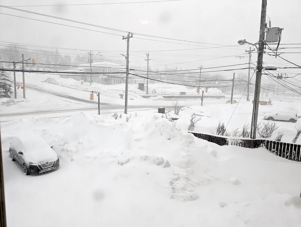
Heavy, blowing snow makes for hazardous conditions in Newfoundland
Prepare for deteriorating conditions to continue across southeastern Newfoundland Sunday morning as heavy snow and high winds spread over the region.
A winter storm warning is in effect for the Avalon Peninsula as a result of the disruptive storm’s arrival. Snow-covered roads and reduced visibility will make driving during the storm difficult if not impossible.
Stay home if possible, and prepare for widespread delays if travel is unavoidable.
PHOTOS: Snow piling up quickly as intense nor'easter batters Atlantic Canada
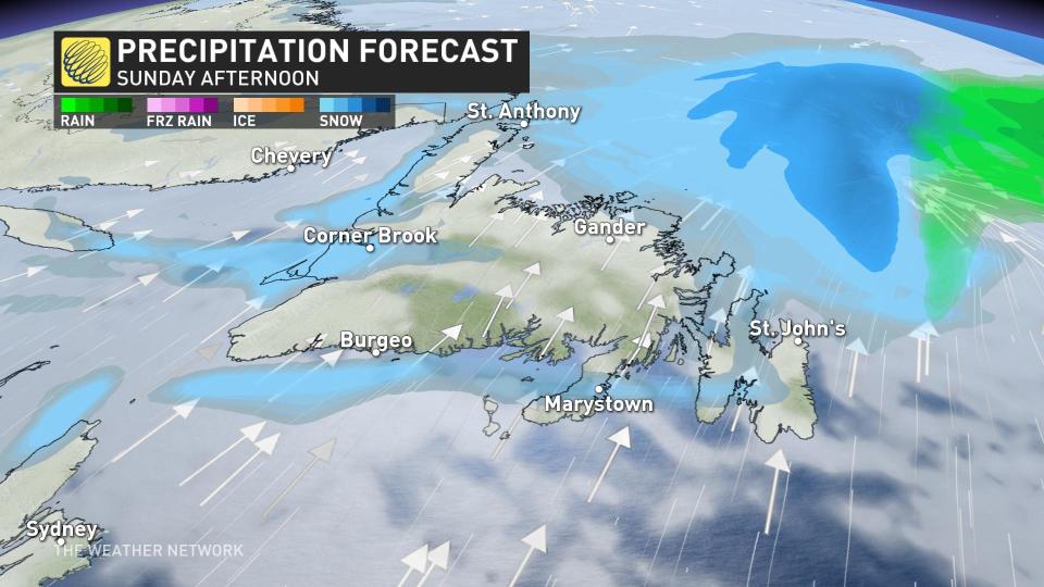
Heavy snow spread over southeastern Newfoundland through the overnight hours Saturday, and peaked in both intensity and coverage Sunday morning. This will be a quick-hitting storm, beginning and ending within a period of about 12 hours.
Snowfall rates will rapidly east into Sunday afternoon.
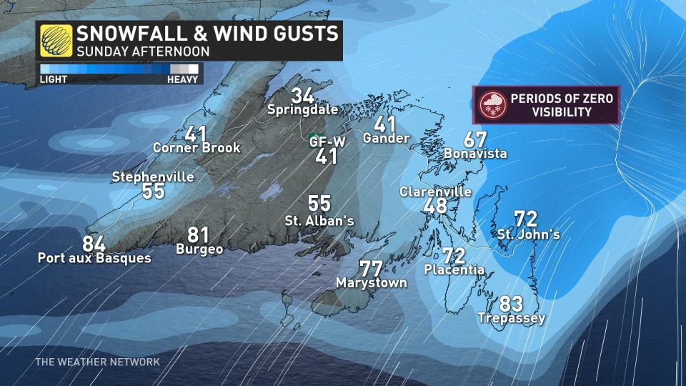
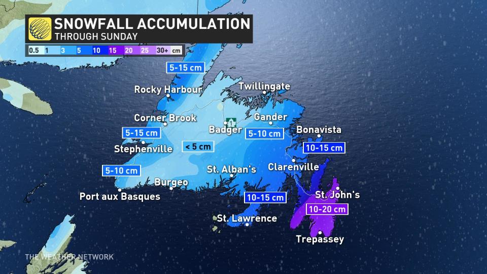
Snowfall totals of 10-20 cm are expected by the end of the storm, with the brunt of the accumulation focused on the Avalon, including the St. John’s area. It’s been a wintry few days around the city, which saw 40-50 cm of snow from the storm a few days ago.
Totals will come in much lower farther to the west, with about 5 cm of snow expected toward Gander. That’s good news for folks in the area still contending with mountains of snow from that mid-week storm.
BEWARE: Towering snow piles could lead to very expensive problems you didn't see coming
Gander saw 84.9 cm of snow on Wednesday and Thursday, making for their largest two-day storm on record. The weekend began with a whopping 118 cm of snow on the ground at the Gander airport.
Folks across western and northern Newfoundland will miss the brunt of this storm, but stiff westerly winds will allow sea-effect snow to kick up through the latter half of the weekend.
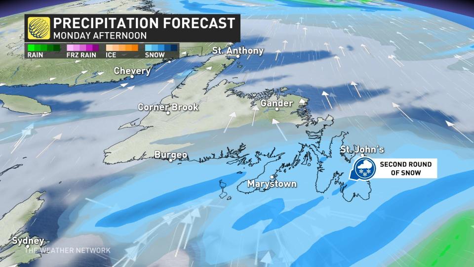
A much weaker system floats across Newfoundland throughout the day on Monday, bringing localized snowfall amounts in the 3-5 cm range across Newfoundland and pockets of the Maritimes.
Looking ahead, forecasters expect below-seasonal conditions to linger across the region heading into early this week.
An active pattern is expected to return to the region for the latter half of this week, which could bring the risk for another significant storm or two. However, the storm track and local impacts are still uncertain.
Check back for all the latest on your forecast across Newfoundland.
Thumbnail courtesy of Colin Lane.

