
Poor travel lingers on the eastern Prairies as wintry weather hangs on

A sprawling, sluggish spring storm will continue to meander across the eastern Prairies Thursday, leaving behind more snow, but conditions will gradually improve through the day as the system departs the region.
MUST SEE: No April fool: Almost every province could see snow this week
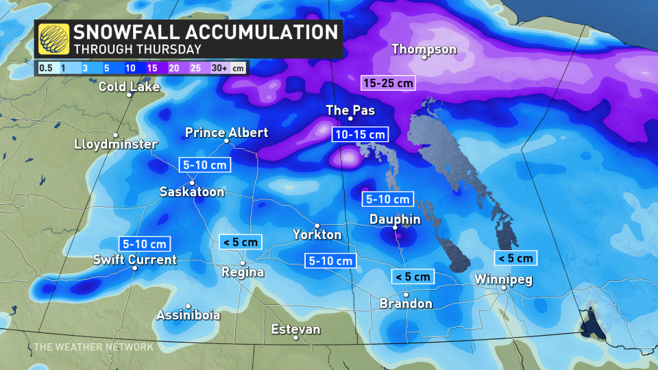
By the time all is said and done, central and northern Saskatchewan, as well as parts of Manitoba, are in line to potentially see 10-30+ cm of snow.
However, drivers will need to be aware of poor road conditions continuing in many areas on Thursday as some snow will still be falling amid cleanup crews making their rounds.
For southern Manitoba, the additional precipitation has been of concern for rivers and streams. With previously melting snow and this week's soaking rains, a provincial flood warning is still in effect for some areas, including the Assiniboine River.
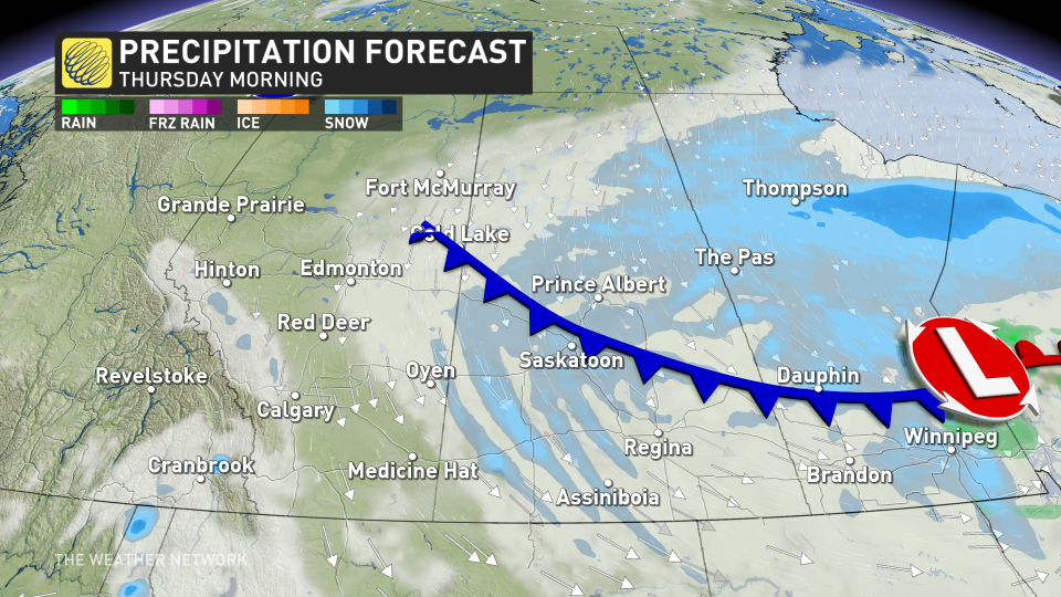
Thursday: Snow lingers in the morning, rain switches to flurries in Manitoba
Due to its stationary position, a stalled system brought significant snowfall to parts of the eastern Prairies and heavy rain to southern Manitoba this week, raising flood concerns for Brandon’s Assiniboine River.
Snow will continue to fall in central and southern Saskatchewan, as well as northern Manitoba, Wednesday overnight into Thursday morning.
All in all, between 10-30+ cm is possible over the three-day period. The highest totals will likely fall near Thompson, Man.
SEE ALSO: How Omega blocks and Rex blocks can affect Canada's weather
The widespread, persistent rain has ended in southern Manitoba, and because of colder air moving in, flurries will fall Thursday morning and continue through the day.
Lighter snowfall is expected in southern Manitoba, with less than 5 cm expected for areas such as Winnipeg.
Raised flood concerns with recent snowmelt and rain
Rainfall totals weren't overly excessive in southern Manitoba, either, but with the recent rapid snowmelt and additional precipitation, flood forecasters are still on alert.
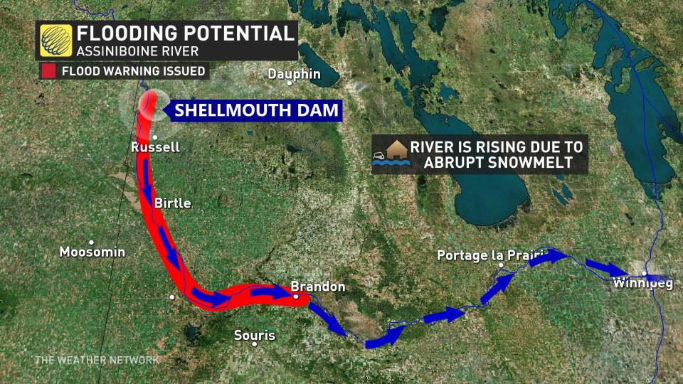
Late last week, a flood warning was issued for the Assiniboine River, between the Shellmouth Dam and the city of Brandon.
"A flood warning has been issued for these areas as the rising water levels could impact low-lying areas," a Friday news release from the province said. "The Assiniboine River is expected to be within the banks in the third week of April."
LEARN MORE: Flood warning issued for Assiniboine River near Brandon
As the melt continues and precipitation moves in, river flows and levels are expected to fluctuate in the coming days.
Manitobans are urged to stay off the weak ice and take caution around water systems, as conditions can change rapidly and without warning.
Stay with The Weather Network for all the latest on this snowstorm across the Prairies.

