
Dynamic, uncertain storm threatens Quebec with heavy snow
All eyes are on a late-weekend storm that could pose major travel challenges across portions of southern Quebec.
This looming storm’s precise track will make all the difference for communities near the rain-snow line. Short distances will likely result in dramatic changes in weather conditions as this dynamic storm sweeps through the region on Sunday and into Monday.
DON'T MISS: Montreal's recent snowstorm was a 'rare' event. Let's uncover why
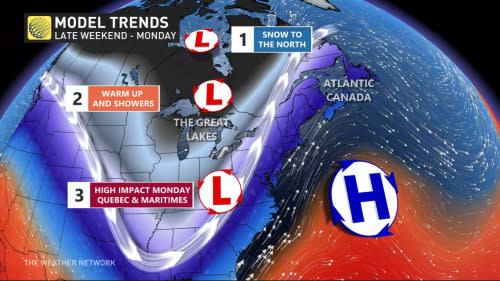
This major system is the last of three low-pressure systems to affect the province in rapid succession. One clipper hit northern and western Quebec on Friday, while a milder low en route looks to bring rain to much of Quebec through Saturday.
But it’s a third storm developing south of the border that’s cause for concern, and it’s one that folks across Quebec will have to watch throughout the week. A heavy swath of snow may threaten the south and east on Monday, impacting travel and possibly resulting in school bus cancellations or closures.
Strong storm system set to develop Sunday, threatens difficult travel into Monday
We’ll see this strong low-pressure system develop south of the border by Sunday, driven by a fine line between cold air to the north and warm, moist air to the south.
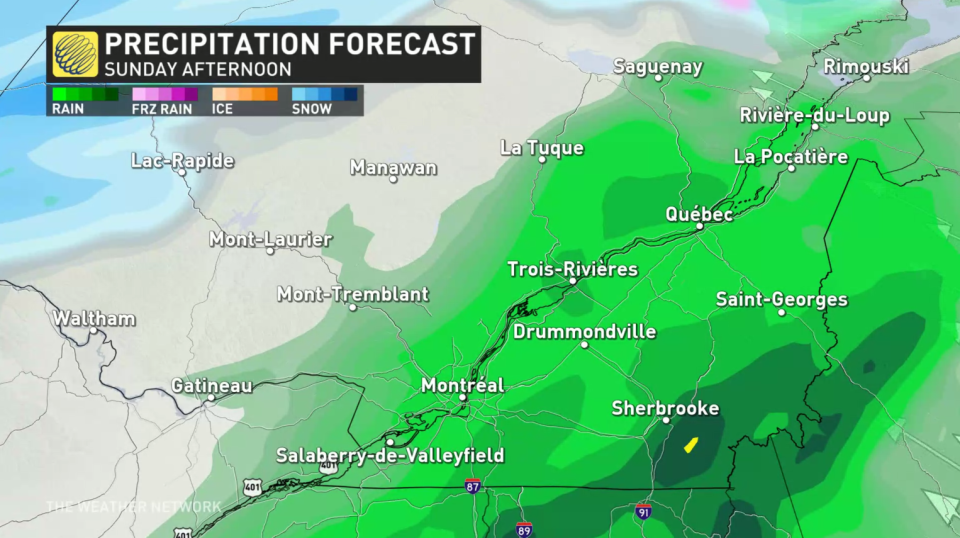
The northerly track of the system will push milder temperatures across much of southern Quebec on Sunday, as well as heavy rainfall—at least to start.
But forecasters are closely watching the flip from rain to snow as the storm retreats and very cold air rushes to fill the gap. This poses a threat for significant snowfall in the east, possibly affecting the St. Lawrence region and Montreal.
However, there is high uncertainty at this time for a few reasons.
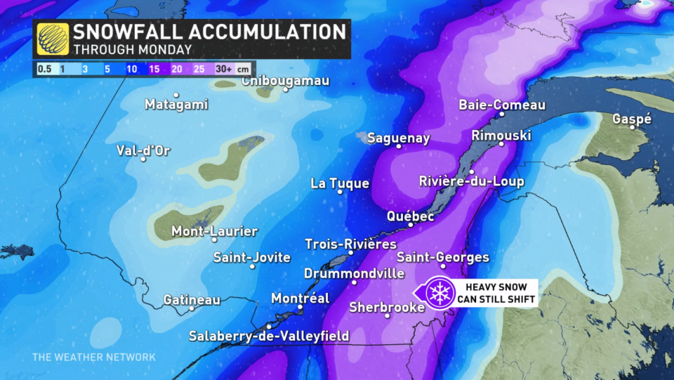
First, computer models are unsure of how fast we will change into the cold air—a quicker switch would lead to heavier snowfall. Another is that the storm track continues to shift, movement north or south could make or break bigtime snow totals in metro Montreal.
Confidence is building that the Eastern Townships, Gaspe Peninsula, and North Shore are the most at risk for significant snow.
Residents should prepare for a soggy end of the weekend, and winter travel on Monday morning.
Continue checking back through the weekend as forecasters work to nail down the track and eventual impacts of this late-weekend system.
Going somewhere? Check out the current highway conditions before heading out!

