
Quick shot of snow in Ontario precedes a potential, impactful storm
While focus in Ontario has been on the possible impacts from a low-pressure system taking shape for the weekend, we can't overlook the quick shot of snow coming through the southern areas before then.
WINTER 2024: El Niño will play a critical role in the weeks ahead
Wednesday overnight into Thursday morning will see snow sprinkle across the region, giving some areas a quick 2-5 cm of accumulation. While not excessive, the amounts will be enough to make for tricky travel Thursday morning from slippery roads.
Once the Thursday snow winds down, then efforts will turn to the Texas low that is expected to rapidly intensify as it moves over the region Sunday and into Monday -- a classic late-fall storm that will tap into abundant moisture from the Gulf of Mexico.
Through Thursday morning
A disturbance will track from northwestern to southern Ontario, bringing some snow to the region.
A quick 2-5 cm of snow is possible along the track, with areas away from the centre of the track seeing less than 3 cm. The disturbance does have the potential for some areas to overachieve, potentially bringing some areas near Georgian Bay and central Ontario above 5 cm.

The snowfall will make for slick roads, so be prepared for tricky travel for the early Thursday morning commute.
WATCH: Greater Toronto Area Thursday morning commute concerns
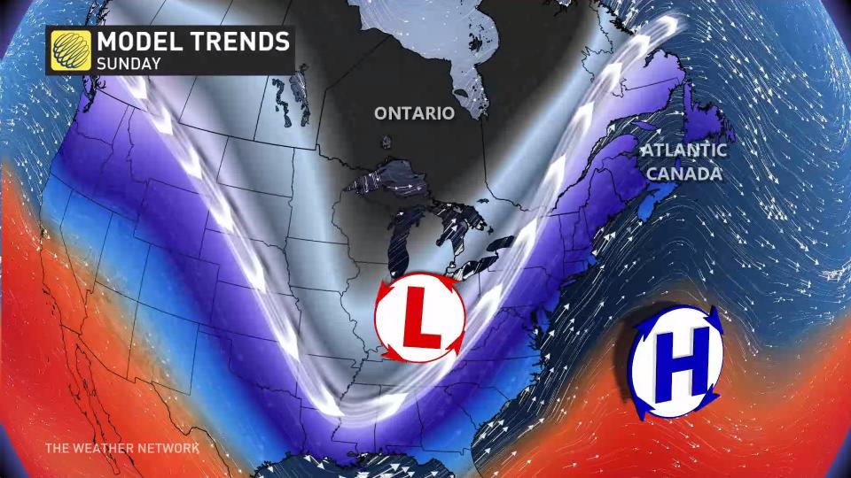
Sunday into Monday: Texas low threatens rain, wind and snow
When systems are several days to a week out, there is the potential for lots of uncertainty, and for a lot to change. There has definitely been a change to the system over the past 24 hours. There was always uncertainty in the track of the system, which can drastically change the type of precipitation that could fall and the amounts in each location.
Below is a look at how the models have change and have been inconsistency.
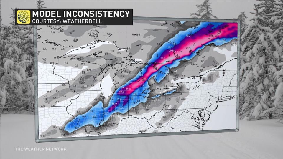
Previous model run above, new model run below.
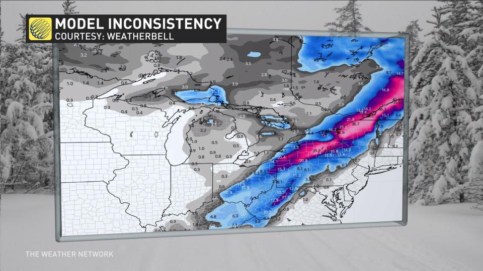
There are several ingredients to this system that are working with and against each other for the forecast. These ingredients include a Prairie low tracking into northern Ontario, as well as an elongated area of energy passing through Texas that could develop a low.
However, it might even develop two lows, which would split the energy and change the location and timing. With this scenario, the low in northern Ontario will help push this system farther east.
RELATED: How Colorado lows and Texas lows affect our weather in Canada
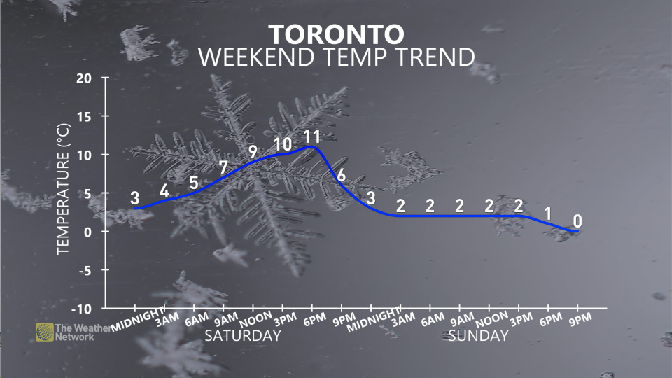
Milder temperatures are expected to start the weekend, with some rain for Ontario, but as the second low develops, that is when temperatures will drop and the potential develops for snow creeps into the forecast to end the weekend and start next week, with uncertainty in the location.
WATCH: Hamilton Thursday commute impact
Milder temperatures ahead of Christmas
A few days of colder weather, and lake-effect flurries, are expected for the middle of next week before temperatures rebound again late next week and into the following week, as well.
Going somewhere? Check out the current highway conditions before heading out!
While the temperature roller-coaster will continue into the weeks to come, at this point, it looks relatively mild during the week leading up to Christmas.
WATCH: Three things to know this weekend about Ontario's high-impact weather
Be sure to check back for all of the latest weather updates across Ontario.

