
Rainfall warnings in place for much of Maritimes
The Maritime provinces are in for some wet weather Saturday but the region is likely to be spared the worst of Hurricane Franklin as it makes its way north, according to CBC meteorologist Tina Simpkin.
Winds are expected to pick up over the course of Saturday and there is a risk of thunderstorms.
Environment Canada is reporting that most of Nova Scotia's mainland will see rainfall that could reach from 40 to 70 millimetres.
Rainfall rates are expected to be heaviest for the Annapolis Valley through to northern Nova Scotia during the day and for the Atlantic coast during the night.
For Cape Breton, there is a possibility of rainfall for some areas of 25 to 40 millimetres, but it could exceed that if thunderstorms develop today, tonight and Sunday.
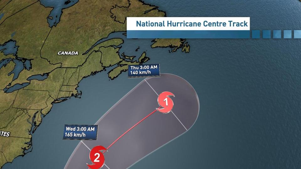
The latest track from the National Hurricane Centre expects Franklin to become a Category 2, possibly a Category 3 storm by Monday. Then, it is expected to turn to the northeast and pass south of Nova Scotia. (Tina Simpkin/CBC)
Environment Canada has also issued rainfall warnings for southern New Brunswick and central and eastern P.E.I. It says "significant" rainfall is expected today and into tonight and early Sunday in those areas.
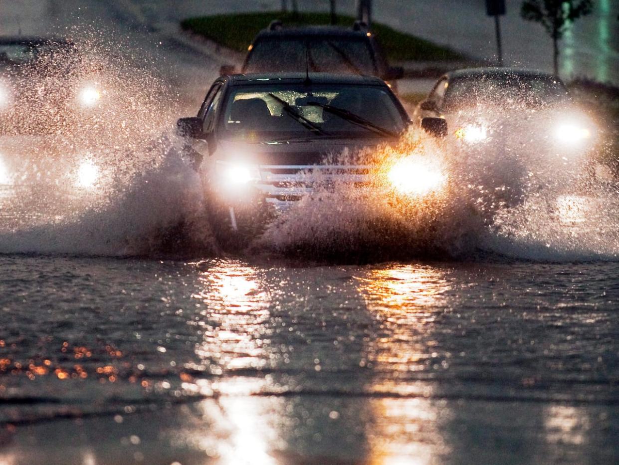
Similar storms in the past have caused hazardous driving conditions and localized flooding, especially in poor drainage areas. Environment Canada is warning that heavy downpours can cause flash floods and water pooling on roads.
Northumberland Ferries announced Saturday it had cancelled the 5 p.m. and 6:30 p.m. crossings from Wood Islands and Caribou due to strong winds.
Franklin expected to pass to the south
The latest update from the National Hurricane Center says Franklin could strengthen to a Category 3 hurricane by Monday. But it is expected to turn to the northeast and pass south of Nova Scotia.
Franklin officially passed from tropical storm to a hurricane on Saturday.
On its current track, the strongest winds and rain would be offshore.
"That's not to say there won't be some wind, rain and waves," Simpkin said in a Saturday weather update.
MORE TOP STORIES

